Added
IN PROGRESS — PLEASE SEND COMMENTS
Boundary posts, markers, bollards, benchmarks etc
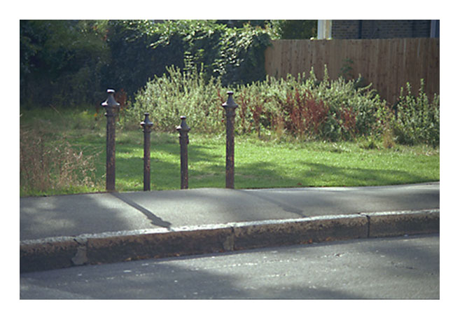
Wandsworth Common posts, St James's Drive [No 2 RED on the map below].
(Click on image to enlarge)
There are several kinds of boundary post and bollard on or near Wandsworth Common. Some indicate parishes (Wandsworth/Battersea), some the boundary of the London County Council (LCC), and some (tall thin ones) the boundary of Wandsworth Common [in 1871?].
In addition, some (but not all) of the parish posts are also surveyors' benchmarks (marked "B.M." on maps). These have the bar-and-three-line birds-foot motif on the top. (You may also come across them on walls.)
Several C19 large-scale maps of Wandsworth give precise locations for the parish/LCC markers, but not (I think) for the Wandsworth Common posts. [CHECK] There were originally far more markers than now, some of them in back gardens (e.g. in the houses between Trinity and St James's Drive).
It would be good to know if any of these markers remain. Do they? Ask people?
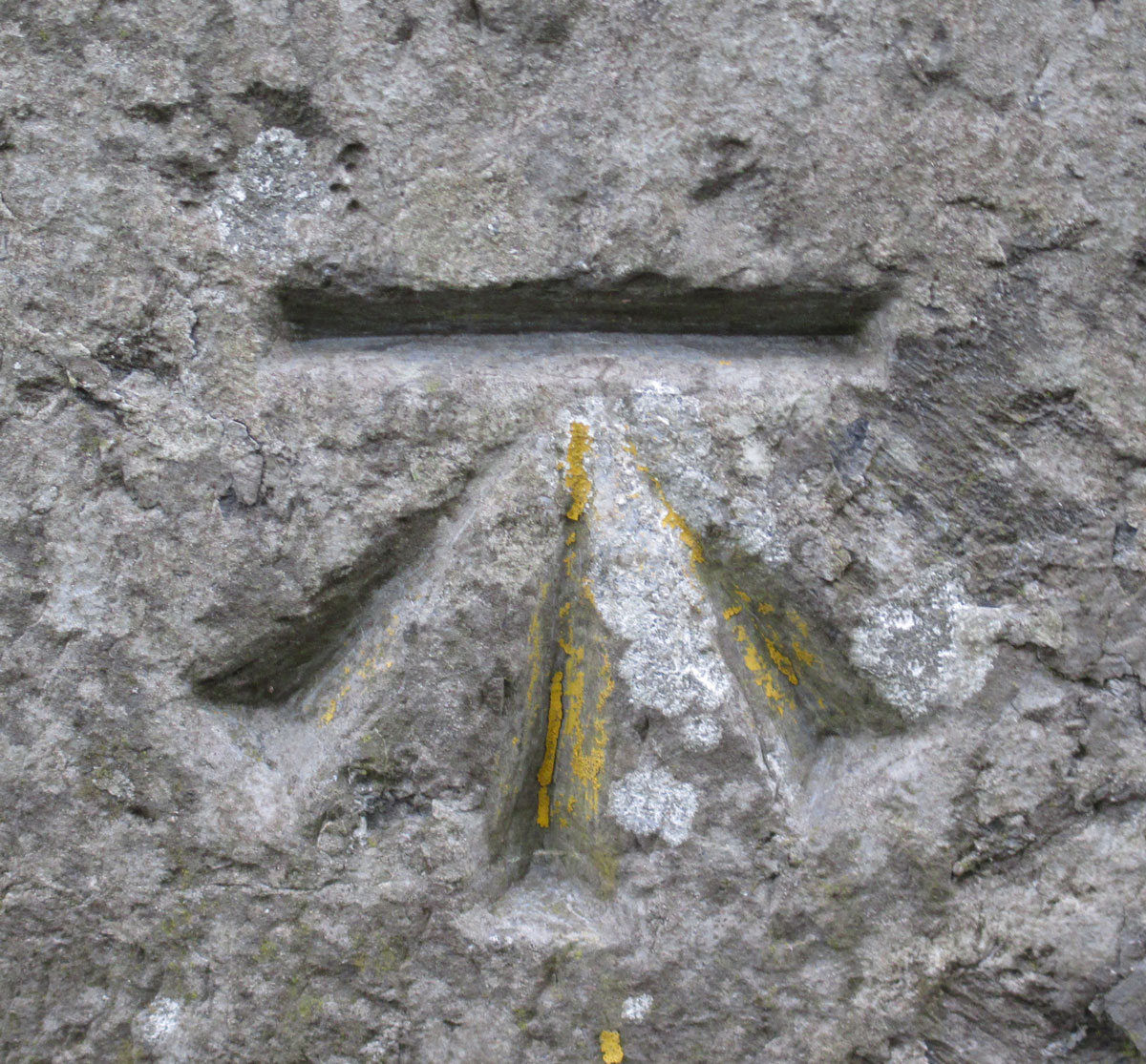
Benchmark sign
(Click on image to enlarge)
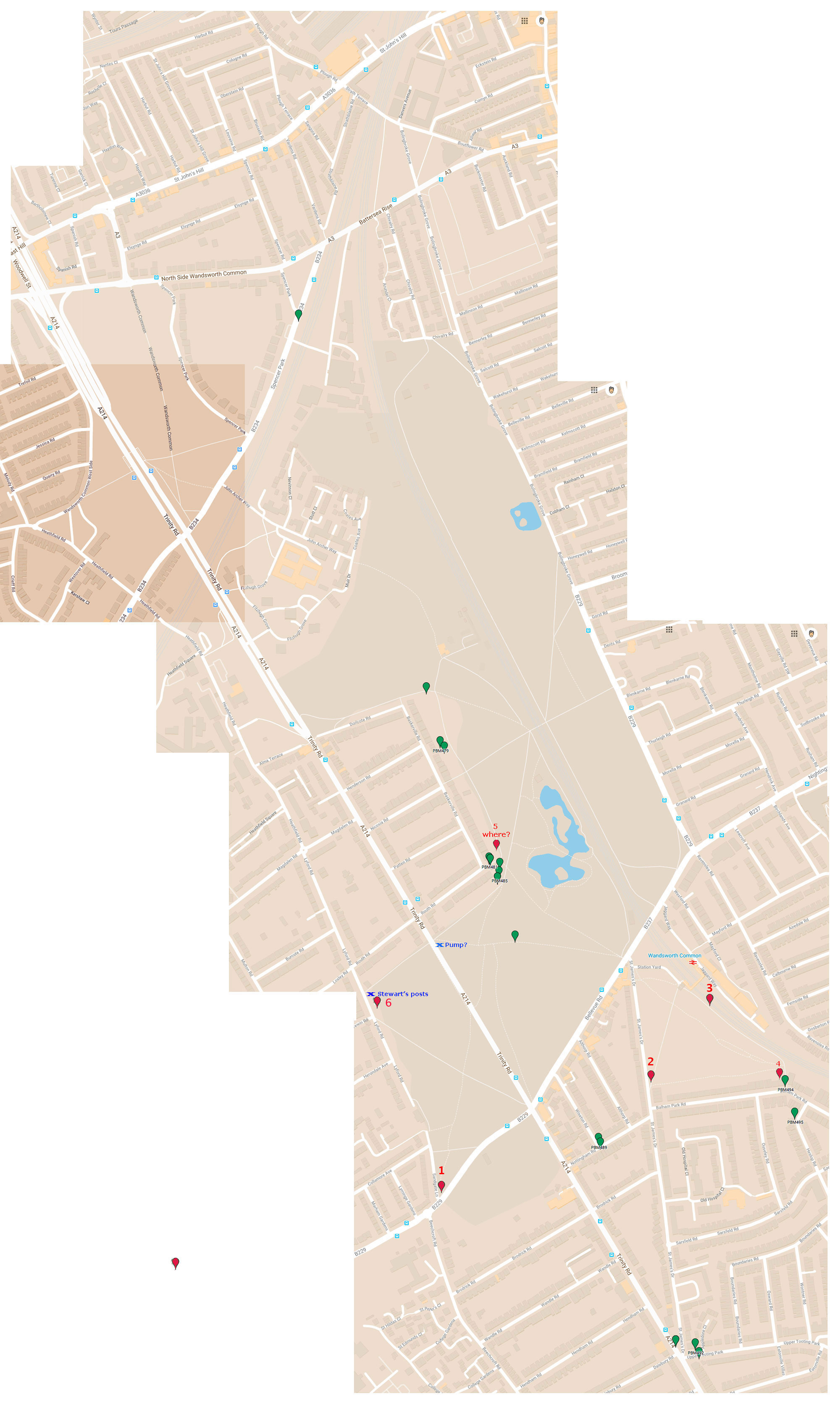
Mike Horne's Metadyne website: Parish boundaries and markers [MH's are marked in GREEN; PB's additional markers in RED.]
PB ASKS READERS: DO YOU KNOW OF ANY MORE MARKERS? PLEASE EMAIL ME WITH THEIR POSITION (and a photograph would be good too).
Find a good OS map with boundary posts marked. Emphasise the posts visually and add here.
(Click on image to enlarge)
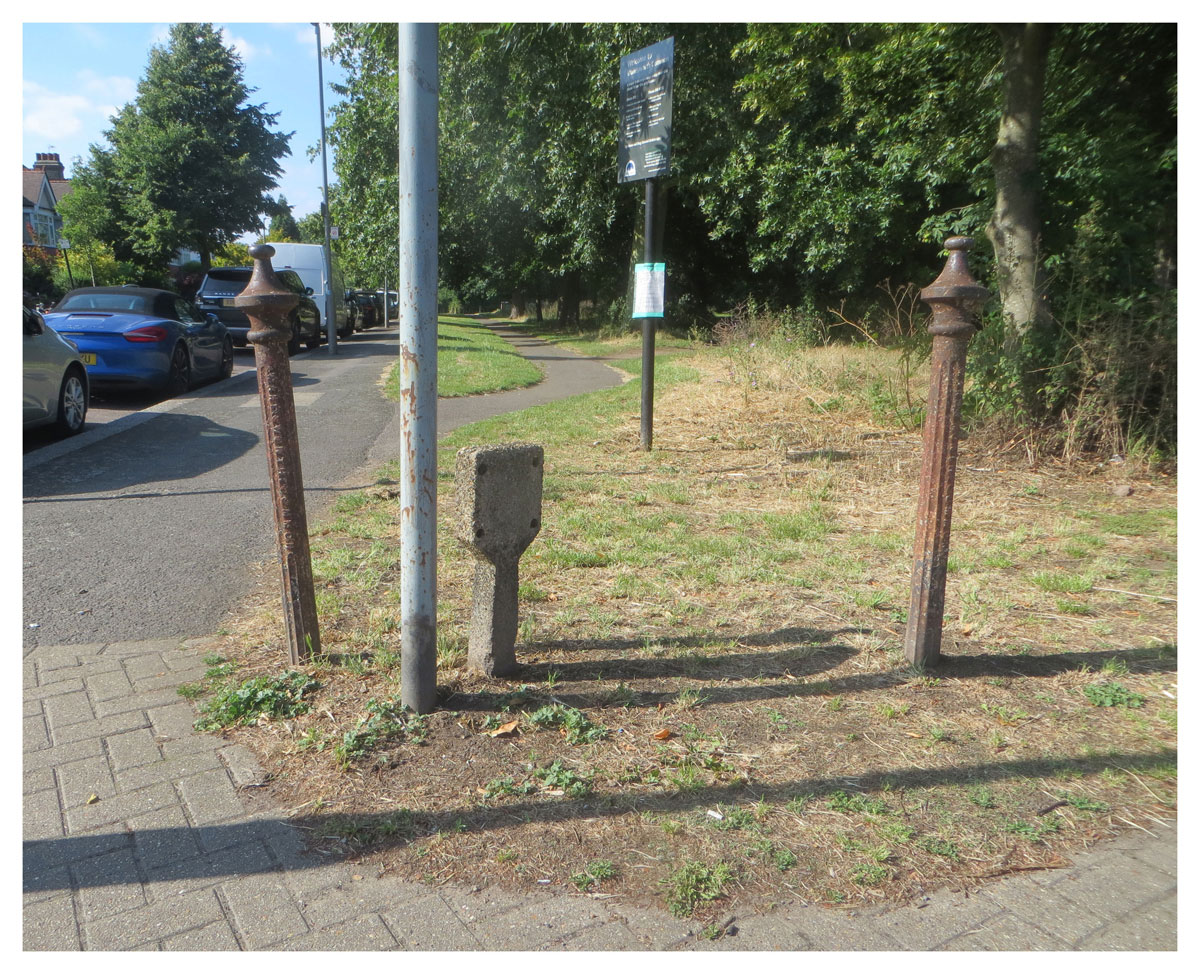
[PB: I have begun to add additional markers [in RED] e.g. here are two iron posts (with "Wandsworth Common" in relief) on the corner of Sandgate Lane and Burntwood Lane (opposite Beechcroft Rd) [RED 2 on the map]. More photographs and info to follow. There is a WC post just inside the alleyway to the Common from Balham Park Rd [RED 4]]
(Click on image to enlarge)
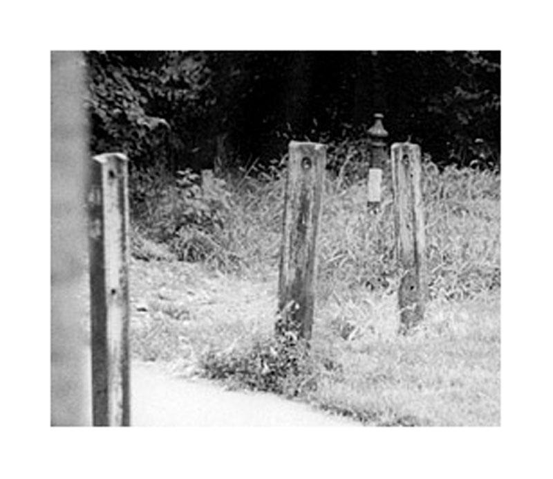
Stewart McLaughlin's photograph of strange girders or rails (and a part-painted WC post behind them) that once stood next to Lyford Rd. ADD comments from Greg Smye-Rumsby that these may relics of the Craig Telescope. When were they removed? I recall somebody saying that Wandsworth Council claimed they were not historically significant, so were removed when they created the cycle route.
Notice the old post RED 6 behind.
(Click on image to enlarge)
"Five bollards off St James's Drive"
[Five? I can only see 4 in the photo.]
Photo by David March, 1999
(Click on image to enlarge)
WANDSWORTH COMMON SW12 1. 5033 Five bollards off St James's Drive at TQ 276732 TQ 2773 14/3 II 2. Later 19th Century. Iron. Fluted shafts. Concave conical caps. Legend: 'H R Morsey Wandsworth Common".
Images of England: Five bollards off St James's Drive
IoE Number: 207167
Location: FIVE BOLLARDS OFF ST JAMES'S DRIVE AT TQ 276732, ST JAMES'S DRIVE SW12 TOOTING, WANDSWORTH, GREATER LONDON
Photographer: Mr David March
Date Photographed: 14 August 1999
Date listed: 07 April 1983
Grade II
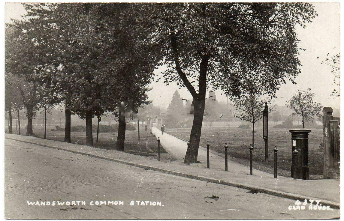
Edwardian? postcard showing 7 bollards: path to Wandsworth Common Station from St James's Drive.
[Try to find a better version with no watermark.]
wc_bollards_st_jamess_drive_PC.jpg
(Click on image to enlarge)
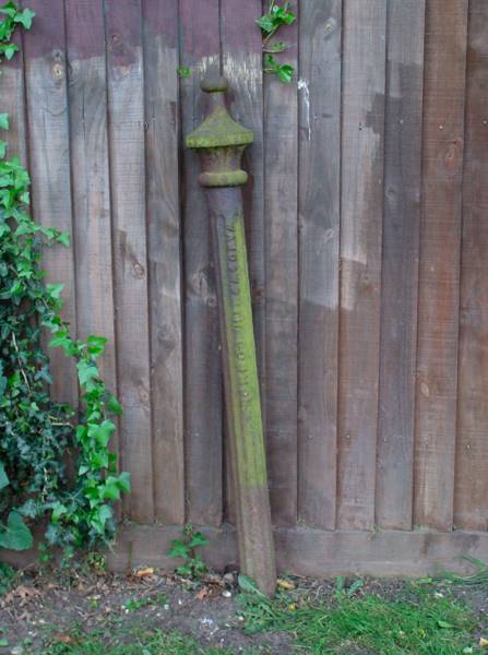
wc_post_lovebattersea_corner_near_routh_passageway.jpg
[RED 5: Where is this exactly?]
wc_post_lovebattersea_corner_near_routh_passageway.jpg
(Click on image to enlarge)
Love Battersea: Battersea's Historic Boundary Markers

(Click on image to enlarge)
Battersea's Historic Boundary Markers
All around the edges of Battersea one can find old historic Parish Boundary Markers, or Posts, that were erected to ensure that residents knew the 'bounds' of the place they lived. It is an old English tradition to 'beat the bounds' of parishes and records describing one of these events in Battersea are preserved. These boundary markers are visible signs and added proof of the historic and ancient boundaries of Battersea, which are first recorded in the 11th century.
The boundary posts below are across, or near to, Clapham Common and Wandsworth Common (old name: Battersea West Heath). They show the old boundary between what was "Battersea East Heath" and "Clapham Common" - the latter came to claim the entire area with its name, but the Parish, Metropolitan Borough and Parliamentary Constituency of Battersea maintained its boundary in the middle of Clapham Common. This is why the boundary is also, today, the line between the Boroughs of Wandsworth and Lambeth, and why the famous bandstand on Clapham Common is actually a Battersea and Wandsworth landmark. Being generous folk, Battersea people are pleased to share it with Clapham, which is a parish and town in Lambeth.
[MARKERS ON WIX LANE, LAVENDER HILL, CLAPHAM COMMON, CLAPHAM SOUTH - see link.]
Wandsworth Common
This picture shows the walkway onto Wandsworth Common at the corner of Baskerville Rd and Routh Rd. There are three boundary markers in sight here, two for Battersea (posts left and right of path - the latter at the foot of the second pillar from the right) and one for Wandsworth (black square fixed on to the pillar to the right of the picture). One can see that the gardens of the properties alongside Baskerville Rd are half in Battersea and half in Wandsworth:
POST 8 - the Wandsworth Parish marker dated 1884:
POST 9 - the Battersea Parish marker:
POST 10 - the other Battersea marker on the opposite side of the path from post 9:
Walking on to Wandsworth Common from the path shown above, you will find post 11 if you turn right and head south keeping the garden fences to your right. As you do so, you will notice one of many narrow posts that were erected to mark the boundary of Wandsworth Common:
POST 11 - is fixed right next to Post 12, which is for Wandsworth Parish. The view of the cycle and pedestrian path shown in the picture looks west towards Trinity Rd:
POST 12 - the Wandsworth parish marker behind and nestled up to the Battersea marker (post 11):
POST 11 & 12 - shown looking from south to north; to the right is the path that takes you back to posts 10, 9 and 8:
POST 11 & 12 looking towards post 13, which lies on the path before Bellevue Rd. It is behind the tree that has a leaning trunk (1st tree to the left of the tree in the foreground from the right side of the picture):
A recognisable feature showing the fallen tree trunk and the 'leaning tree' mentioned above, beyond it. To the left of the leaning tree, to the right of the tree to the left of the picture one can see the small Battersea boundary marker, which is post 13:
POST 13 - shown under the elephant trunk-like 'leaning tree', looking towards the popular Bellevue Rd:
POST 14 - walking north back to post 11, but remaining within Wandsworth Common, one will arrive near the cricket pitches by the bottom (i.e. eastern end) of Dorlcote Rd. Here just peeping above the ground is Post No.14:
Spencer Park (by Wandsworth Common)
POST 15 - approaching from Battersea Rise along the edge of the Railway Line, near to the memorial to the Clapham Junction Rail Crash, at Spencer Park, one finds Post 15, before Windmill Rd. The picture below is the view looking towards Battersea Rise, with the fence marking the railway line to the right:
POST 16 - this is found, along with others like it, if one walks south west along Windmill Rd from Spencer Park. It marks the boundary of the old London County Council which also happens to be (at this point) the boundary between Wandsworth Parish and Battersea Parish:
POST 17 - like the one above, this Battersea marker post lies alongside the railway fence. The view below is south east towards Trinity Rd, and shows the old base of the famous Wandsworth Windmill:
[Source: Love Battersea: Battersea Boundary Markers.]
Historic England: PARISH BOUNDARY POSTS SOUTH OF TRIANGULAR DETACHED PORTION OF WANDSWORTH COMMON
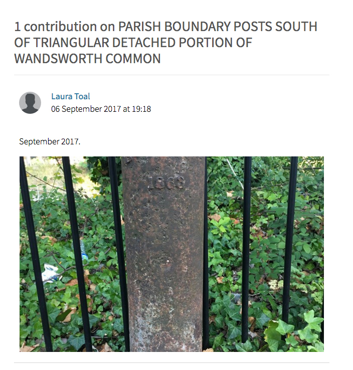
(Click on image to enlarge)
Statutory Address: PARISH BOUNDARY POSTS SOUTH OF TRIANGULAR DETACHED PORTION OF WANDSWORTH COMMON, SPENCER PARK SW18
County: Greater London Authority
District: Wandsworth (London Borough)
National Grid Reference: TQ 26912 74759
Details
TQ 27SE 4/31
SPENCER PARK SW18 Parish boundary posts south of triangular detached portion of Wandsworth Common
GV II Cast iron in form of rounded obelisk. Legend: "Battersea 1863".
Listing NGR: TQ2691274759
Download full-scale map pdf
[Source: Historic England: Parish boundary post south of detached portion of Wandsworth Common [near Spencer Park].]
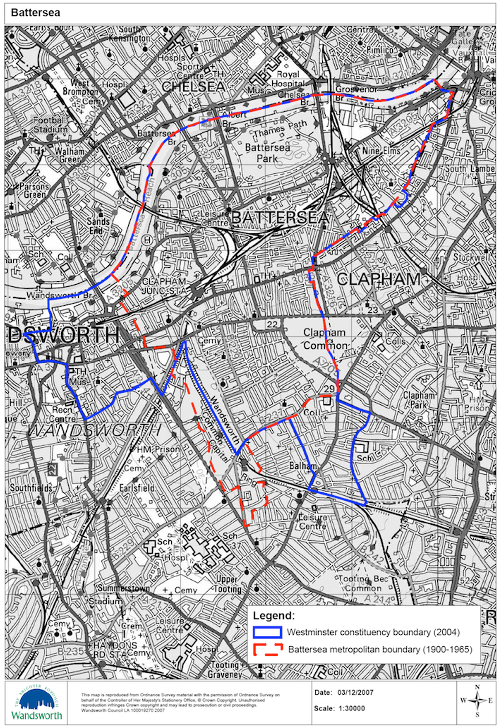
Battersea_boundary_changes_1900-2004.jpg
[Not very accurately drawn? May be interesting sometime?]
(Click on image to enlarge)
External links
- LINK
- Love Battersea: Battersea Boundary Markers
- LINK
- LINK