1841 Census: Parish of Wandsworth
Enumeration District Descriptions
HO 107/1069 — Parish of Wandsworth, Surrey
This page presents transcriptions of the enumerators’ schedule descriptions for all sixteen Enumeration Districts in the Parish of Wandsworth, as recorded in the 1841 census. These preamble pages describe the geographical boundaries of each district, written by the individual enumerator before the enumeration began. Census night was 6 June 1841.
The descriptions have been transcribed from the original images. Uncertain readings are marked (?). Where images are available they appear alongside the transcription; others will be added in due course. For the detailed household returns for ED 10 (Wandsworth East Common, Garratt Green), see the separate transcription page.
County: Surrey (Parliamentary Division: East Surrey)
Hundred: Brixton
Parish: Wandsworth (part of)
Superintendent Registrar’s District: Wandsworth & Clapham
Registrar’s District: Wandsworth
Registrar: Whitfield Foster
Superintendent Registrar: Benjamin Field
TNA Piece References: HO 107/1069/1, 1069/2, 1069/3, 1069/4
Enumeration Districts — Index
- ED 1 — High Street north
- ED 2 — High Street south (north part)
- ED 3 — High Street south (south part)
- ED 4 — East Street, West Common, St Ann’s Hill
- ED 5 — West Hill, Wimbledon Park, South Fields
- ED 6 — Lees Lane, Elm Place, North Fields
- ED 7 — Point Pleasant
- ED 8 — Church Row, the Plain, Frogmore
- ED 9 — Frogmore, Snuff Court, Church Passage
- ED 10 — East Common, Garratt Green, Sumner Town
- ED 11 — Dunt’s Hill, Garratt
- ED 12 — Garratt Lane, St Ann’s Lane, Maltspits
- ED 13 — Garratt Lane, Allfarthing Manor
- ED 14 — North Street, Ram Lane
- ED 15 — Swing Bridge, Spencer’s Court, Thames Bank
- ED 16 — Thames Bank, Wandsworth Distillery
Enumeration District 1
HO 107/1069/1 — Enumerator: L. J. Upcher
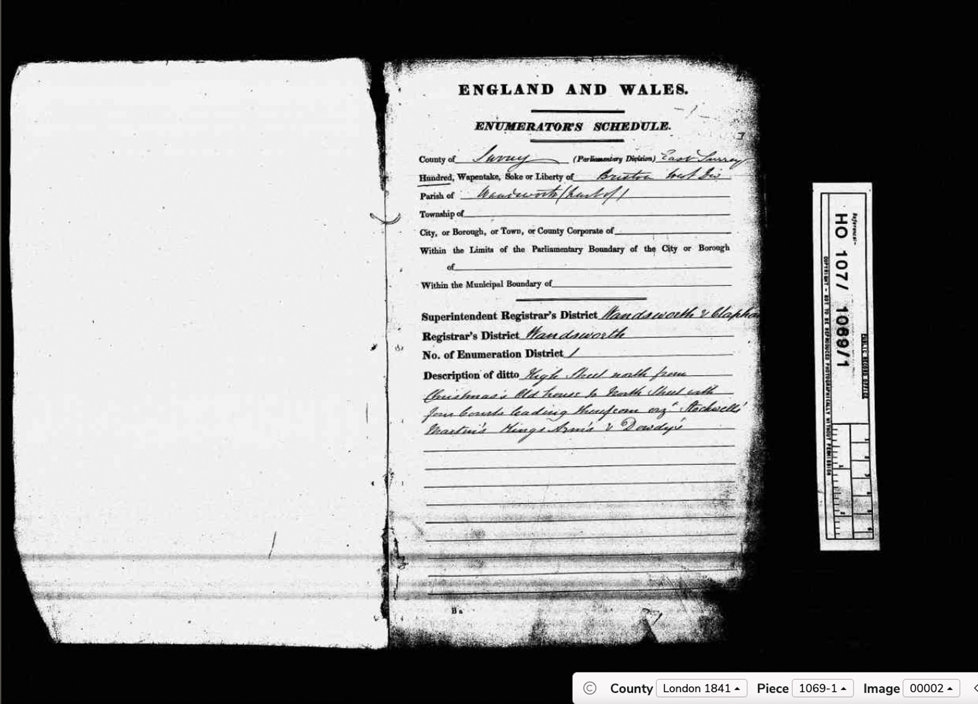
HO 107/1069: Wandsworth ED1 boundary description. (Click to enlarge.)
Enumerator: L. J. Upcher
Registrar: Whitfield Foster
Superintendent Registrar: Benjamin Field
Description: High Street north from Christmas’s Old House to South Street with Junction Roads leading therefrom viz. Stockwell’s, Martin’s, King’s Arms & Dawdy’s.
Enumeration District 2
HO 107/1069/1 — Enumerator: John Nugent
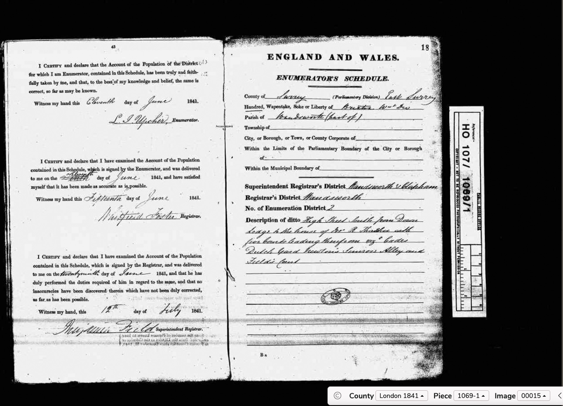
HO 107/1069: Wandsworth ED2 boundary description. (Click to enlarge.)
Enumerator: John Nugent
Registrar: Whitfield Foster
Superintendent Registrar: Benjamin Field
Description: High Street South from Down Lodge to the house of Mr R. Thatcher with Junction Roads leading therefrom viz. Eades, Dutch Yard, Newton’s, Simson’s Alley and Fields Court.
Dutch Yard — a possible trace of the Huguenot and Dutch Protestant community known to have settled in Wandsworth in the late 17th century. Worth investigating further.
Enumeration District 3
HO 107/1069/1 — Enumerator: George Sayers
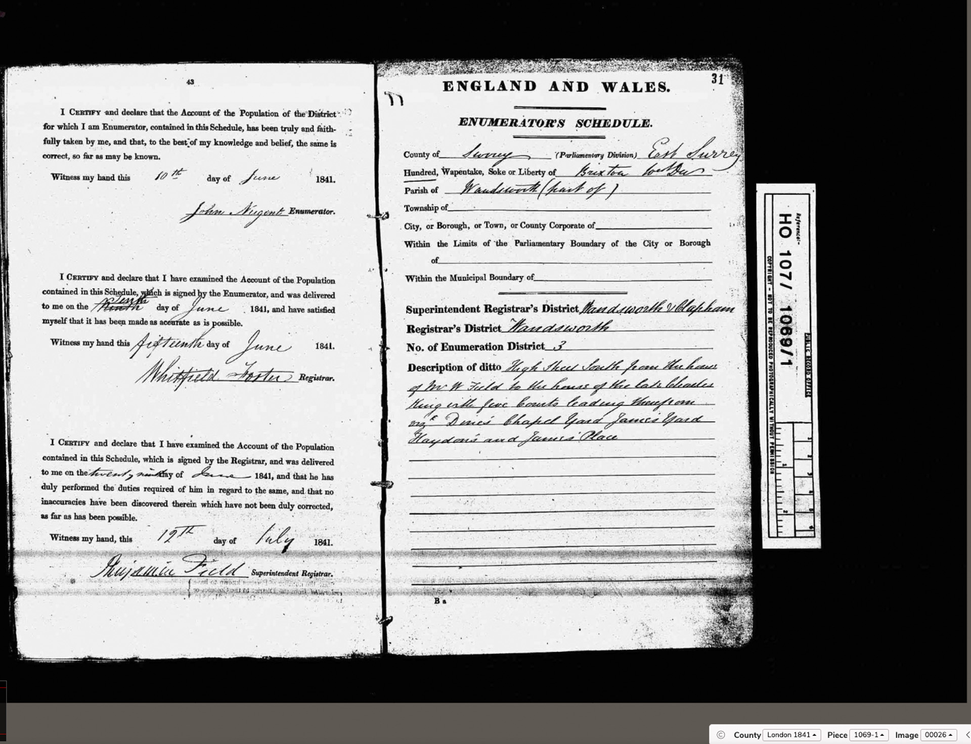
HO 107/1069: Wandsworth ED3 boundary description. (Click to enlarge.)
Enumerator: George Sayers
Registrar: Whitfield Foster
Superintendent Registrar: Benjamin Field
Description: High Street South from the house of Mr W. Field to the house of the late Charles King with Junction Roads leading therefrom viz. Denis Chapel Yard, James’s Yard, Haydon’s and James’s Place.
Enumeration District 4
HO 107/1069/1 — Enumerator: not yet captured
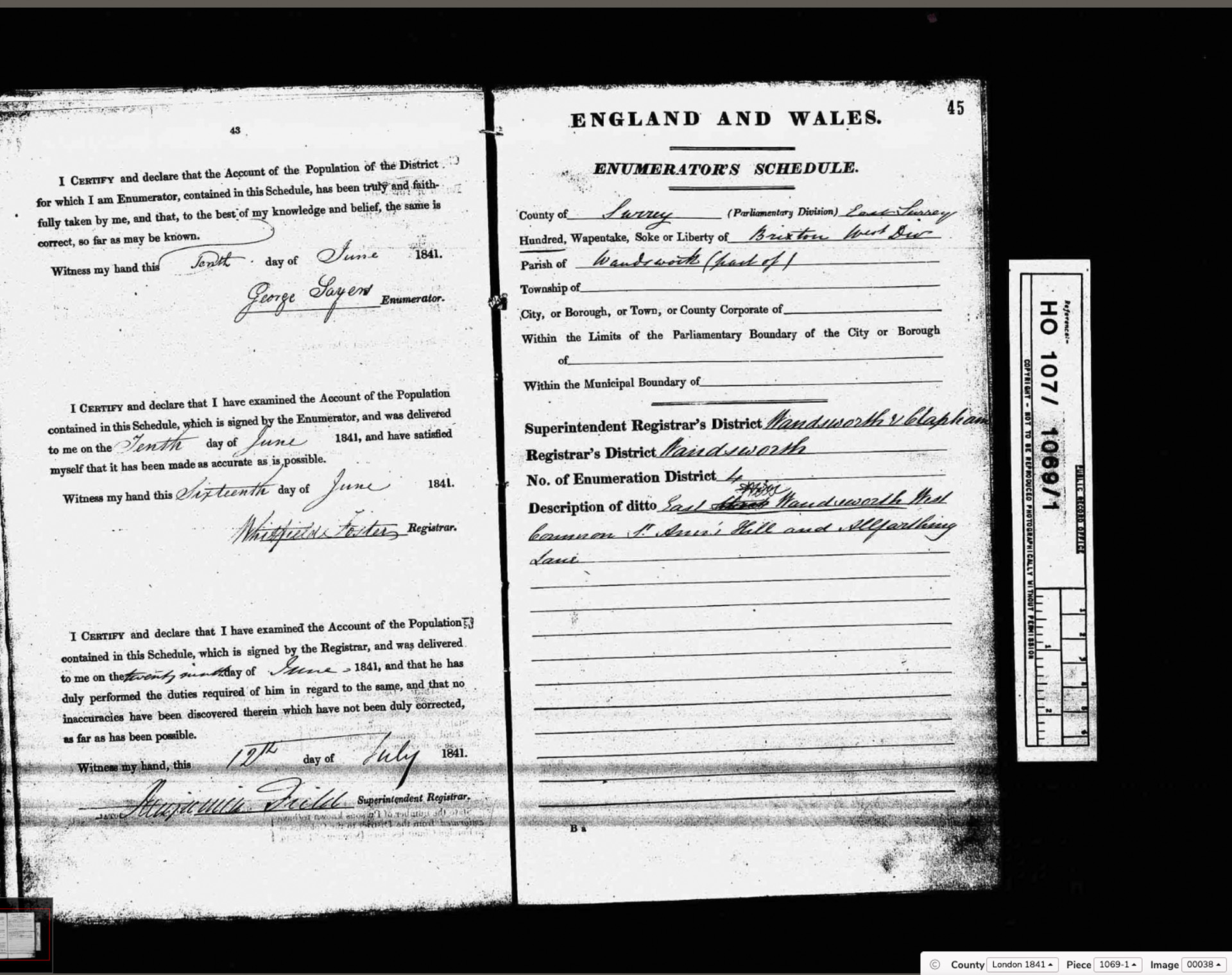
HO 107/1069: Wandsworth ED4 boundary description. (Click to enlarge.)
Enumerator: not yet captured
Registrar: Whitfield Foster
Superintendent Registrar: Benjamin Field
Description: East Street, Wandsworth West Common, St Ann’s Hill and Allfarthing Lane.
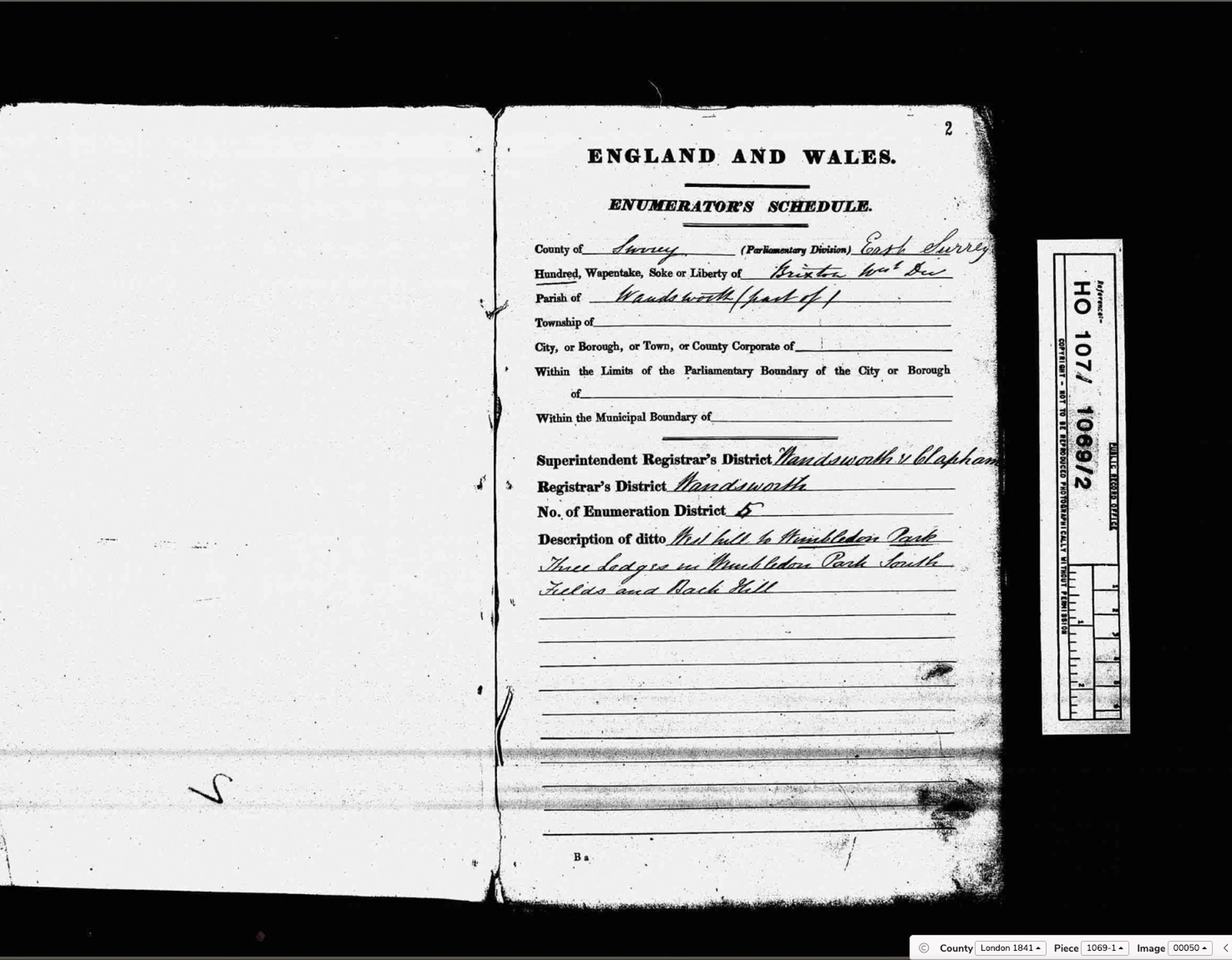
Enumeration District 5
HO 107/1069/2 — Enumerator: William Bartley Linfield
HO 107/1069: Wandsworth ED5 boundary description. (Click to enlarge.)
Enumerator: William Bartley Linfield
Registrar: Whitfield Foster
Superintendent Registrar: Benjamin Field
Description: West Hill to Wimbledon Park. Three Lodges in Wimbledon Park. South Fields and Back Hill.
Wimbledon Park in 1841 was Earl Spencer’s private deer park — the same Spencer family who would become the principal antagonist of the campaign to save Wandsworth Common from enclosure in the 1860s and 70s. The Three Lodges were accommodation for park staff.
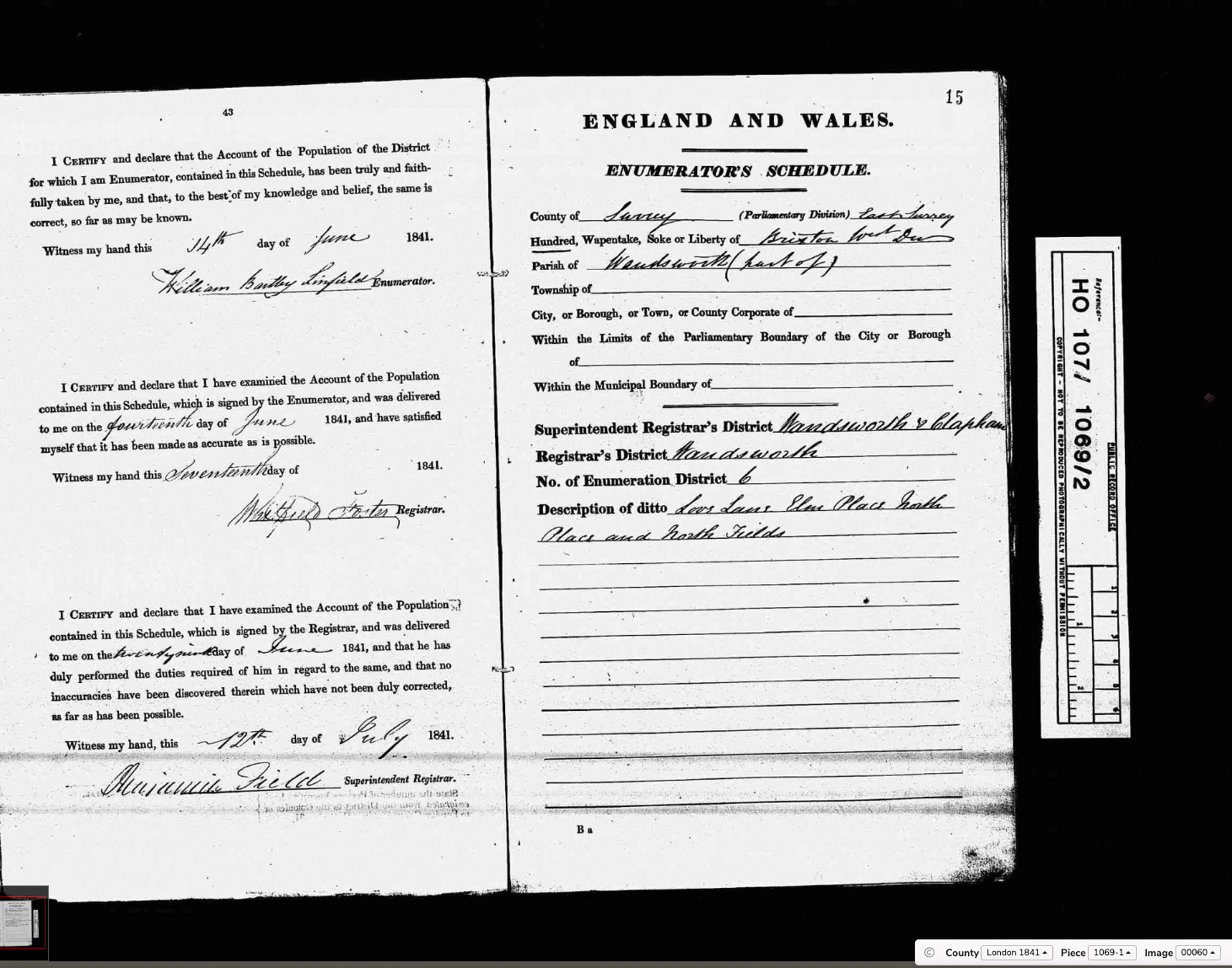
Enumeration District 6
HO 107/1069/2 — Enumerator: Robert Thomas Green
HO 107/1069: Wandsworth ED6 boundary description. (Click to enlarge.)
Enumerator: Robert Thomas Green
Registrar: Whitfield Foster
Superintendent Registrar: Benjamin Field
Description: Lees Lane, Elm Place, Hollis Place and North Fields.
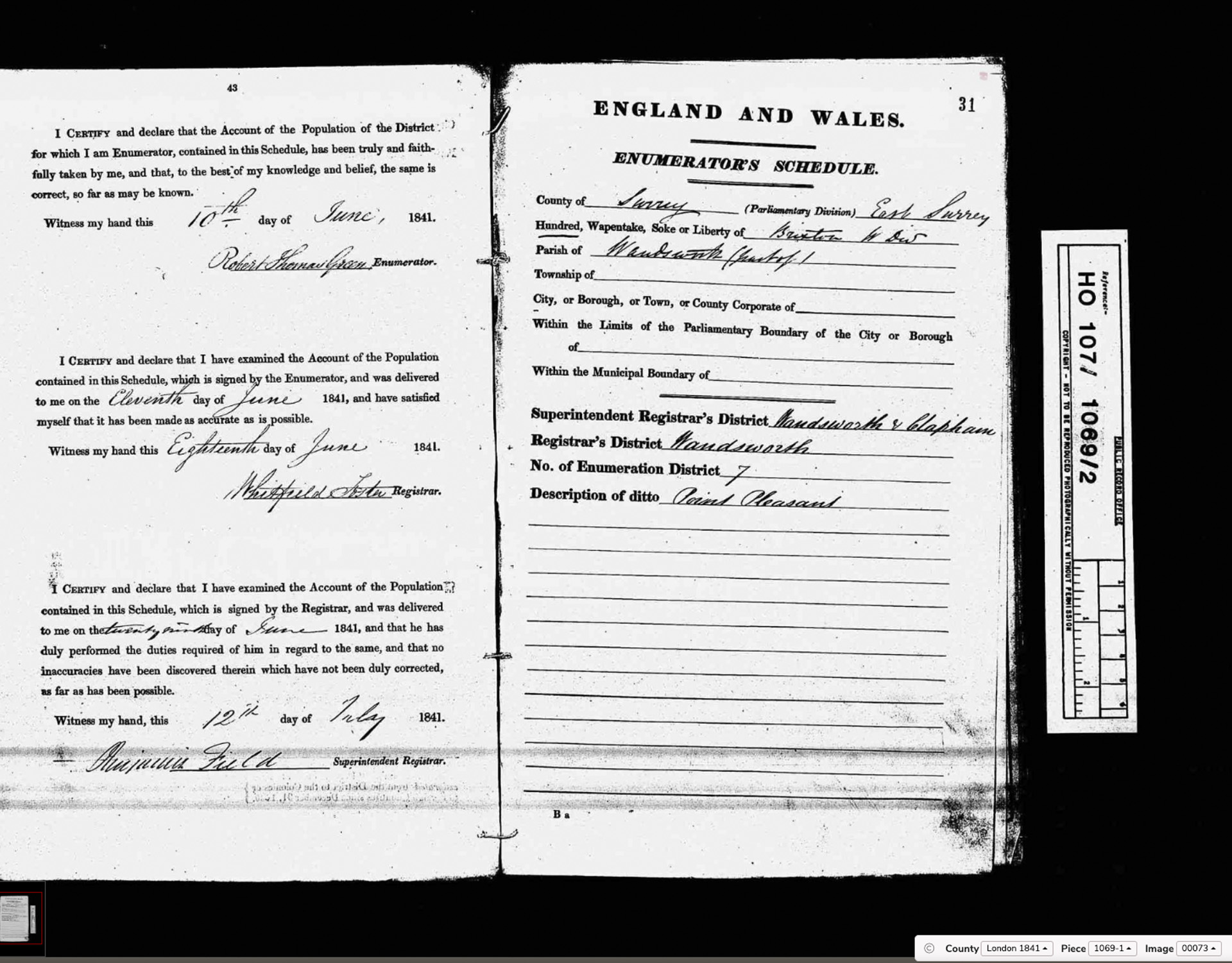
Enumeration District 7
HO 107/1069/2 — Enumerator: Edward Adams
HO 107/1069: Wandsworth ED7 boundary description. (Click to enlarge.)
Enumerator: Edward Adams
Registrar: Whitfield Foster
Superintendent Registrar: Benjamin Field
Description: Point Pleasant.
Point Pleasant is a riverside street running along the Thames below Wandsworth town. The Cartwright family of Point Pleasant feature in a newspaper cutting from 1846 concerning body-snatching on the Common.
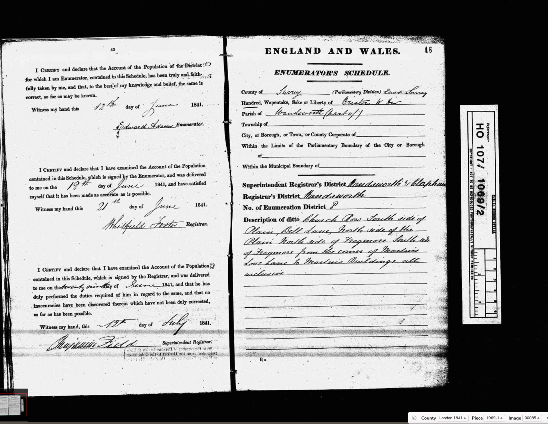
Enumeration District 8
HO 107/1069/2 — Enumerator: not yet captured
HO 107/1069: Wandsworth ED8 boundary description. (Click to enlarge.)
Enumerator: not yet captured
Registrar: Whitfield Foster
Superintendent Registrar: Benjamin Field
Description: Church Row, South side of the Plain, Bell Lane, North side of the Plain, North side of Frogmore, South side of Frogmore from the corner of Martin’s Low Lane to Martin’s Buildings all inclusive.
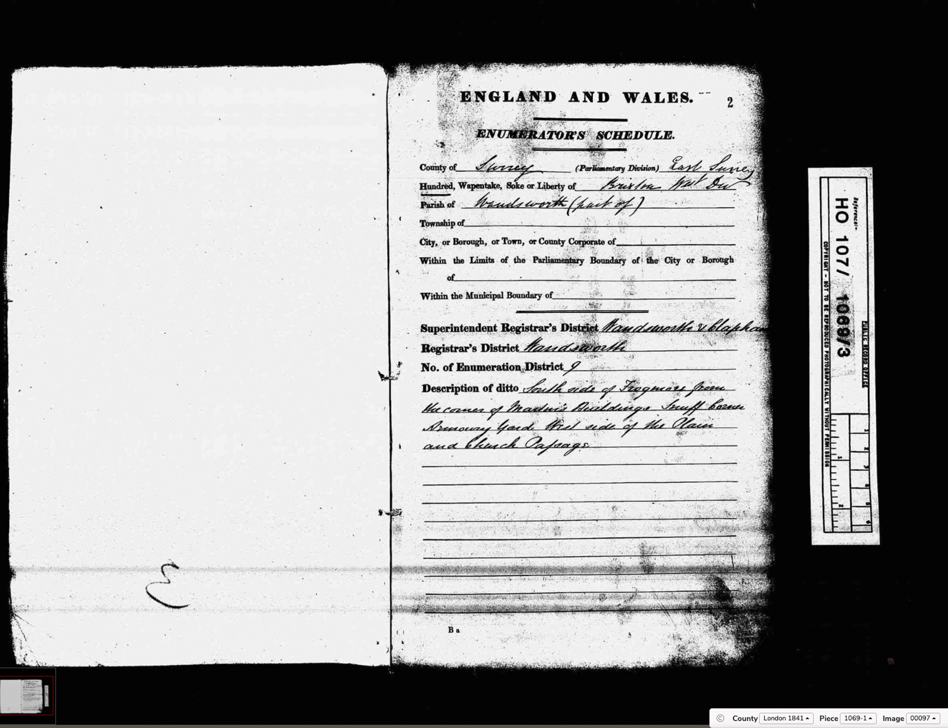
Enumeration District 9
HO 107/1069/3 — Enumerator: Francis Parsons
HO 107/1069: Wandsworth ED9 boundary description. (Click to enlarge.)
Enumerator: Francis Parsons
Registrar: Whitfield Foster
Superintendent Registrar: Benjamin Field
Description: South side of Frogmore from the corner of Martin’s Buildings, Snuff Court, Armoury Yard, West side of the Plain and Church Passage.
Snuff Court and Armoury Yard are vanished Wandsworth place-names which can now be located for the first time through this ED boundary. Francis Parsons may be a family connection to the Parsons who appeared among those paraded at the 1840s fence-breaking demonstrations on Wandsworth Common.
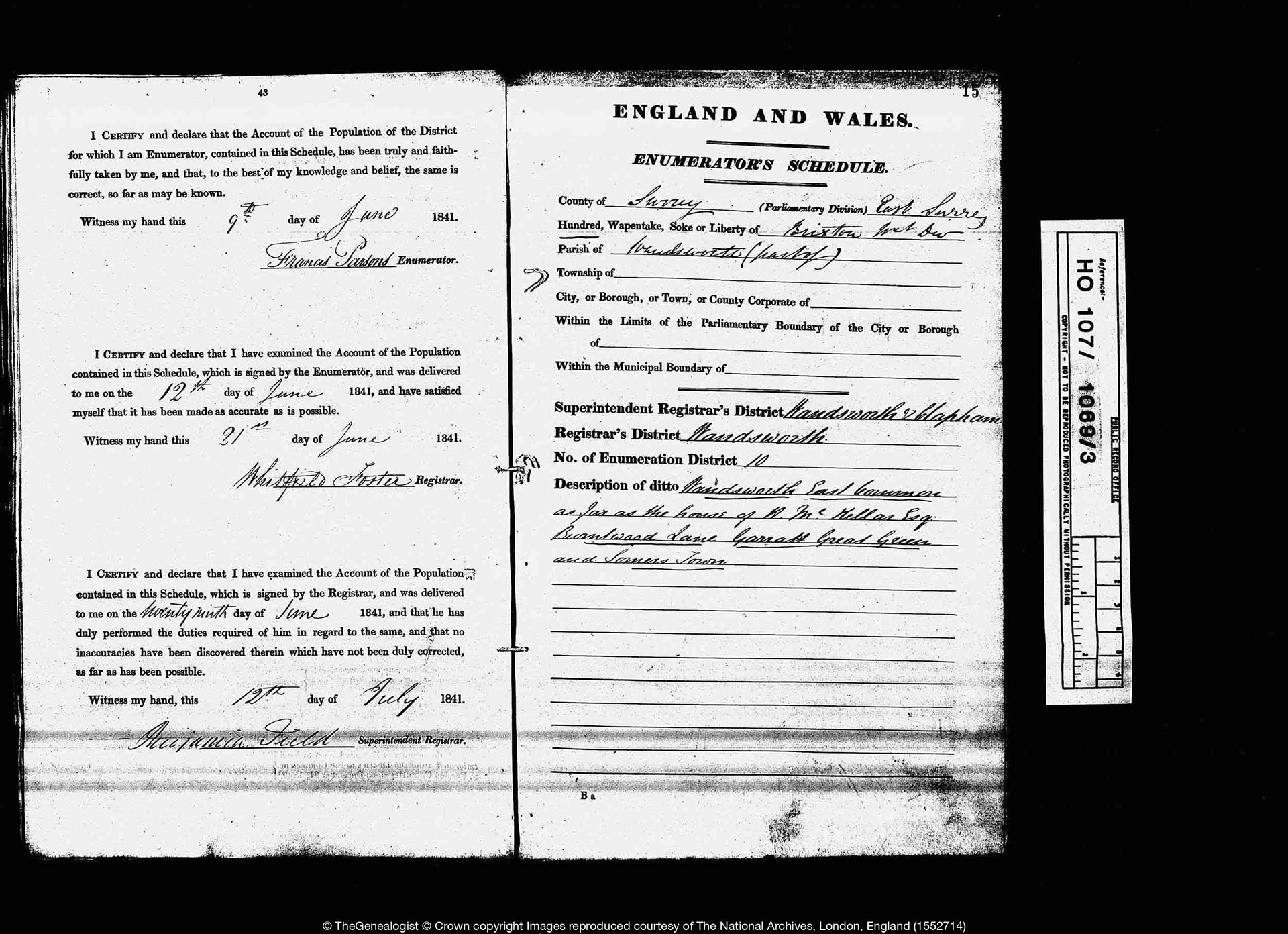
Enumeration District 10
HO 107/1069/3 — Enumerator: W. H. Barsel
HO 107/1069: Wandsworth ED10 boundary description. (Click to enlarge.)
Enumerator: W. H. Barsel
Registrar: Whitfield Foster
Superintendent Registrar: Benjamin Field
Description: Wandsworth East Common as far as the house of W. McMillan Esq., Bramblewood Lane, Garratt, Garratt Green and Sumner Town.
A full transcription of the household returns for this district is available on the
ED 10 detail page. This district includes Garratt Green, where the Neal and Rough families — market gardeners closely connected with the Common — are recorded in some numbers.
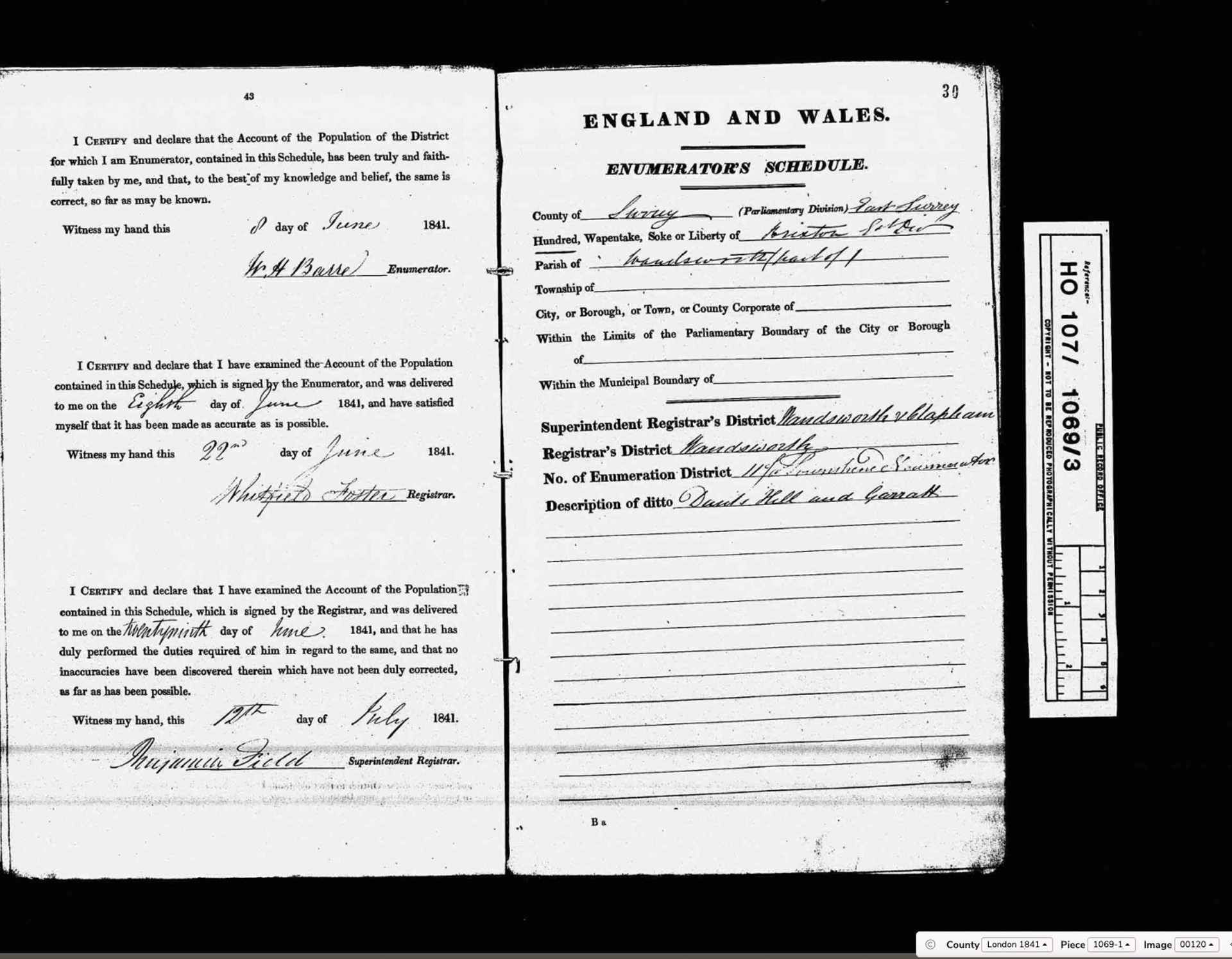
Enumeration District 11
HO 107/1069/3 — Enumerator: Jo. Townshend
HO 107/1069: Wandsworth ED11 boundary description. (Click to enlarge.)
Enumerator: Jo. Townshend
Registrar: Whitfield Foster
Superintendent Registrar: Benjamin Field
Description: Dunt’s Hill and Garratt.
Dunt’s Hill is a medieval manor name, surviving in 1841 as an ED boundary description. It is now reduced to a single short road near the River Wandle.
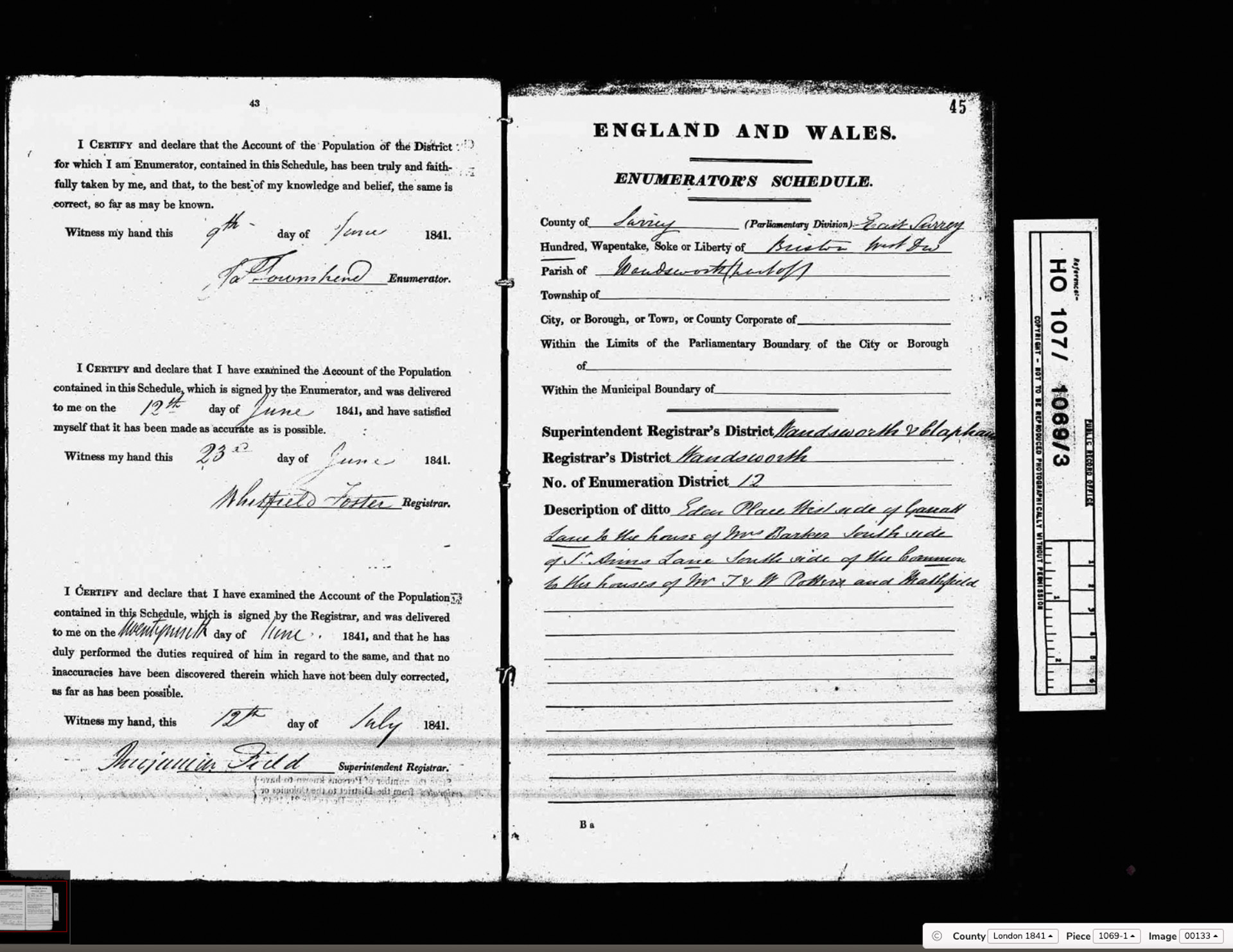
Enumeration District 12
HO 107/1069/3 — Enumerator: not yet captured
HO 107/1069: Wandsworth ED12 boundary description. (Click to enlarge.)
Enumerator: not yet captured
Registrar: Whitfield Foster
Superintendent Registrar: Benjamin Field
Description: Eton Place, West side of Garratt Lane to the house of Mr Barker, South side of St Ann’s Lane, South side of the Common to the houses of Mr J. & W. Pollens and Maltspits.
Maltspits is an ancient place-name referring to malting pits associated with the brewing industry along the Wandle. It does not appear to survive in any modern street name.
Enumeration District 13
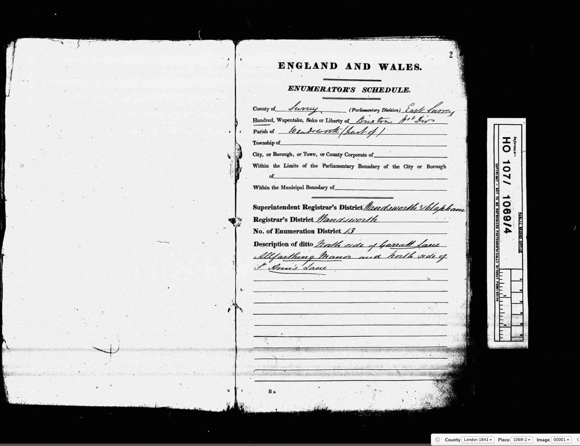
HO 107/1069/4 — Enumerator: James Bricknow(?)
HO 107/1069: Wandsworth ED13 boundary description. (Click to enlarge.)
Enumerator: James Bricknow(?)
Registrar: Whitfield Foster
Superintendent Registrar: Benjamin Field
Description: North side of Garratt Lane, Allfarthing Manor and North side of St Ann’s Lane.
Allfarthing Manor was one of the two ancient manors of Wandsworth (the other being Wandsworth Manor itself). Its appearance here as a living place-name in 1841 is a primary source of real significance — the manor persisting in local consciousness long after its legal dissolution.
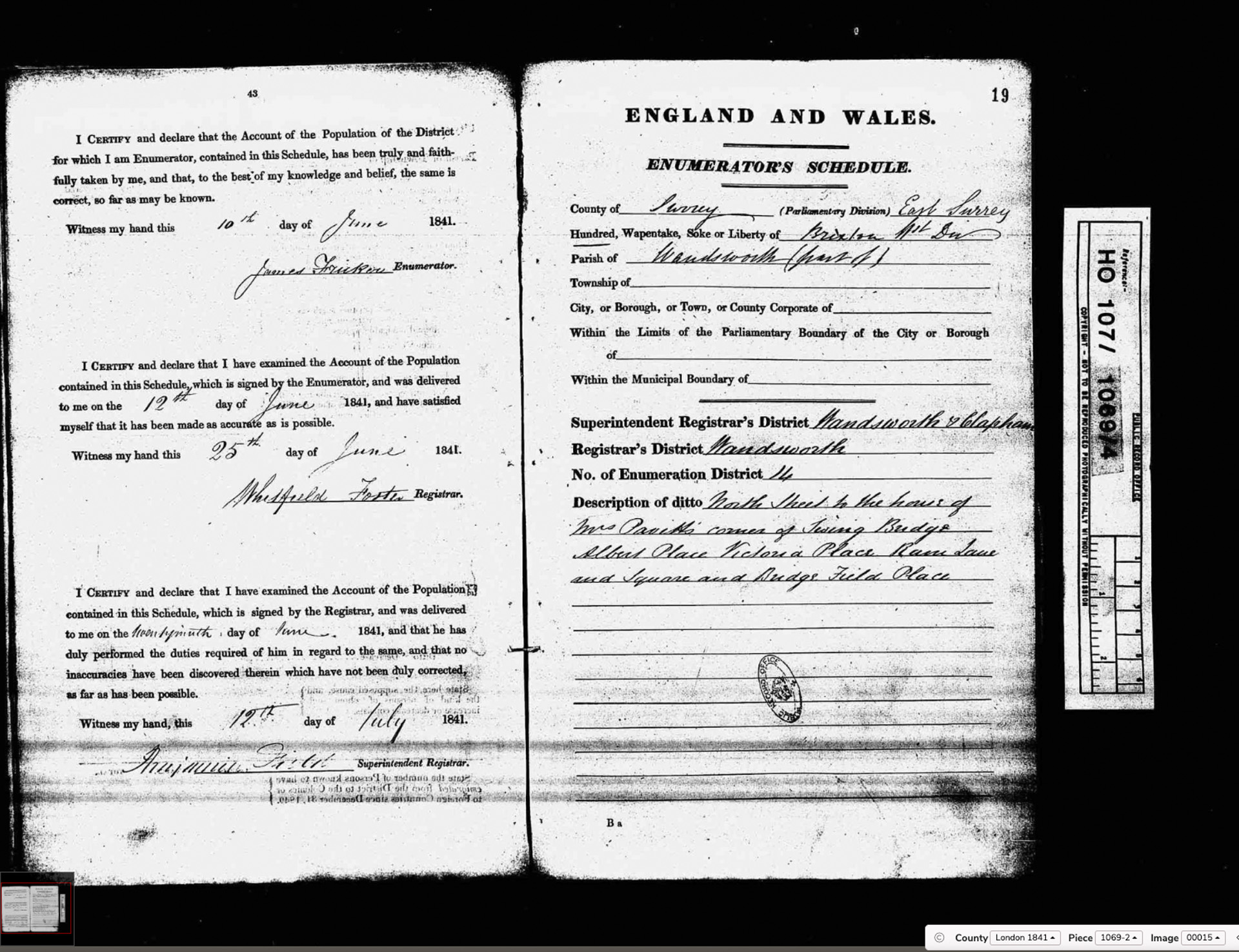
Enumeration District 14
HO 107/1069/4 — Enumerator: John Hinderson
HO 107/1069: Wandsworth ED14 boundary description. (Click to enlarge.)
Enumerator: John Hinderson
Registrar: Whitfield Foster
Superintendent Registrar: Benjamin Field
Description: North Street to the house of Mrs Daniells, corner of Swing Bridge, Albert Place, Victoria Place, Ram Lane and Square and Bridge Field Place.
Ram Lane was the address of the Ram Brewery, one of the oldest continuously operating breweries in England. Albert Place and Victoria Place are newly named at this date — post-1837 nomenclature honouring the new monarch.
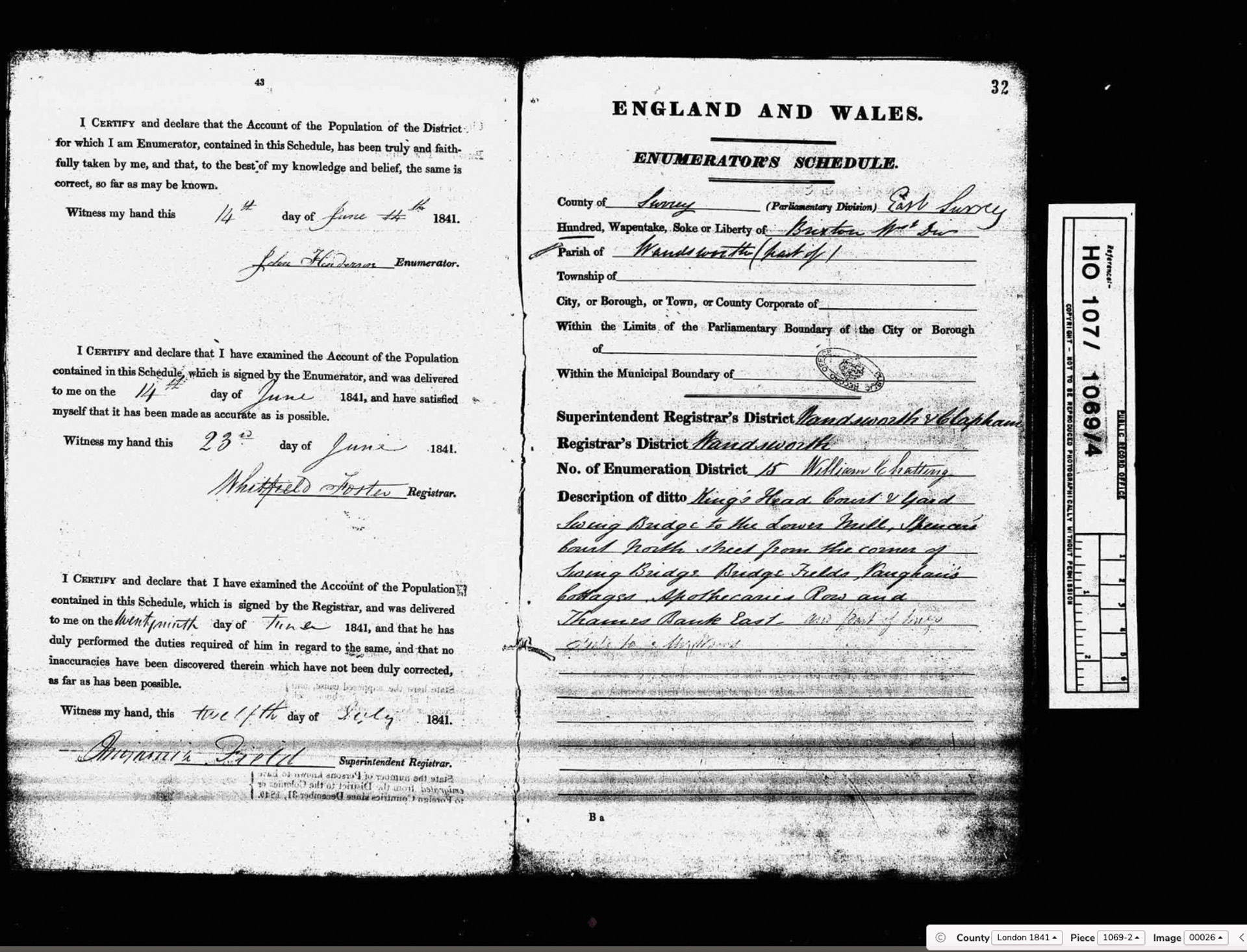
Enumeration District 15
HO 107/1069/4 — Enumerator: William Chatting
HO 107/1069: Wandsworth ED15 boundary description. (Click to enlarge.)
Enumerator: William Chatting
Registrar: Whitfield Foster
Superintendent Registrar: Benjamin Field
Description: King’s Head Court & Yard, Swing Bridge to the Lower Mills, Spencer’s Court, North Street from the corner of Swing Bridge, Bridge Fields, Vaughan’s Cottages, Apothecaries Row and Thames Bank East and part of [illegible].
Spencer’s Court on the Wandsworth riverside may connect with the Spencer family whose Wimbledon Park estate made them the dominant landowner in the area, and who became opponents of the Common preservation movement in the 1860s–70s.
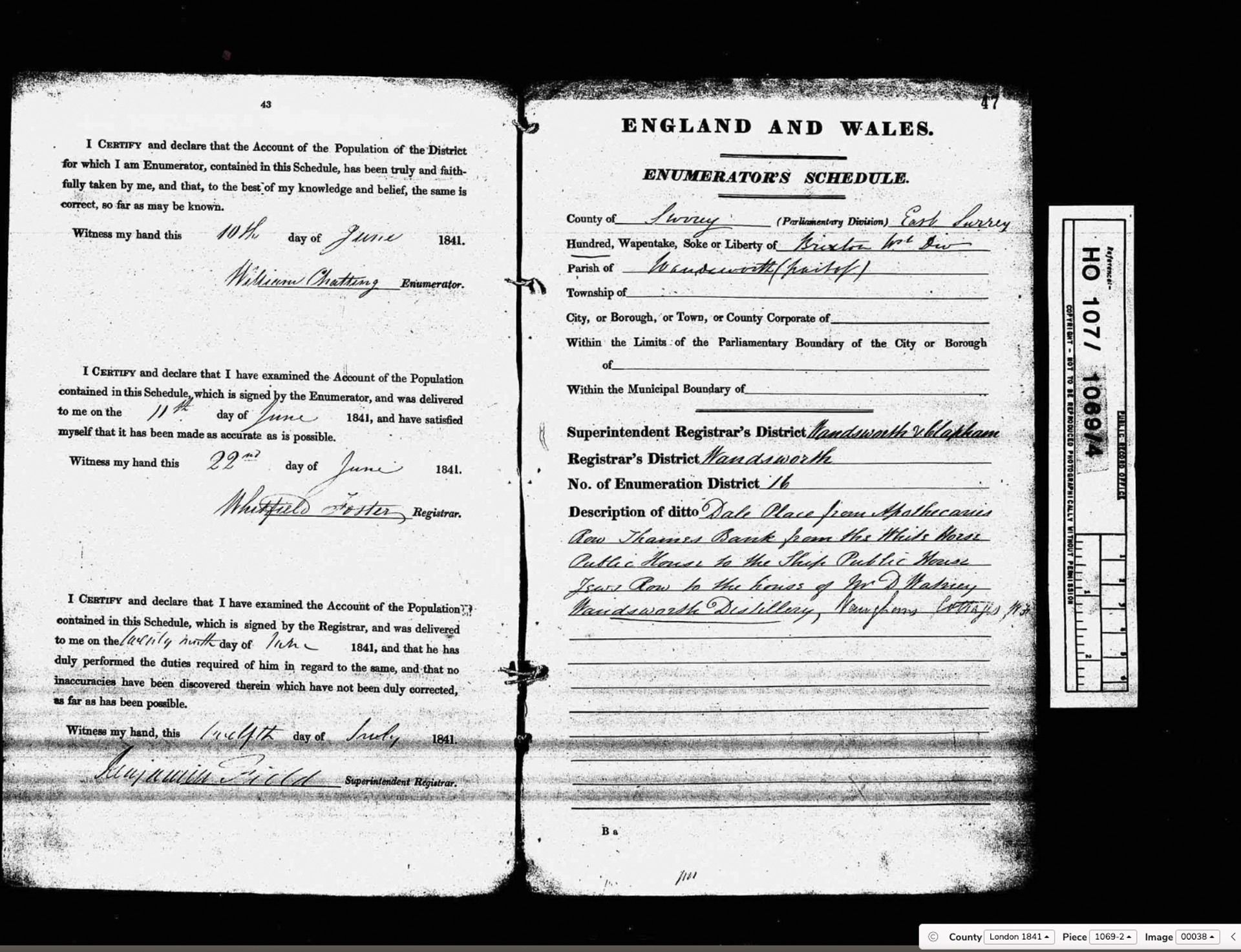
Enumeration District 16
HO 107/1069/4 — Enumerator: G. Phillips
HO 107/1069: Wandsworth ED16 boundary description. (Click to enlarge.)
Enumerator: G. Phillips
Registrar: Whitfield Foster
Superintendent Registrar: Benjamin Field
Description: Dale Place, from Apothecaries Row, Thames Bank from the White Horse Public House to the Ship Public House, Jones Row to the house of Mr J. Watney, Wandsworth Distillery, Vaughan’s Cottages [and continues — right edge cut off].
Mr J. Watney on Thames Bank in 1841 is almost certainly a member of the Watney brewing family, who had interests in the Wandsworth area long before their brewery consolidation later in the century.
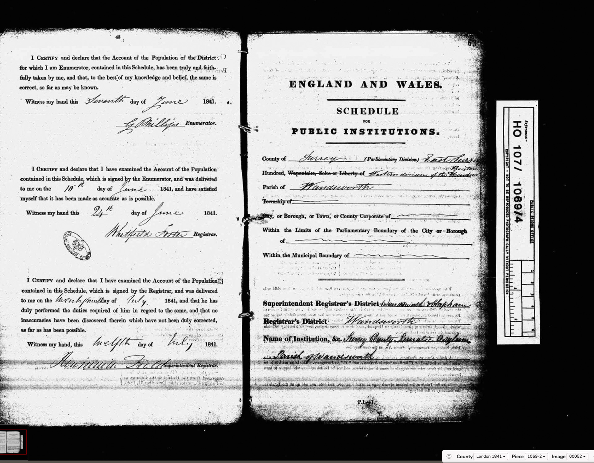
Public Institution
HO 107/1069/4
HO 107/1069: Surrey County Pauper Lunatic Asylum (Springfield), Wandsworth. Newly opened 1841. (Click to enlarge.)
Institution: Surrey County Lunatic Asylum, Parish of Wandsworth
The Surrey County Pauper Lunatic Asylum (now Springfield University Hospital, Glenburnie Road) was newly built and opened in 1841, the very year of this census. It was one of the first purpose-built county asylums in England, situated on Garratt Lane.
Transcriptions made June 2026 from original images held by The National Archives (HO 107/1069). © historyofwandsworthcommon.org