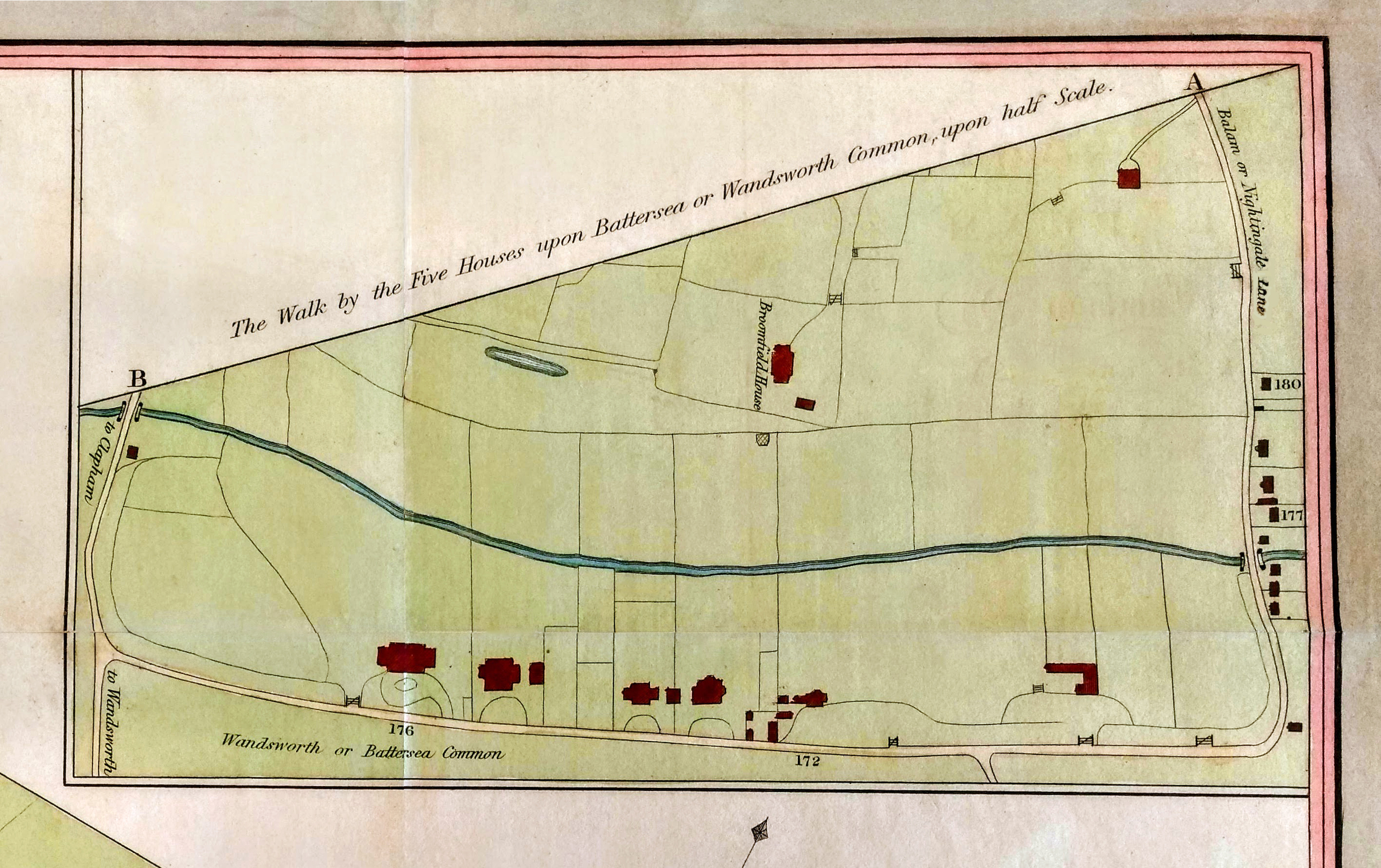
The inset in close-up: "The Walk by the Five Houses upon Battersea or Wandsworth Common", 1827 — showing Broomfield House and the other four houses strung along the walk between Balham/Nightingale Lane (A) and the road to Wandsworth (B).
Notice e.g." Wandsworth or Battersea Common", "Balam or Nightingale Lane", and the Falcon Brook (seemingly without weirs, pools or further bridges along its length).
The Five Houses are built on the edge of the valley, ? metres above the Brook, on gravel. Thanks to erosion by water, the gravel gives way to clay further down the slope.
The field boundaries, mostly rectilinear, reflect the topography - they run straight down into the valley of the Falcon Brook or parallel to it. At the end of the 19th century, these will be reflected in the pattern of roads between the Commons.
Are the curving field boundaries on either side of the Five Houses (more or less parallel to Bolingbroke Grove) evidence of fairly recent encroachment from the Common? (Compare with the Corris map of Battersea for Earl Spencer of c.1787, and Davey's plan of the Harman estate of 1773.)
The road across the Common that joins Bolingbroke Grove at the bottom of the inset map has since disappeared. This was the extension of what is now St James's Drive, its course interrupted later in the century by the railway line.
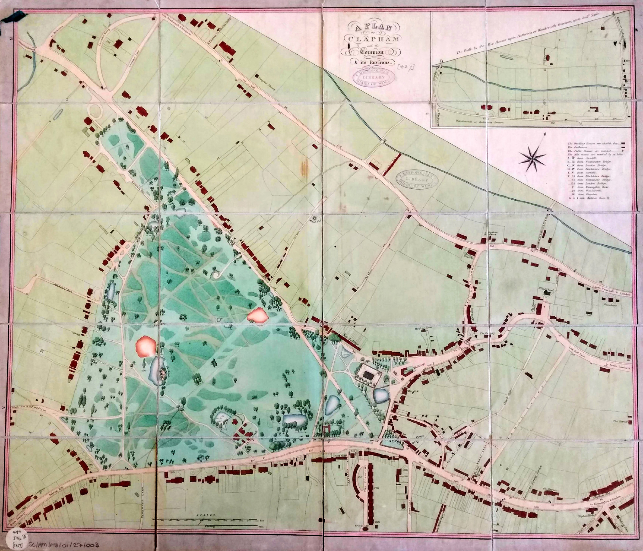
"A Plan of Clapham with the Common & its Environs" — surveyed and drawn by J. Batten, 1827. Top right shows an inset detail, "The Walk by the Five Houses upon Battersea or Wandsworth Common".
(Add source, and thanks to Mike Tuffrey for supplying a version.)
>