
The Gardner–Porter map of Allfarthing Manor, c.1633–1640. Part of Wandsworth Common is named (“Wandelesworth Common”) at top right. NB The map is oriented so that North (the River Thames) is on the left.
Peter Gardner created a map of Allfarthing Manor c.1633 for the Lord of the Manor, Endymion Porter; this is a copy made in 1640. It is the earliest known map to name any part of what we now call Wandsworth Common, here recorded as “Wandelesworth Common.”
[There's a lot to be said about this map, and many excellent images (entire and details) that are not (yet) shown here. Many images inside the "archive" folder are likely to be duplicates or stale, and should be removed. Add notes on its fairly recent discovery in the Surrey Archives by Rita Ensing and its subsequent restoration. I believe it is currently (2026) being geo-referenced by the Wandsworth Historical Society. I bought a scan of this map from the Surrey Heritage archive some years ago. I have commented on this map in various Chronicles, e.g. in February 2025. NB Surrey Archives records "For two 19th century steward's notebooks relating to the manorial property of Earl Spencer, including Allfarthing (acquired by Spencer in 1816) see 174/4/1,2."]
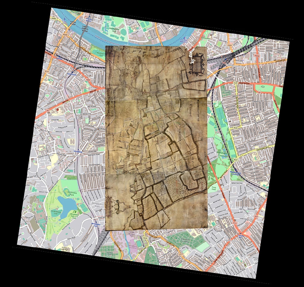
Gardner-Porter map re-oriented and imposed on a modern map
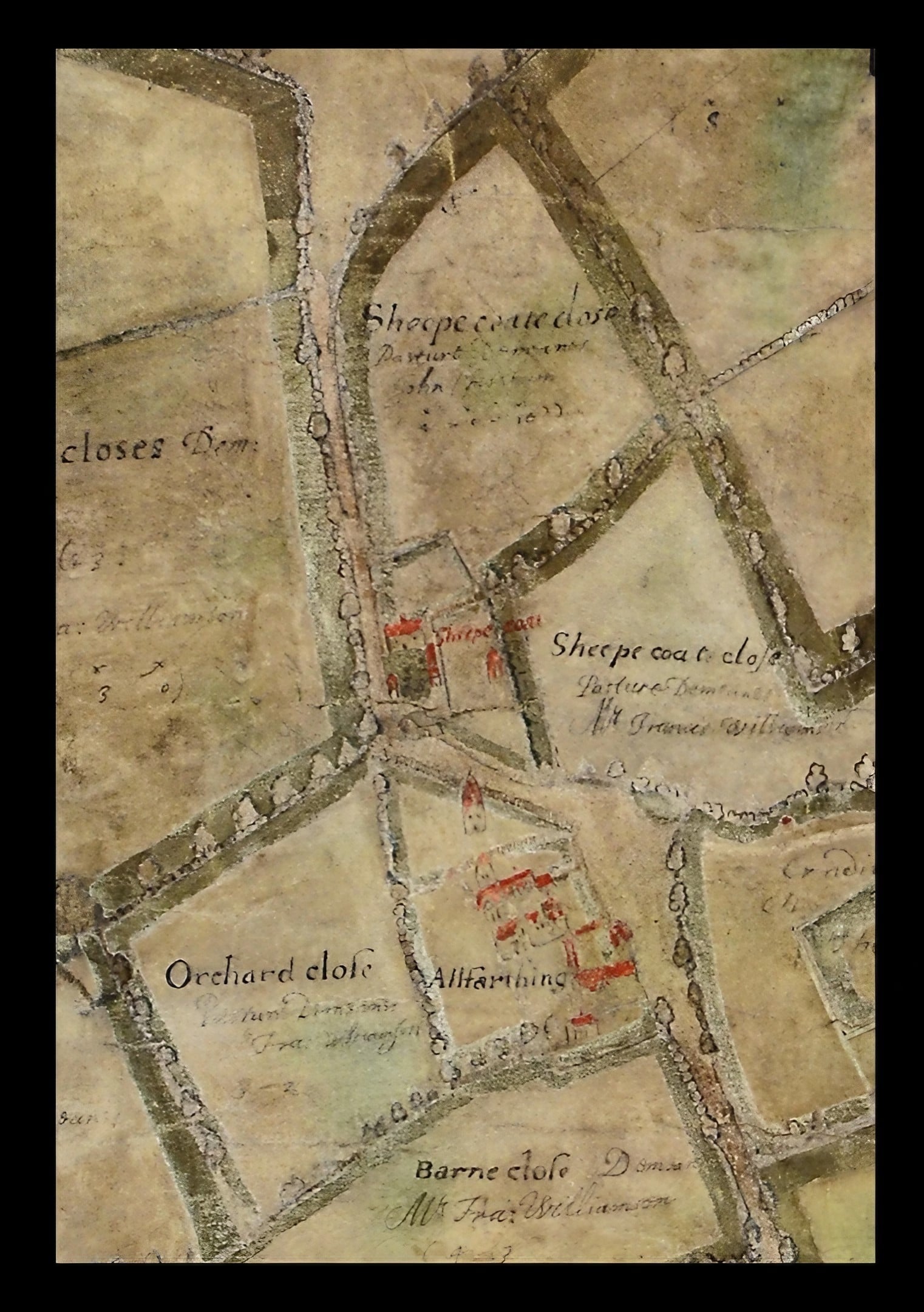
Close-up of Allfarthing Manor House, near today's Allfarthing Lane. Notice the "bird-beak" mouth of the Lane that aided the herding of animals onto and off the Common. Also the sharp bends in the road, which are still evident today.
The map is oriented East–West rather than the conventional North–South. To aid readability, I have tinted the Thames, the Wandle and some other stretches of water blue.
At the top of the map, “Allfarthin Peece” is the area we now call the Toast Rack. The rectangle at top right, labelled “Common Belonging to All-Farthing Manor,” corresponds to the Toast Rack today.
The map shows the Allfarthing estate in considerable detail but leaves adjacent manors (which Endymion Porter did not own) largely blank — as John Corris was to do in reverse in his survey of Earl Spencer's Wandsworth in 1787. (Spencer purchased Allfarthing Manor 1816-1821.)
[PB: Check relationship between this map and the copy held at — where? Also: the “Fit old on new” sequence of images showing the 1640 map overlaid on modern mapping is in the archive folder.]
Endymion Porter (1587–1649) was a courtier, diplomat and art patron, a close associate of both James I and Charles I, and a friend of Anthony van Dyck, who painted him. He was Lord of the Manor of Allfarthing — the estate whose boundaries this map records. Porter was a significant collector and patron of the arts; his circle included Rubens as well as Van Dyck.
[PB: See also the Anthony van Dyck portrait in the archive folder for this map: Endymion Porter with Anthony van Dyck, c.1635 (Prado, Madrid). Add further biographical notes and link to /people/ entry when created.]
— Rita Ensing, field and place-name research (documents in archive folder for this map)
— Allfarthing Manor (this site)
— People — see Endymion Porter [to add]
[PB: Add British Library / other institutional references for the original map and for copies. Dorian Gerhold's pamphlet on the Corris map (WHS, 2002) has context relevant here too.]
Page created June 2026. Part of Wandsworth Common in Maps.