Wandsworth Common
Sources of maps
[NEEDS SORTING OUT]
Sources of maps
[NEEDS SORTING OUT]
Aerial photographs
[Britain from above: Link.]
Maps
- Historic OS 1976-1995 London
- History OS 1950-1990
- Historic OS 1951-1978 London
- Historic OS 1947-1952 London
- Historic OS 1938 London
- History OS 1930s
- Historic OS 1916-1919 London
- Historic OS 1896 London
- Historic OS 1868-1881 Surrey
- Historic OS 1869-1874 London
- Stanford, 1866? [sections seem to be from different dates?]
- Ordnance Survey 5 feet to the mile, 1894-96 [folder on this site, here]
Ordnance Survey First Series 1:63360 (170 sheets covering England and Wales, 1805 to 1869)
C. Smith New Map of Great Britain and Ireland 1:633600 (4 sheets covering Great Britain, 1806)
Ordnance Survey of England and Wales Revised New Series 1:253440 (19 sheets covering England and Wales, 1902 to 1905)
Ordnance Survey of Great Britain New Series 1:633600 (8 sheets covering Great Britain, 1904)
Ordnance Survey of Great Britain New Popular Edition 1:63360 (114 sheets covering England and Wales, 1945 to 1948)
OS, 1894-96, 5 feet to the mile

(Click on image to enlarge)
Geographicus: Rare maps of London.
Check this link and add a note about how useful it might be.]
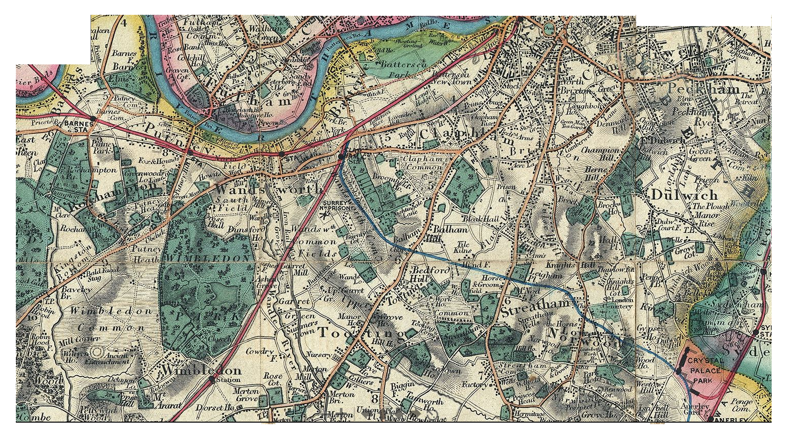
[NB There are some weird things in this map - parks [including large gardens] are marked in green but not commons - notice the "Iron Rail Way" is prominent - Garratt Lane is called "Grove Lane" - the Southampton Railway appears to cross "Wandsworth Common Fields" [in a deep cutting] - there is no Clapham Junction, only a small "Clapham Common Station" at the top of Battersea Rise before Wimbledon Station - and what appears to be the route of a [planned?] branch of this railway crossing Burntwood Lane just above Garrett Green heading south-east. What was this? The Crystal Palace line had not yet been connected. Notice Burntwood Lodge is marked - It looks like Burntwood House called "Burntwood Cottage"? Broomwood House is prominent. Notice a clear sprinkling of 11 or so houses where the Toast Rack will be built. There is an unnamed house & park along Heathfield Road/St Ann's Hill/Allfarthing Lane (presumably this is "Earlsfield" etc?)
(Click on image to enlarge)
Ash Rare Books: Books about London, including maps.
Check this link and add a note about how useful it might be.]
Mappalondon: Stanford, Library Map of London and its Suburbs, 1862

(Click on image to enlarge)
Mappa London: Stanford 1862, London, South West.
This is an excellent source of the 1862 edition. I have also downloaded the files to /wandsworth_common/maps/stanford_1862/]
Mappa London: other maps of London.
British Library: London maps.
Check this link and add a note about how useful it might be. Excellent source. ]
Includes the excellent CRACE COLLECTION.
Mapco: London maps.
Check this link and add a note about how useful it might be. Excellent source. ]
Including the excellent WYLD map of 1872.
Wyld, "A New Topographical Map Of The Country In The Vicinity Of London, Describing All The New Improvements, Metropolitan Boroughs And Parish Boundaries c1872"

(Click on image to enlarge)
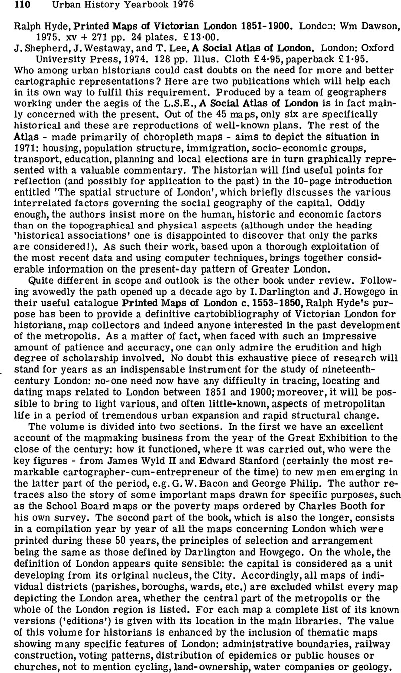
Ralph Hyde, Printed maps of Victorian London, 1851-1900, Dawson, 1975, 271 pages
[PB: Secondhand copies very expensive (£40+) - so try to borrow from Wandsworth Library.
Maps of London in the year of the Great Exhibition
The Ordnance Survey
The rise of Edward Stanford
Rivals to Stanford
Railway maps
Metropolitan improvement maps
Thematic maps
Booths poverty maps
Geological maps
Cycling maps
Maps for the School Board of London
Property maps
19th-century atlases of London
Mapmakers of the 90s
etc
Review
(Click on image to enlarge)
[Source: Ralph Hyde, Printed maps of Victorian London, 1851-1900.]
NB - see the excellent obituary of Ralph Hyde (1939-2015) by Erkki Huhtamo, which contains references to RH's numerous related works e.g. on panoramas etc.
DORIAN GERHOLD, from Wandsworth Past (2002)...DEVELOPED...
[Annotations and links by PB to be done.]
Maps
The most useful collection of maps is in WHerS [Wandsworth Heritage Service], which apart from original maps and copies has a microfilm covering most of the collection.
Other good collections of published material such as Ordnance Survey maps are in Guildhall Library, LMA and the British Library Map Library.
Manorial maps for the Spencer manors (many of them covering only small patches of ground) are in the British Library, Manuscripts Collection, Additional Manuscripts (Althorp Papers). [PB: FIND AND VIEW]
Copies of the map of Putney in 1636 can be purchased from St Mary's Church, Putney (by Putney Bridge), and copies of the map of Wandsworth in 1787 and the south-west parts of Stanford's London map of 1862 from Wandsworth Historical Society. Many of the 25 inch to the mile Ordnance Survey maps are available in the Godfrey series of reprints.
The most important large-scale maps for each parish, showing individual houses and fields, up to and including the first Ordnance Survey 25 inch to the mile maps, are as follows (copies in WHerS unless indicated otherwise):
Whole Borough
1862 Stanford's Library Map of London and its Suburbs.
1865-70 Ordnance Survey 25 inch to the mile.
Wandsworth
1633 manorial map of Allfarthing, i.e. eastern part of Wandsworth only (not in WHerS; original in Surrey History Centre, 3991/1). [PB: COPY IN HAND]
c.1740 manorial map of Downe and Dunsford, i.e. western part of Wandsworth only (original in TNA, MR 1/1152).
1755 map covering Bridge Field, the north-east part of the parish, only.
1787 manorial map by Corris, with book of reference (original map in British Library, Add 78154, item BB, with book of reference as item B; see Dorian Gerhold, John Corris's map of Wandsworth in 1787 (2002) for main part of book of reference). [PB: COPY IN HAND]
1835/6 maps of Spencer freeholds offered for sale (original maps at British Library, Add 78149, items I to N, and Add 78154, items T to W). [[PB: SOUNDS INTERESTING]
1838 tithe map, with book of reference. [PB: COPY IN HAND]
Battersea
1760 map of northern part only (original in British Library, Crace, port. XVI, No. 71).
1787 manorial map by Corris, with book of reference (original map and a later copy in British Library, Add 78149, items T and U). [PB: MAP IN HAND - FIND BOOK OF REFERENCE]
1838 tithe map, with book of reference. [PB: COPY IN HAND]
Tooting Graveney
1767 manorial map of Tooting Graveney and part of Streatham parish (original in Lambeth Archives, 25/1767/MF).
1844 parish map.
1847 tithe map, with book of reference.
Streatham
1729 manorial map of Tooting Bec and Furzedown (original in LMA, E/BER/S/E/ 5/3/1, with book of reference at E/BER/S/E/4/1; no copy of latter at WHerS).
c.1820 manorial map of Tooting Bec (original in LMA, SKCS PR 14; not in WHerS).
1840 tithe map, with book of reference.
1843 parish map (original in LMA, SKCS PR 20).
Putney
1636
estate map by Nicholas Lane, not including Roehampton (original on display in St Mary's church, Putney).
1787 manorial map by Corris, with book of reference (original map held by Wandsworth Museum; another version is at British Library, Add 78153, item D; see Wandsworth Historian, No. 67 (1995), pp. 4-10 for book of reference).
1834 parish map.
1849 tithe map, with book of reference.
_________
Among the most important later maps are Charles Booth's poverty maps of 1889 and 1898-9, colour-coding streets according to the poverty or wealth of their inhabitants. The 1898-9 map covers most of the Borough, but the 1889 one only the northern part of Battersea. The 1889 map has been published by the London Topographical Society (No. 130, 1984); the 1898-9 map can be found in Charles Booth, The life and labours of the people in London, part 3, vol. 5 (1902).
WHerS has copies of Goad's insurance plans, at a very large scale but mainly of industrial areas, from 1903.
[Source: Link.]
DORIAN GERHOLD, from [REF] / TO BE DEVELOPED
Maps
The most useful collection of maps is in WHerS [Wandsworth Heritage Service], which apart from original maps and copies has a microfilm covering most of the collection. Other good collections of published material such as Ordnance Survey maps are in Guildhall Library, LMA and the British Library Map Library. Manorial maps for the Spencer manors (many of them covering only small patches of ground) are in the British Library, Manuscripts Collection, Additional Manuscripts (Althorp Papers).
Copies of the map of Putney in 1636 can be purchased from St Mary's Church, Putney (by Putney Bridge), and copies of the map of Wandsworth in 1787 and the south-west parts of Stanford's London map of 1862 from Wandsworth Historical Society. Many of the 25 inch to the mile Ordnance Survey maps are available in the Godfrey series of reprints.
The most important large-scale maps for each parish, showing individual houses and fields, up to and including the first Ordnance Survey 25 inch to the mile maps, are as follows (copies in WHerS unless indicated otherwise):
Whole Borough
1862 Stanford's Library Map of London and its Suburbs.
1865-70 Ordnance Survey 25 inch to the mile.
Putney
1636estate map by Nicholas Lane, not including Roehampton (original on display in St Mary's church, Putney).
16371787 manorial map by Corris, with book of reference (original map held by Wandsworth Museum; another version is at British Library, Add 78153, item D; see Wandsworth Historian, No. 67 (1995), pp. 4-10 for book of reference).
1834 parish map.
1849 tithe map, with book of reference.
Wandsworth
1633 manorial map of Allfarthing, i.e. eastern part of Wandsworth only (not in WHerS; original in Surrey History Centre, 3991/1).
c.1740 manorial map of Downe and Dunsford, i.e. western part of Wandsworth only (original in TNA, MR 1/1152).
1755 map covering Bridge Field, the north-east part of the parish, only.
1787 manorial map by Corris, with book of reference (original map in British Library, Add 78154, item BB, with book of reference as item B; see Dorian Gerhold, John Corris's map of Wandsworth in 1787 (2002) for main part of book of reference).
1835/6 maps of Spencer freeholds offered for sale (original maps at British Library, Add 78149, items I to N, and Add 78154, items T to W).
1838 tithe map, with book of reference.
Battersea
1760 map of northern part only (original in British Library, Crace, port. XVI, No. 71).
1787 manorial map by Corris, with book of reference (original map and a later copy in British Library, Add 78149, items T and U).
1838 tithe map, with book of reference.
Tooting Graveney
1767 manorial map of Tooting Graveney and part of Streatham parish (original in Lambeth Archives, 25/1767/MF).
1844 parish map.
1847 tithe map, with book of reference.
Streatham
1729 manorial map of Tooting Bec and Furzedown (original in LMA, E/BER/S/E/ 5/3/1, with book of reference at E/BER/S/E/4/1; no copy of latter at WHerS).
c.1820 manorial map of Tooting Bec (original in LMA, SKCS PR 14; not in WHerS).
1840 tithe map, with book of reference.
1843 parish map (original in LMA, SKCS PR 20).
_________
Among the most important later maps are Charles Booth's poverty maps of 1889 and 1898-9, colour-coding streets according to the poverty or wealth of their inhabitants. The 1898-9 map covers most of the Borough, but the 1889 one only the northern part of Battersea. The 1889 map has been published by the London Topographical Society (No. 130, 1984); the 1898-9 map can be found in Charles Booth, The life and labours of the people in London, part 3, vol. 5 (1902).
WHerS has copies of Goad's insurance plans, at a very large scale but mainly of industrial areas, from 1903.
[Source: Link.]