← OS map, 1894–96
Today →
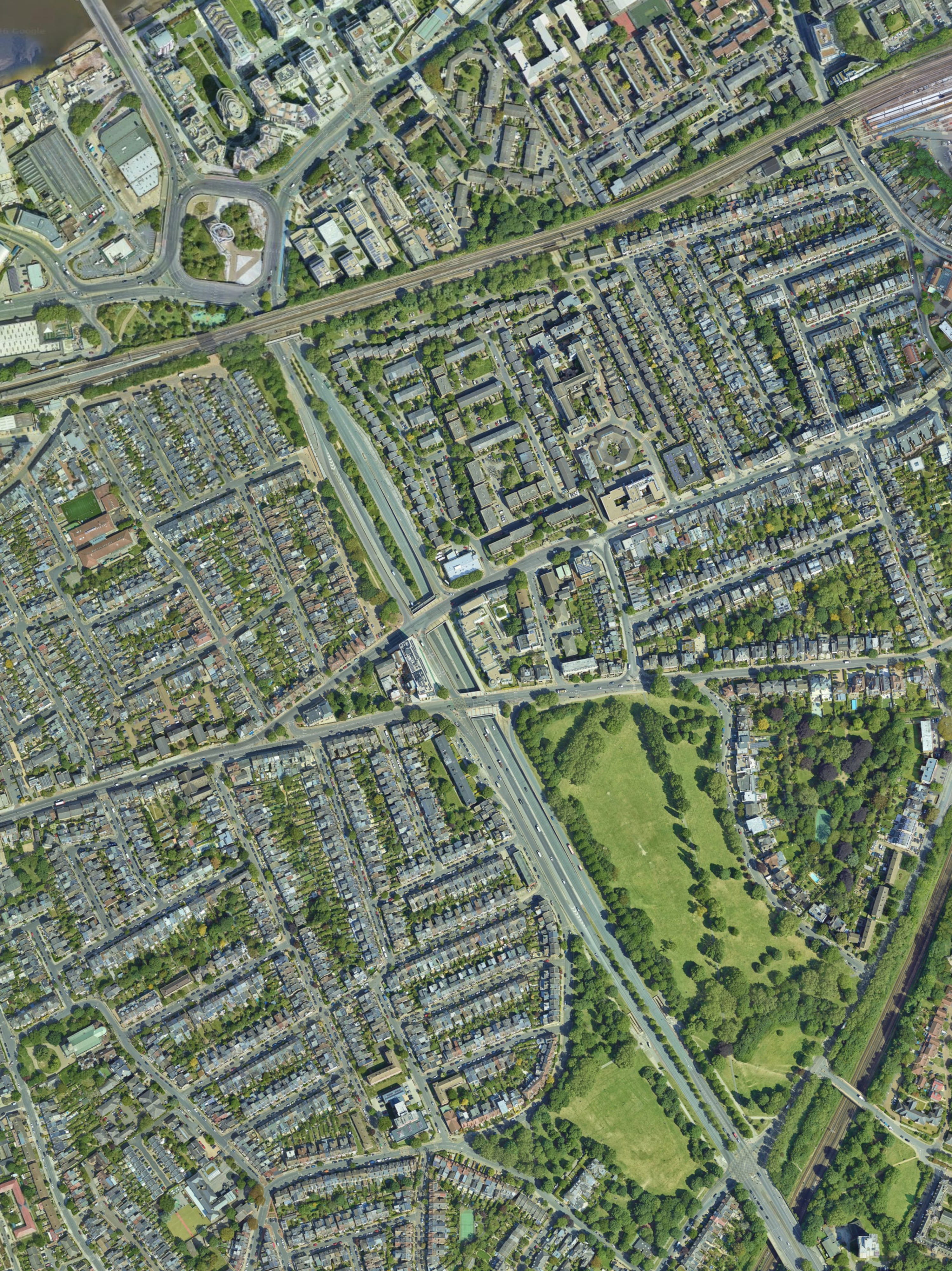
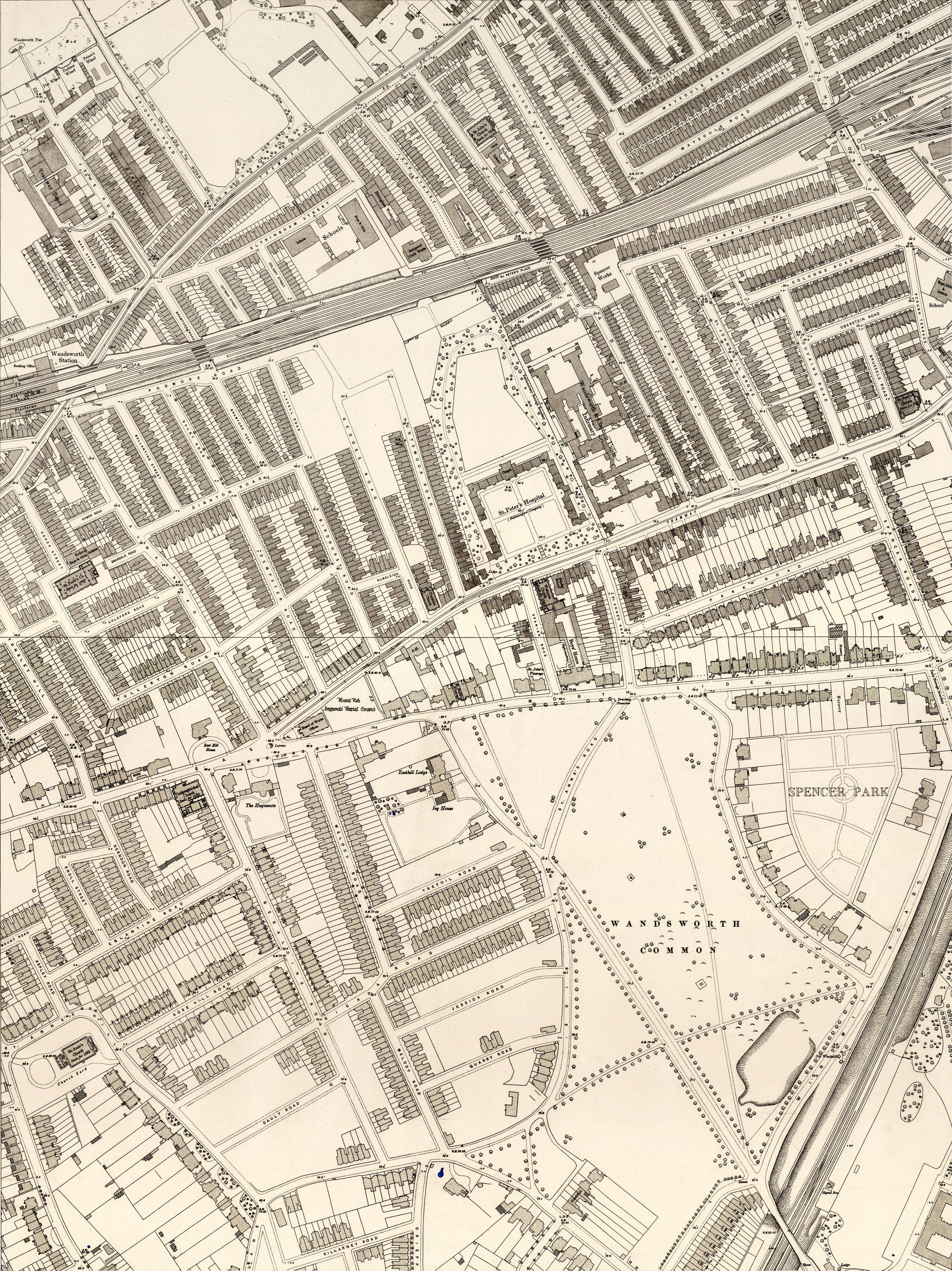
The construction of the widened Trinity Road, the Wandsworth roundabout and underpass between 1968 and 1972 involved the demolition of a substantial number of Victorian streets. The OS map of 1894–96 (60-inch survey) shows the dense terraced housing that once occupied the area now taken up by the dual carriageway and roundabout. Use the slider on the map to dissolve between the two views.
Drag the slider to fade between the OS map of 1894–96 and the modern aerial view.
The widening of Trinity Road, the digging of the underpass and the construction of the "Square-about" near Wandsworth Bridge was begun in 1968 and completed in 1972. On North Side a number of houses were demolished, including the historic ?? (the former Mulberry Cottage) and Lake Terrace.
Roads that disappeared or were greatly changed included Huntsmoor and Geddes Roads, and part of Birdhurst Road, south of the railway line, and beneath the railway and the river. Eltringham Street, which once ran all the way to Wandsworth Town, was among the streets demolished to make way for the new road layout.
The underpass later became (in)famous as the location used by Stanley Kubrick for a scene in A Clockwork Orange (1971).