Last modified: 3 October 2026
[March 2023": THINK I NOW HAVE BETTER VERSIONS OF SOME ROCQUE MAPS — CHECK AND ADD.]
CHECK this image is of the 1746 1st edition — the map was frequently reproduced and partly revised at least to 1769.]
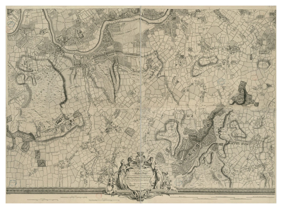
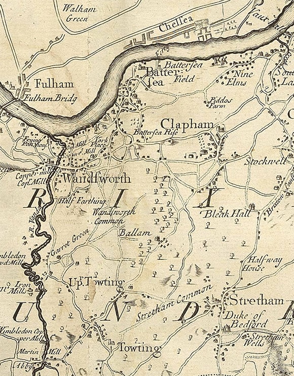
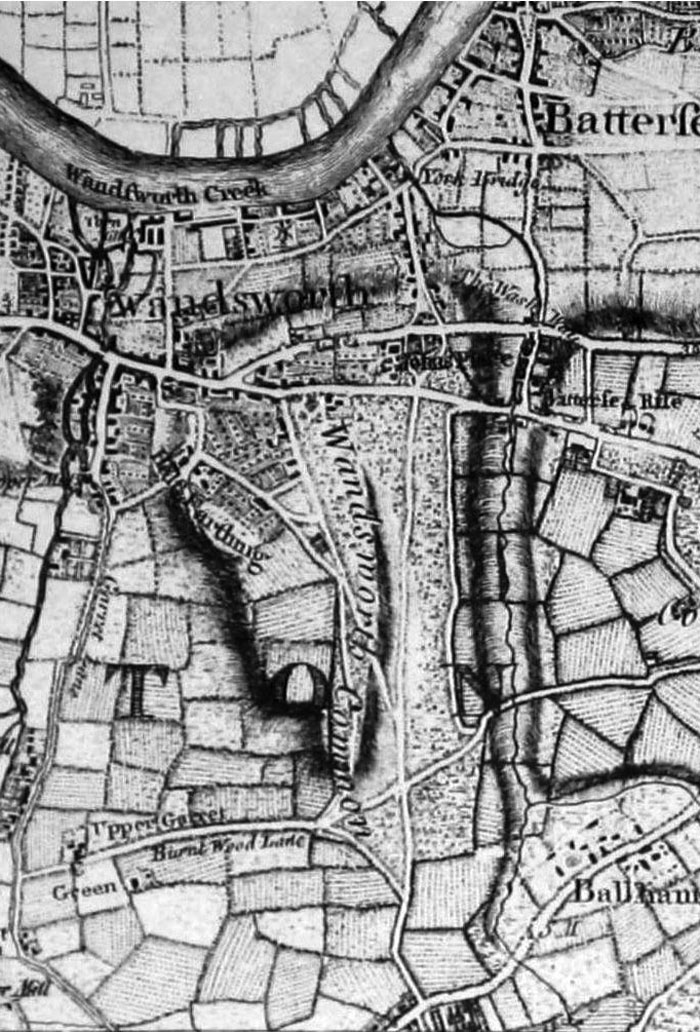
This is the earliest map (that I know of) that combines the wastes or commons of the two adjacent parishes (Wandsworth East Field and Battersea West Field) as "Wandsworth Common".
Notice how few houses are shown.
The roads or tracks across the common are a challenge to interpret. [BUT TRY.] Only Burntwood Lane is named. Some roads seem to correspond reasonably well with today's roads — Burntwood Lane and Nightingale Lane, and the track that joins them (the future Bellevue Rd). Also something like Lyford/Heathfield Roads and St Anne's Hill/North Side. And North Side/Battersea Rise, Bolingbroke Grove.,br>
The most problematical roads are the ones running more or less north-south from Tooting. There is nothing that is clearly "Trinity Rd" (a name that wasn't used until the 1870s [?], while Thomas Hardy was resident), except at the bottom end (an earlier name for this lower section was Wheatsheaf Lane, posssibly after the pub at the corner). The left hand, branch runs to the point where Beechcroft Road (now parallel to Trinity Rd) now meets Burntwood Lane.,br>
The most puzzling roads apparently fork somewhere in the middle of the Common. A number of branches to the left veer towards Wandsworth. The main track on the left ends at much the point Trinity does now, to reach the main roads between London and Kingston (but veering westward to avoid some large ponds — emphasised in Tirion's map of 1754). Incidentally, Trinity Rd still shows signs of this jink.,br>
But it's the right fork, leading to Battersea, that is the most intriguing, and for which there appears to be no modern equivalent. This road, which ran along the Wandsworth-Battersea parish boundary, appears in a number of maps in the next 50 or so years (see e.g. Cary 1786, and Faden 1790, which omits the proto-"Trinity Rd" entirely), but then disappears. Its only relic (that I know of) is the wide track that runs a few hundred yards behind the Toast Rack garden fences. I wonder if it formerly acted as something of a barrier to encroachment from the west, since this "road" will have been regularly used perhaps for thousands of years? Travellers along it would presumably have resisted incursion over their "desire line".
Notice Rocque indicates mounds or hillocks, particularly in the north of the common. In an article about the Mount Pond on Clapham Common, [NAME?] seems to suggest these are/may be old (Neolithic? Bronze Age? Iron Age) burial mounds. He also suggests they were used to establish boundaries between neighbouring parishes. Or are they simply for artistic effect, to evoke the "wildness" of the terrain Certainly the Common is not flat — this came much later, mainly at the end of the C19 (much to e.g. Edward Thomas's despair).
Online version at British Library./p>
This map was first published by Rocque in 1746, and several editions appeared before his death in 1762. His widow Mary Ann carried on the business for a few years, until, in the late 1760s, she transferred the plates of the map to the publishers Carrington Bowles and Robert Sayer, under whose imprints this edition appeared in 1769. Printed in 16 sheets, the map is set within a decorative border. Its title features in English, Latin and French along the top, with emblematic figures below the City arms at top centre, and the compass star at top left. The map is dedicated to Lord Burlington at bottom centre. Scales are given at the foot of the map in versts, leagues, toises, yards and miles. A key to symbols distinguishing orchards, arable land, formal parkland and gardens, pasture, and woodland is included at bottom right.
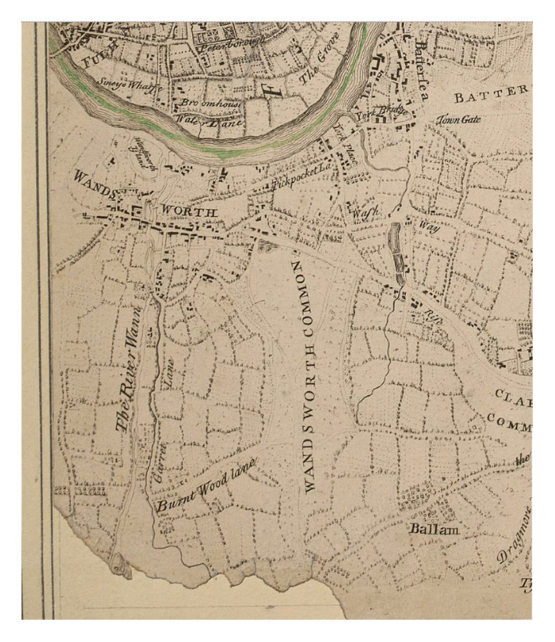
There is an online version in the British Library: Crace Collection of British Maps.
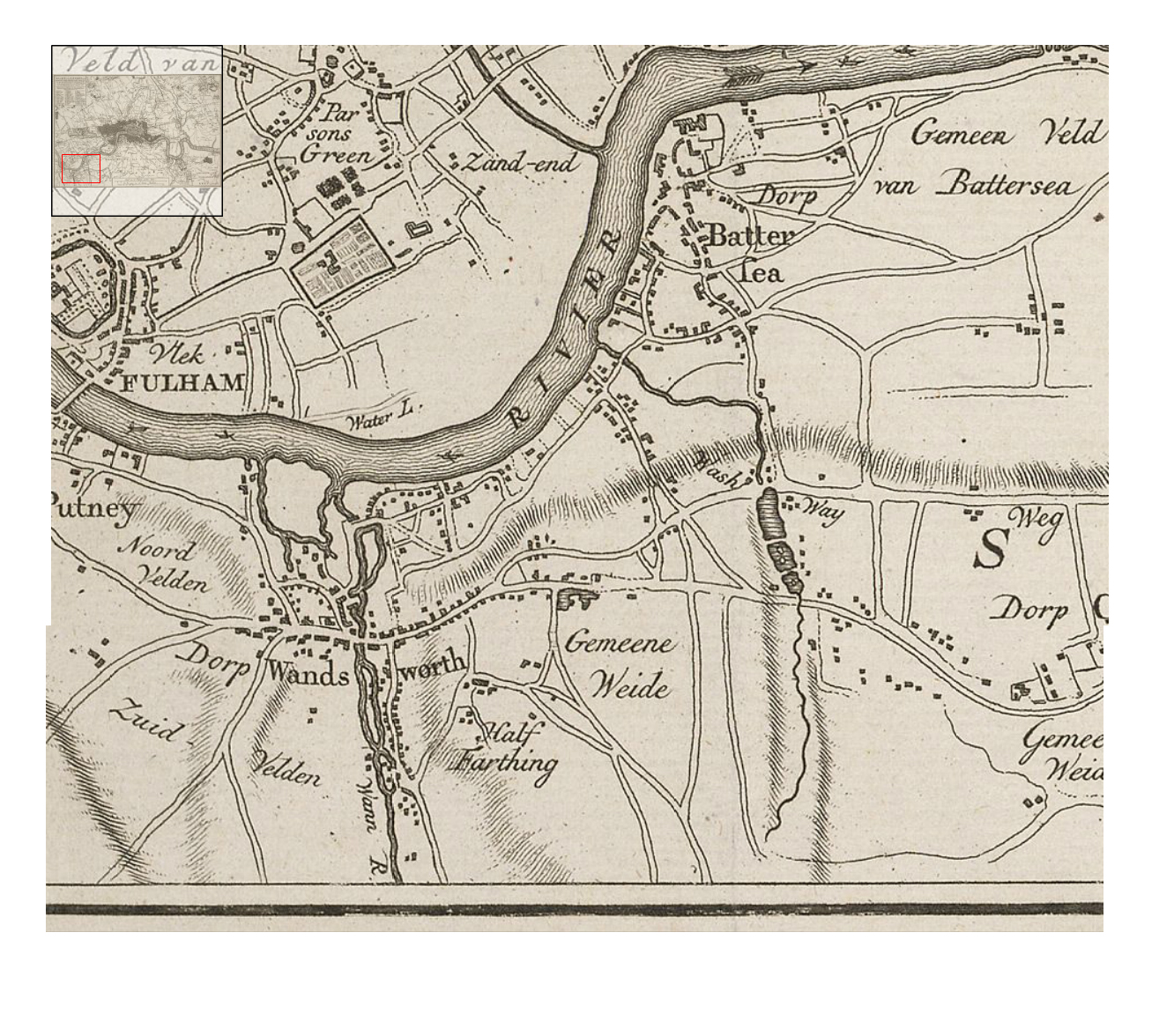
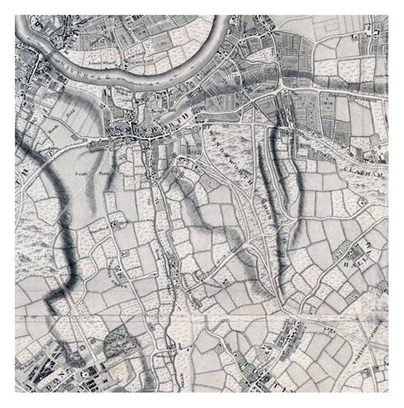
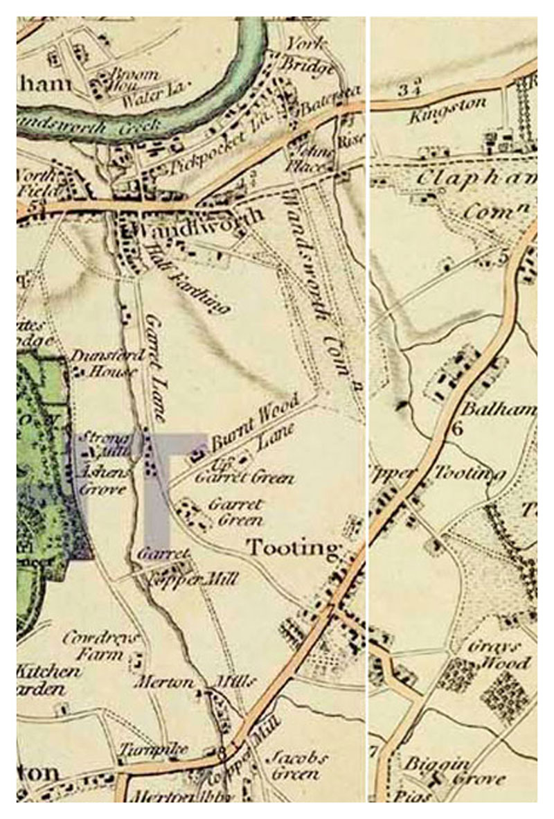
The title states that this map was based on John Rocque (presumably 1744 or soon after). It is much more clearly delineated than Rocque's maps. Notice the hatching to show slopes. However, (so far as I can tell) the reader has to rely on other clues to know whether the slope is up or down, e.g. the relation to nearby rivers.
Notice the (unnamed) Falcon Brook arising in the south. It flows northward into 3 large ponds [where St John's Rd is today], then north for short distance before turning westward into the Thames.
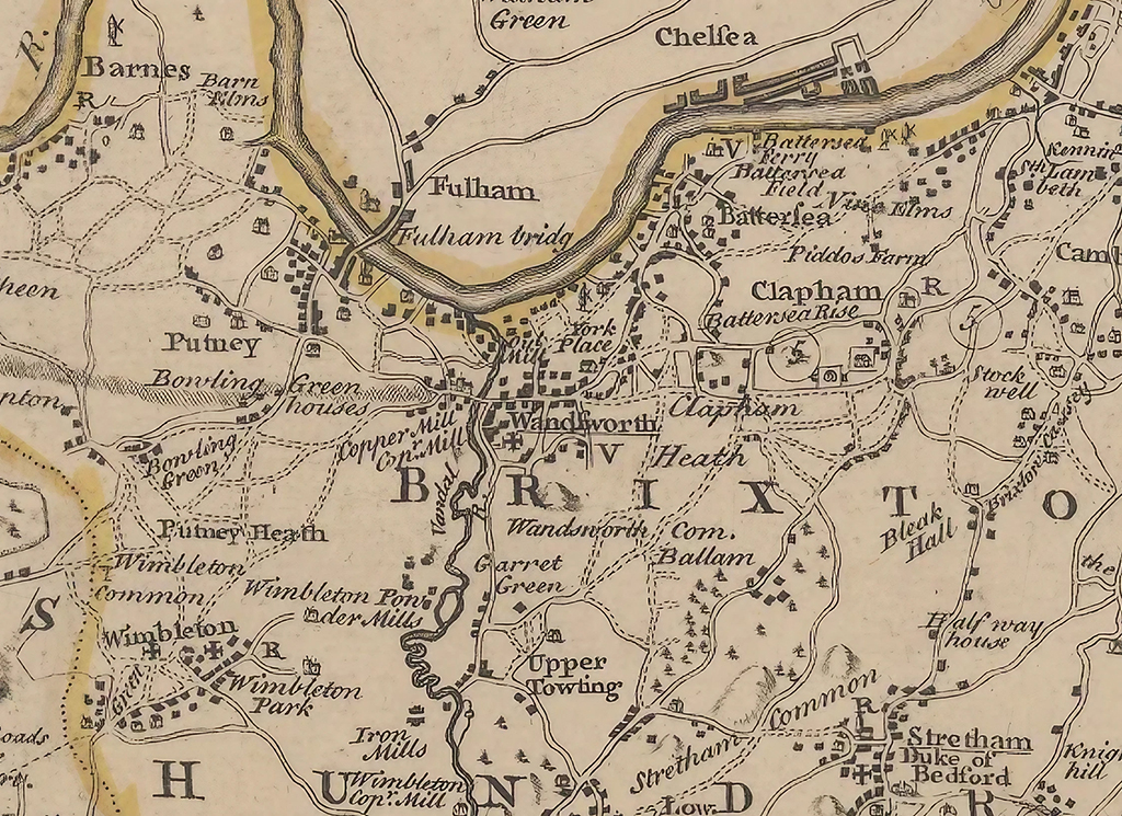
"KAART van LONDEN enz en van het NABY GELEGEN LAND ruim een Uur gaans. rondsom dezelve Stad; getrokken uit de groote gemeeten Kaart van de Hr. JOHN ROCQUE, Te AMSTERDAM by ISAAK TIRION 1754" (Acc. to Google Translate: "MAP of LONDON etc and of the NEARBY LAND more than an Hour around this City; drawn from the large municipalities Map of the Hr. JOHN ROCQUE, in AMSTERDAM by ISAAK TIRION 1754")
British Library:
In the second half of the 18th century, the introduction of turnpike roads and the increased coach-traffic in and out of London contributed to the popularity of the maps of the countryside around the capital.
This map of the area ten miles round the City of London was published in Amsterdam by Isaak Tirion. Based on John Rocque's survey of 1744, the map's title, imprint and key appears in a table at top left. The scale bars are in a panel below the plan. Built-up areas are stippled in the City and hatched..."
Online version at British Library: Crace Collection.
"Gemeene Weide" = Common Pasture = land grazed by a multiplicity of proprietors.
"Gemeen Veld" = Common Field. Is this different from Weide?
"Zuid Velden...Noord Velden" = South Field...North Field
Glossary of Dutch terms relating to Common Land.
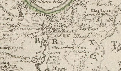
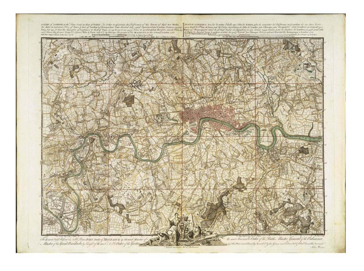
The text (top left) declares the map is the work of "J Rocque Chorographer to His Majesty, in the Strand, London 1762. With new improvements to the year 1766." The map was created explicitly to show how much larger London was at this time than Paris ("the two RIVALS").
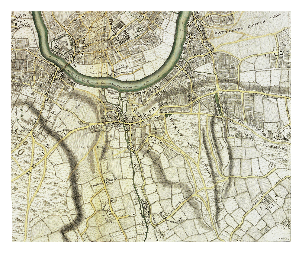
A high-resolution, nicely coloured edition of this map can be seen online at Bern University.
Of which, South-west London.
[PB: Compare this map of 1768 with the high-res Rocque map of 1741-5. Possible areas of further encroachment include east of future Bolingbroke Grove and several areas to the west of the Common. Roads increasingly form the boundary of the Common — previously the roads are shown as tracks, with "waste" land on either side. Now fields go right up to roads. The Rocque map published in Bern in 1766 appears to be a cleaned up copy of the orginal 1746 map, not subsequent versions.]
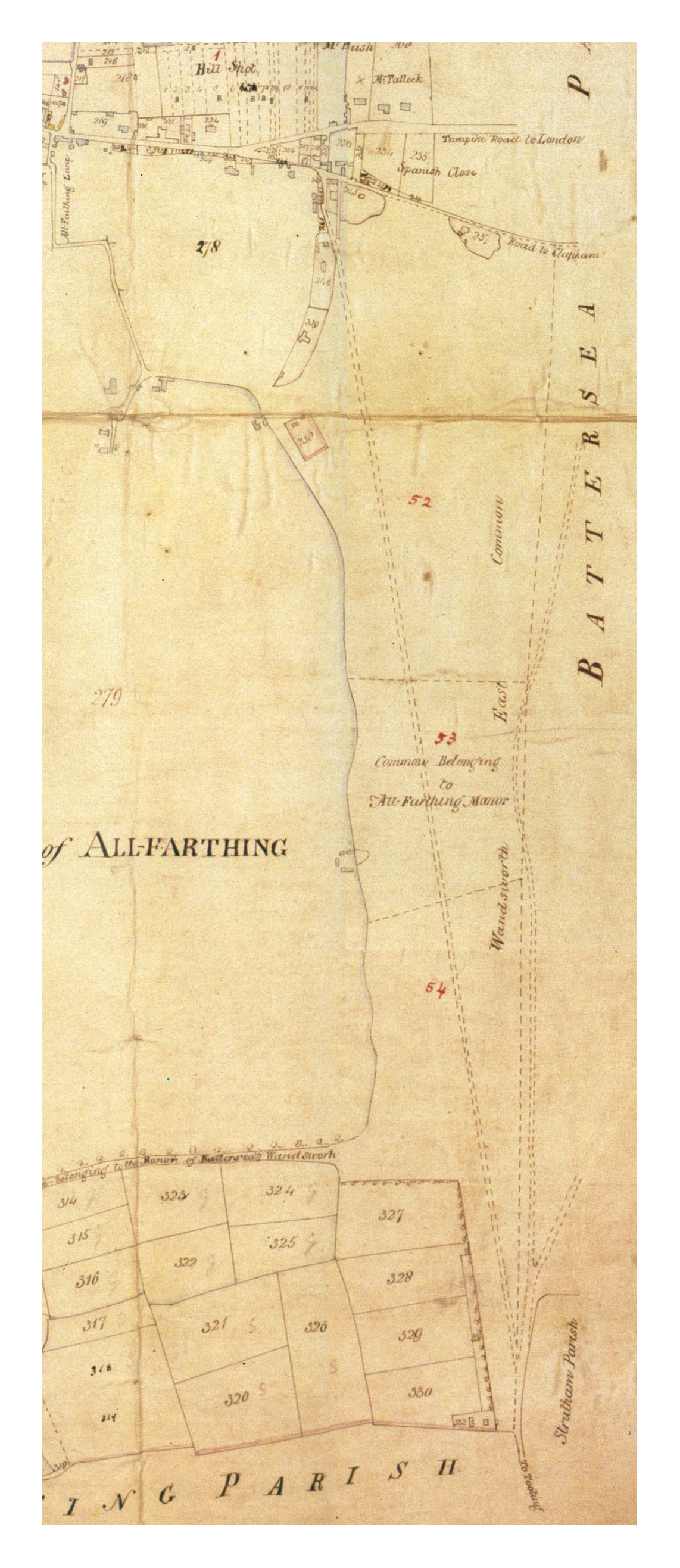
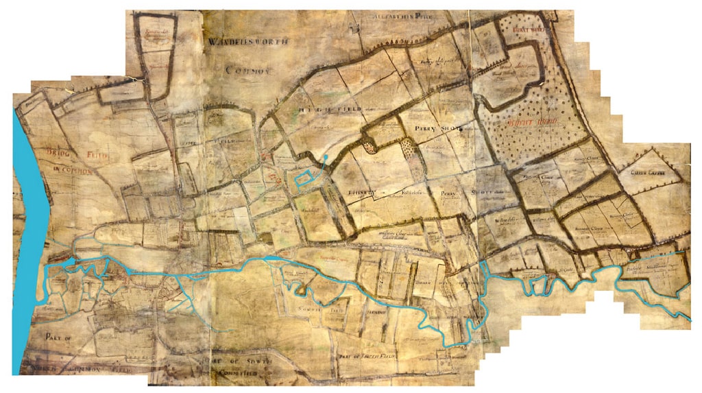
A highly detailed survey of land holdings in Wandsworth conducted on behalf of Earl Spencer. (This explains why the manor of All-farthing, which he did not own, is largely left blank.)
The rectangle numbered 53 in red, "Common Belonging to All-Farthing Manor", is now the "Toast Rack". The track that will become Trinity Rd runs straight (cf Rocque's maps) to the left of a wandering north-south track into Battersea. A relic remains today in the wide cinder track parallel to Baskerville Road.
A reduced-scale reproduction of the map and an excellent pamphlet by Dorian Gerhold analysing the map in detail (published 2002) is available from Wandsworth Historical Society: Publications.
Corris also mapped Battersea and Putney e.g. 'A Plan of Battersea Parish in the County of Surry', 1787 (a 'Correct Copy' by William Ward in British Library, Add. Ms 78149, Vol. MMDCCCXLIX/U).
Has the Battersea map also been reproduced? It would be good to combine it with the Wandsworth map.

Notice Earl Spencer's Freehold Estate outlined in RED, land held by his copyholders in ORANGE, and "Open Fields, Marsh and Commons" in GREEN. There appears to be clear evidence of Spencer encroachment up to the track that will become Bolingbroke Grove — is it? Look also at the "ghost road" from Tooting to Battersea that runs more or less along the parish boundary [see "Explanation" below]

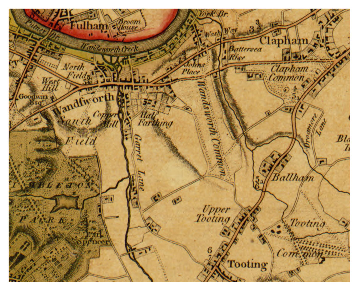
Online versions at different resolutions at Library of Congress.
See also the 2009 redrawing by Andrew Macnair, Faden's Map of London (1788)
Notice the two tributaries of the Falcon Brook — longer and more emphatic than on other Faden maps.
Notice also that the emphatic north-south road across the common is the one to Battersea, along the parish boundary — not the proto-"Trinity Road" (as shown in e.g. Milne 1800). Why?
Online versions at different resolutions at Mapco.
Fro, Mike Tuffrey, 23 February 2023:
Edwards' Companion from c1790s (published 1801) has a good description of all the mansions at Clapham and adjacent areas, but I hadn't realised until Timothy Walker copied me into his correspondence with the British Library that it also has some maps. Or at least some copies do (the BL one doesn't).
Googling for more info, I came across this item for sale at Caburden Rare Maps and helpfully one of the images the seller has included is the south London map (scroll across).
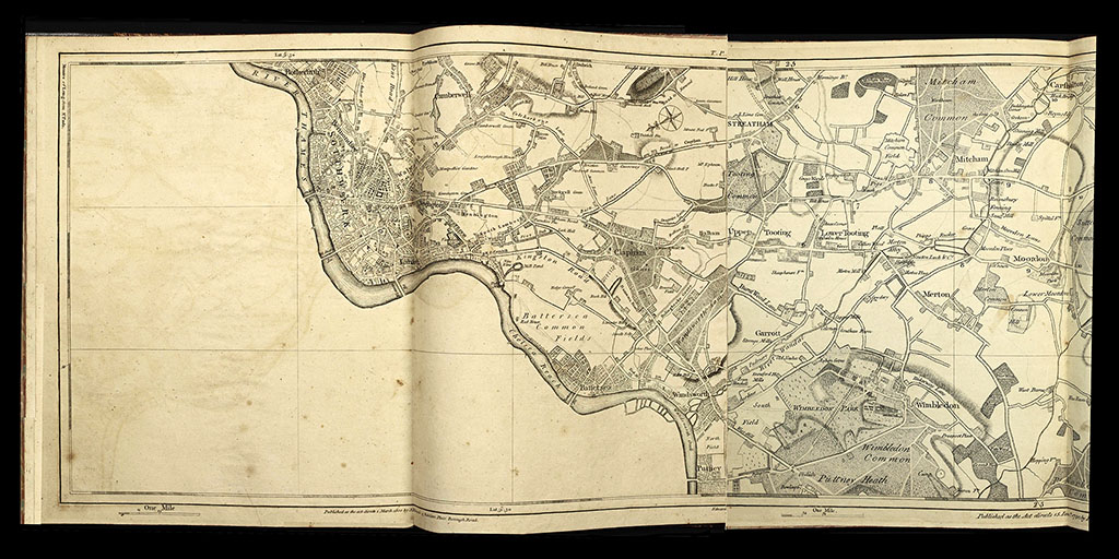
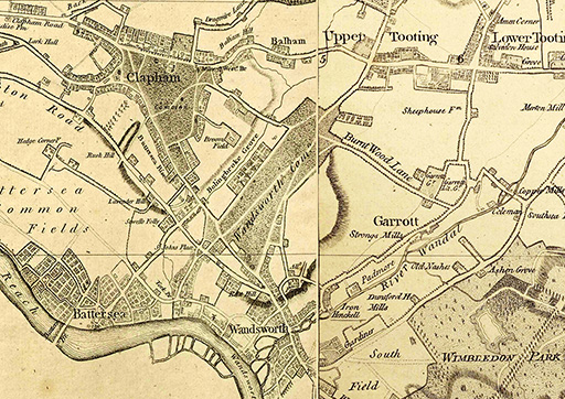
EDWARDS, James E.
A Companion from London to Brighthelmston, in Sussex; Consisting of a Set of Topographical Maps from Actual Surveys, On a Scale of Two Inches to a Mile
For the Author, No. 23, Belvidere Place, St. George, Southwark, London, 1801
Folio (290 x 240 mm.), nineteenth century half red calf, marbled paper boards, gilt ruled, gilt title to the spine, marbled endpapers, light wear. With typographic title page, List of Subscribers, Companion in 2 parts, Description, pp. xiii, 16, 86, 24, with 6 copperplates, 9 double-page detailed maps and 5 further maps, light water staining, otherwise in good condition. Stock number: 10425.
— https://collections.britishart.yale.edu/catalog/orbis:6602248 - https://eehe.org.uk/?p=28908 - https://mertonhistoricalsociety.org.uk/james-edwardss-companion-from-london-to-brighthelmston-1789-1801/

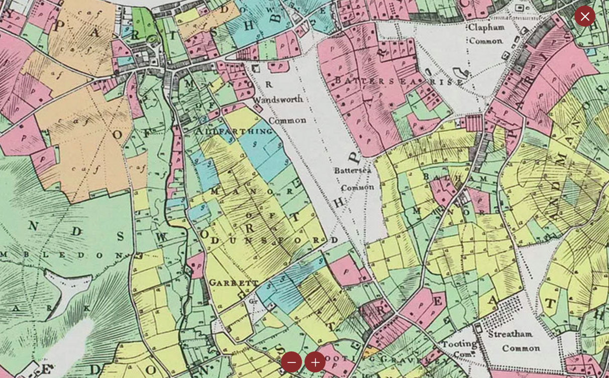
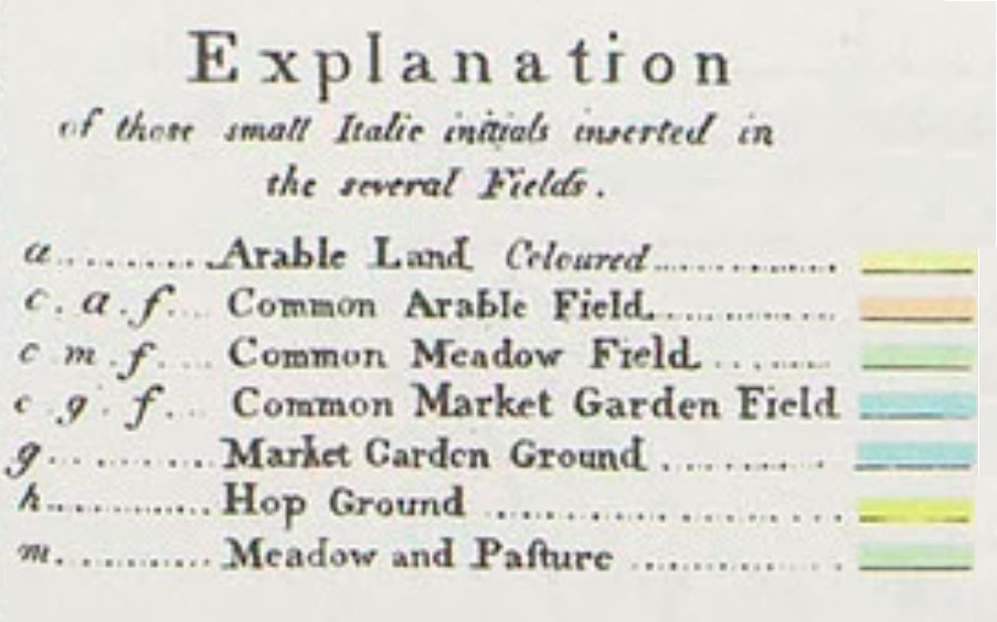
NB 'Paddocks or little parks' are represented by the letter 'p' and pink colour; the position of the residence within the park is shown by a black rectangle. Notice there is no "Allfarthing Piece/College Park/Toast Rack" shown.
[NEEDS MORE WORK]
Pioneering survey. Milne used a new lightweight theodolite.
See e.g. Royal Collection Trust: Thomas Milne's Land Use Map of London and Environs in 1800, which is eloquently colour-coded. The prominent areas coloured pink mainly to the north of WC labelled p = "paddocks or little parks" i.e. house gardens and fields for e.g. horses [pink]. Notice the "common arable fields" (orange-brown) on the east edge of this map [Southfields?] and a small area to the north. But not in the fields bordering WC, which are g = market garden ground [blue], m = meadow and pasture [green], and a = "arable" i.e. could be ploughed for field crops (though presumably also including fallow land and temporary meadows planted with grass for mowing (also grain, legumes and other fodder crops for animals), on which animals could be pastured which added to soil fertility, given how valuable grass/hay was for burgeoning nearby London [yellow].
Wandsworth Common and Battersea Common are separately named. (Also Garratt Green and the future Garratt Park shown as commons.) Notice how little is shown on the common — mainly unfenced roads and tracks, and the parish boundary. No lakes or ponds are shown. Unlike on e.g. Streatham Common, there is no evidence of planted trees.
The map records the use of each field by means of an inserted letter and an overpainted colour. These make it possible to distinguish no less than twelve different types of land uses; as several are sub-divided, seventeen categories in all may be distinguished.
Arable land, when enclosed, is shown by the italic letter 'a' and a pale brown colour not unlike the one used by the Land Utilization Survey a century and a quarter later. Enclosed meadow and pasture are shown exactly as on the later Survey, by the letter 'm' and light green colouring. Woodland is shown by the letter 'w', tree symbols in the form of tiny circles, and dark green colour. Enclosed market gardens receive the letter 'g' and light blue colour; nurseries 'n' and orange colour. Orchards and osier-beds share the letter 'o' and blue colouring, so that the map reader needs to judge from the nearness of the field to the river which of the two is intended. 'Paddocks or little parks' are represented by the letter 'p' and pink colour; the position of the residence within the park is shown by a black rectangle. Drained marshland pasture has the letters 'ma' and grey- green colouring.,/p>
Common fields, with their admixture of small strip-fields used for diverse purposes, present a difficult problem to the cartographer. One-third of the agricultural land of the London area still remained unenclosed in 1800. Milne showed great care and skill in representing, within the limits of scale, the variety of land use in common fields. The letters 'caf' designate common arable fields. They are coloured brown if wholly arable, and bear conventionalized brown and green stripes if there is a considerable admixture of grassland strips with the arable. Common meadows bear the letters 'cmf' and solid green colouring, or green and brown bands as might be appropriate. Common market-garden fields are shown by the letters 'cgf' and blue colouring, or by blue and brown bands.,/p>
Great care is used to make information about common fields comprehensive. Within the common fields of Battersea, for example, it is possible to recognize on the map tracts of wholly arable land, blocks of meadow, areas of mixed arable and market-garden strips, a patch of drained marsh- pasture and a number of nurseries and market-gardens held in severalty within the boundaries of the common fields.
The legend attached to the map enables all forms of land use mentioned above to be distinguished. Other forms depend on the engraving for their recognition.
Commons and open spaces such as village greens are shown without letter or colour, but have the name of the common, or green, inserted within the boundary.
Lakes and flooded pits are shown, as on the modern six-inch Ordnance map, by thickening their outline on the north and west sides.,/p>
The well-spaced buildings on the planned estates of Bloomsbury, Blackheath and Somers Town are stippled, whereas the congested streets in the older parts of London have their buildings densely ruled.,/p>
In addition to roads, field tracks are shown by double lines of dots, with single dotted lines for paths across commons and open fields.
Parish boundaries in open country are shown by dots in groups of three.
Relief is shown by means of hachures assisted by a deepening of the colours over hachured portions which adds emphasis to them. The hachuring reveals clearly the erosion, surfaces bevelling the summits of the ridges of Hampstead, Harrow and Richmond, and enables even subdued features such as the terminal bluff of the Taplow Terrace to be recognized. Milne's map is valuable as a means of visualizing the landscape of the London area in terms of a 'physiographic staircase' of flats and slopes.
[Source: GBG Bull, "Introductory essay on Thomas Milne's Land Use Map of London & Environs in 1800", London Topographical Society 1975-6, Publication nos 188 & 119, on Royal Collection Trust website" here. There is also a JSTOR article by Bull — find. ]
Reproductions also appear to be available from the LTS London Topographical Society
Clapham and Wandsworth Commons almost meet — the are separated by the "paddocks or little parks" around just two villas. Were they once more or less continuous?
The three large ponds on the (unnamed) Falcon Brook are still present. St John's Road, running along the edge of the ponds, is more emphatic than on earlier maps. (I believe this road was still called "Battersea Rise" at this time.)
Notice the house and enclosure that will become Spencer Park. However, no "Black Sea" is shown. Did it not exist, or did Milne ignore it because it had no economic function? There are no ponds shown on WC, however there is just a suggestion of the large pond at the north-west corner, near East Hill (prominent on the Corris map of a few years earlier) — which also appears to be part of an enclosure.
Tracks/roads are clearly marked and relate closely to modern roads e.g. today's Trinity Road, Bellevue, Bolingbroke Grove, East Hill. Or do they? Today's St James's Drive appears to be present, but I'm not sure it matches the track shown, especially where it approaches the bottom of Nightingale Lane.
There are no tracks shown that might correspond with modern roads such as Lyford Road/Heathfield, Earlsfield, Magdalen etc. These did not appear until the late C19.
Curiously, no track is shown following the boundary between the parishes (cf Rocque and Corris maps).
The importance of hay as a major cash crop in areas around London was first brought to my attention by Gillian Tindall, The Fields Beneath. Presumably hay production encouraged enclosure?
Wikipedia: Hay.
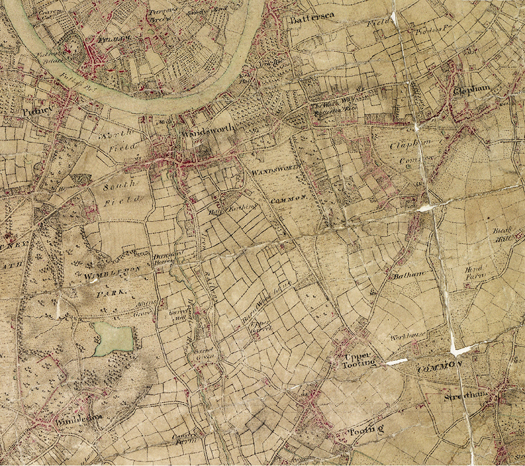
[Layers of London: Ordnance Survey Drawings, 1798-1809.]
[One source [arcaeol] says Wandsworth etc was surveyed in 1804. I have followed this claim, though I am not sure what it is based on.]
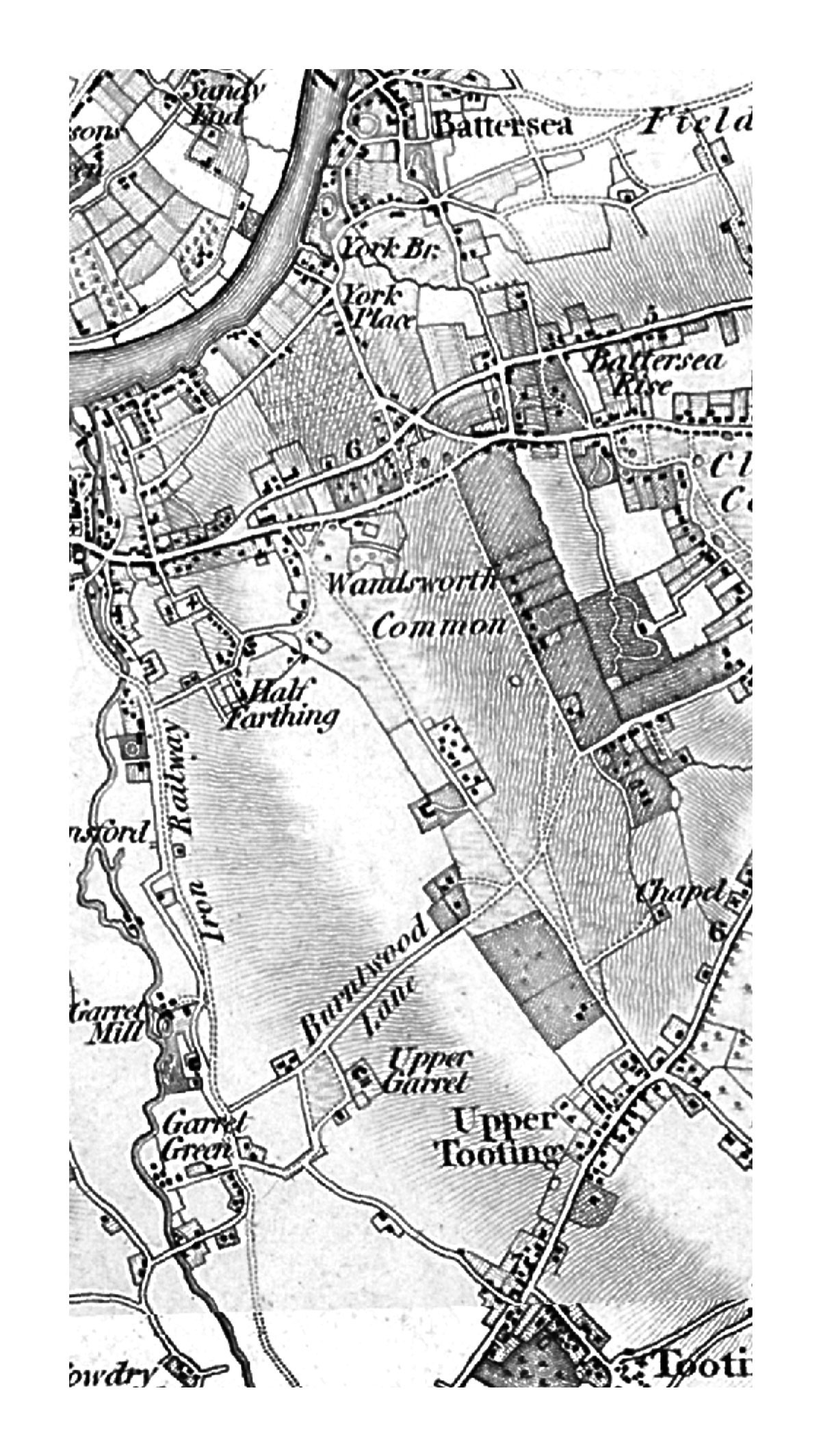
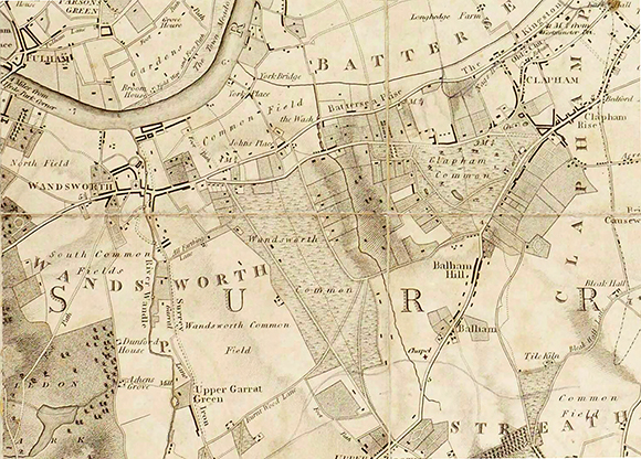
Notice "Wandsworth Common Field". Given that it was certainly divided into fields ("closes" etc"), what does this mean?
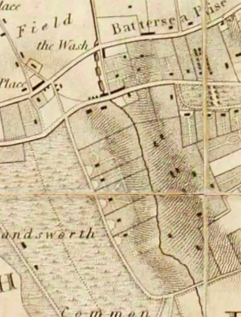
[Shows the lost houses and their parks/gardens rather nicely. Try to find an better copy. ]
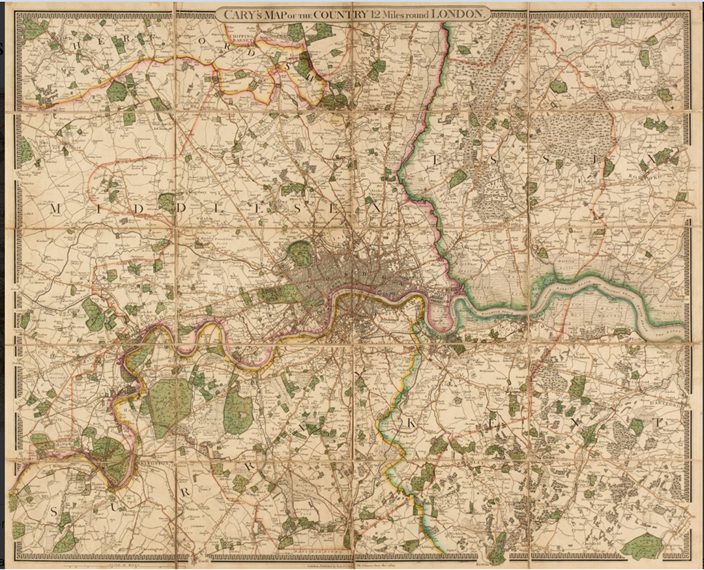
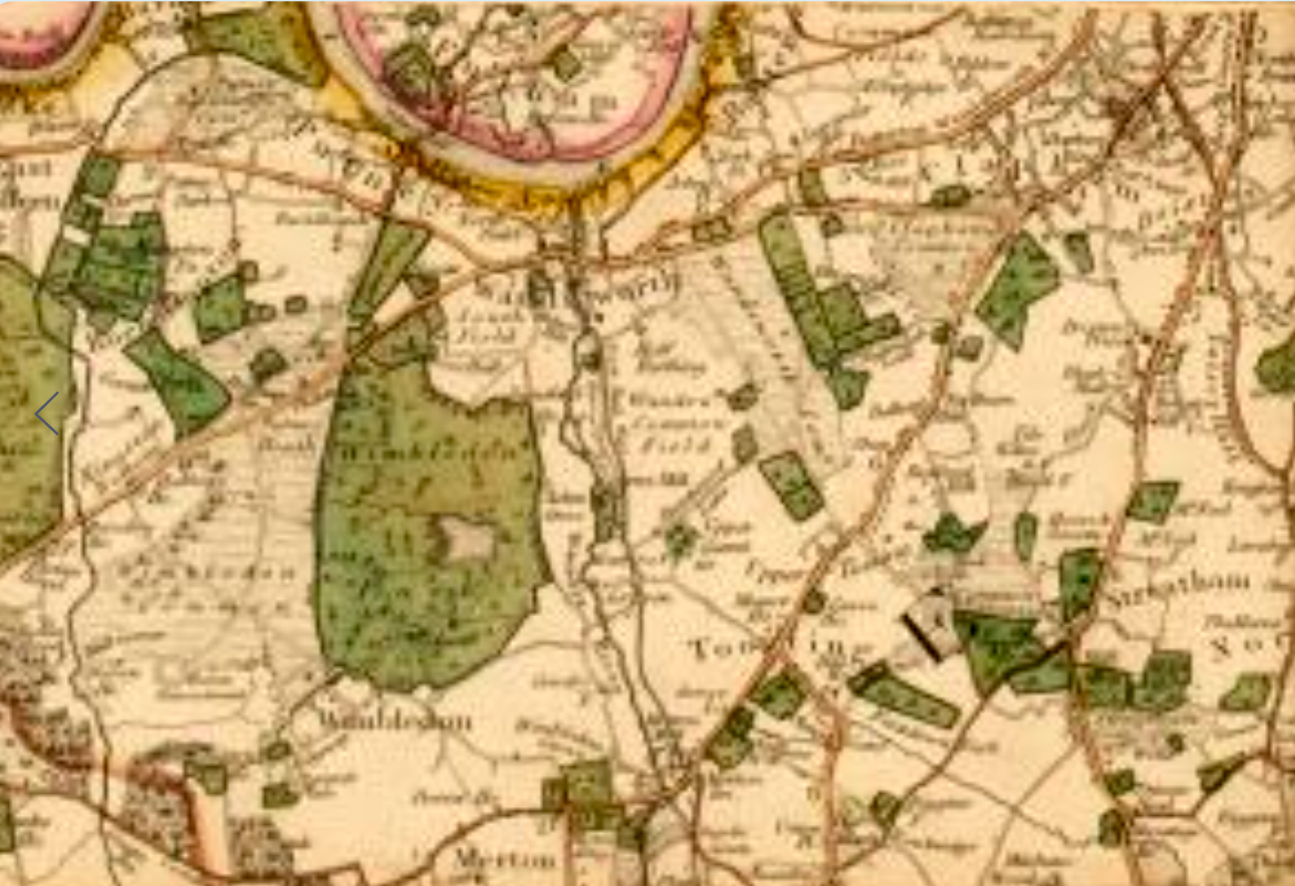
[NB I've seen references to a "Cruchley's Improved Environs of London, 1827". Also references to "Cary". Find, clarify and add.]
[NB this is pre-railway.]
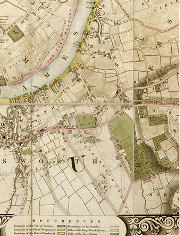
Notice e.g. the "Iron Railway" running north-south, parallel the River Wandle.
The hatching to indicate slope is clear and subtle. The hatching lines are densest or darkest at the top of the slope, fanning out and thinning slightly at the bottom of the slope.
Baldwin & Cradock, "Environs of London" London South, 1832
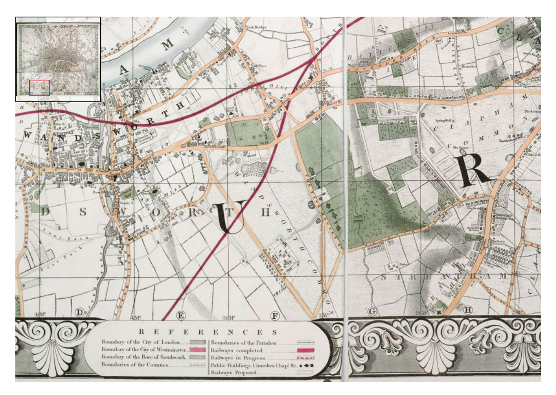
[There may be a third version, showing the railway in a slightly different position with respect to the Black Sea.]
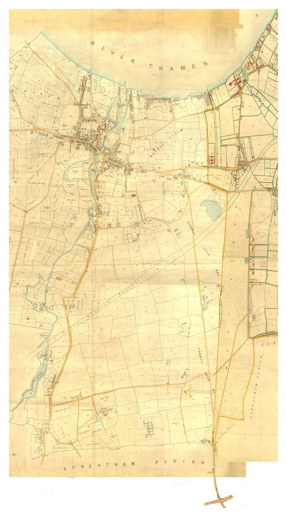
I have digitally patched together sections of the tithe maps of Wandsworth and Battersea parishes to show Wandsworth Common and its context — e.g. Wandsworth Town, River Wandle etc to the east.
And tacked on a small section of Streatham Parish at the bottom to indicate the location of parish boundaries and the crossroads at Tooting Bec.
NB. The fit at the boundary between Wandsworth and Battersea parishes is not always perfect since the maps were probably created some years apart by different surveyors and engravers/printers (and at different scales?), e.g. the route of the planned railway, and the paths/roads between Burntwood Lane and Nightingale Lane.
I have downloaded an interesting-looking journal article: "Maps and the Assessment of Parish Rates in Nineteenth-Century England and Wales", byRichard R. Oliver and Roger J. P. KainImago Mundi
Imago Mundi
Vol. 50 (1998), pp. 156-173 (18 pages)
Published by: Imago Mundi, Ltd.
Previous Item | Next Item
https://www.jstor.org/stable/1151398
Abstract
This paper reviews the role of maps in the assessment of rates levied for the relief of poverty in nineteenth-century England and Wales and examines the relationships between tithe maps and parochial assessment maps both in general terms and with specific reference to Poor Law unions in the county of Kent. An appendix lists 207 parochial assessment maps made in connection with the levy of poor rates which are extant in the public archives and libraries of England and Wales. Other 'lost' examples of this genre awaiting discovery in parish churches and vestries will undoubtedly add to this small but important constituent of the corpus of English and Welsh cadastral maps.
[Source: Link]
I have made a pdf of OLIVER and CAIN, MAPS and ASSESSMENTS OF PARISH RATES (1998) is here.
Have a closer look at this map. Notice the bridge across the Southampton railway, apparently leading from a quarry [?]
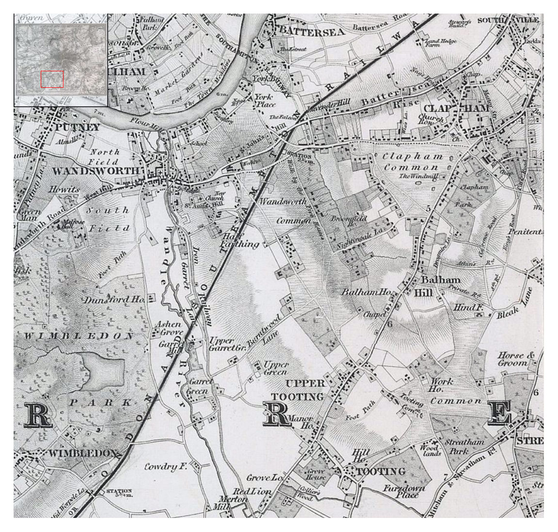
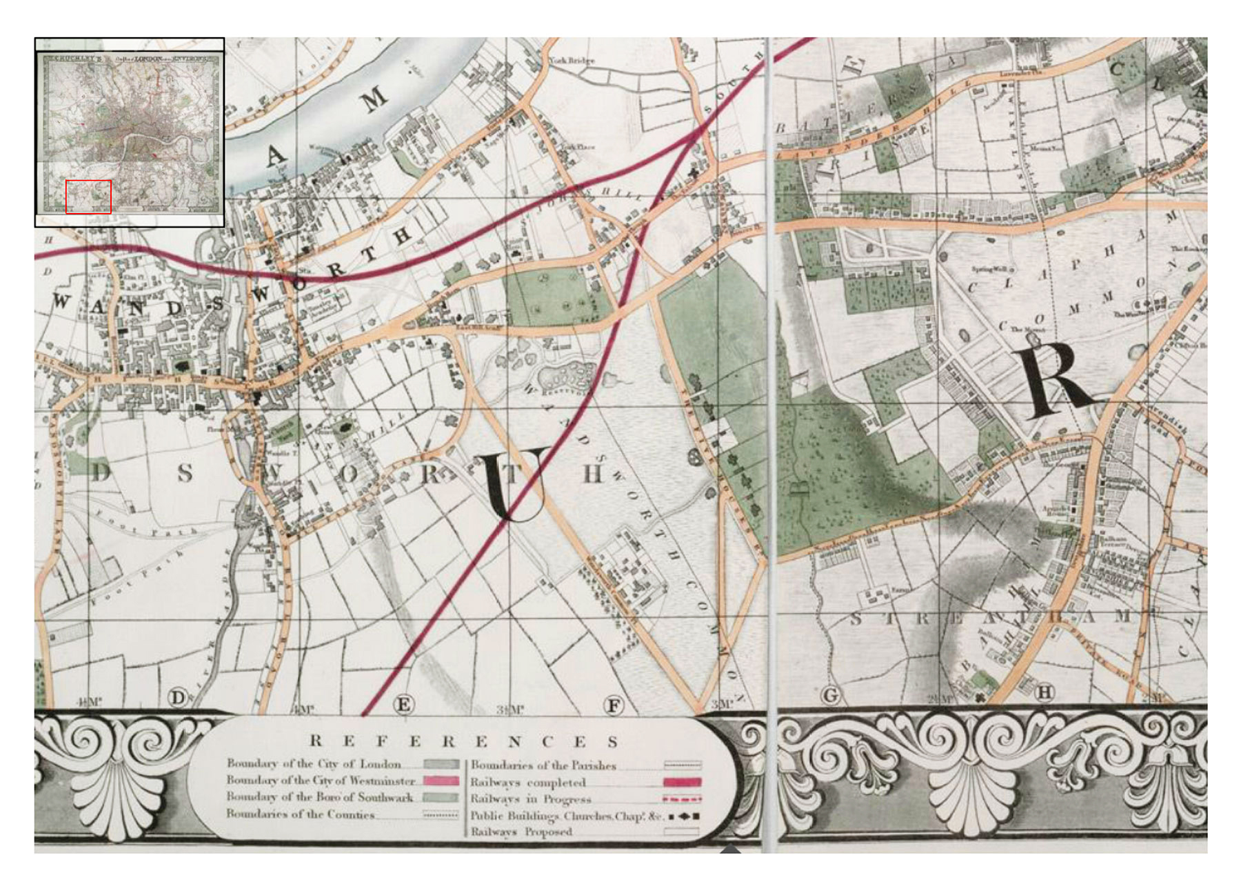
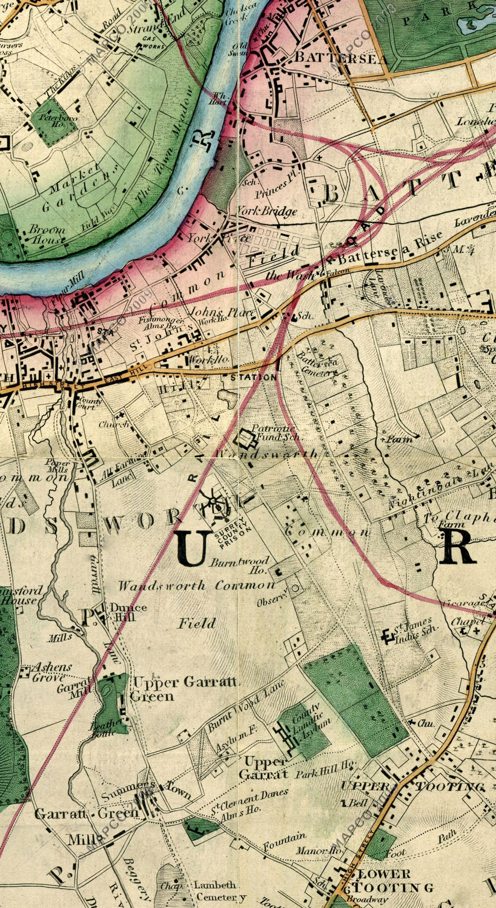
[The map shows the date "1829" prominently, but this is the 11th edition, 1847. Notice there is a completed railway line to Earlsfield, but the one to "Wandsworth Common" to the east has not even in progress. To the south-east, the Common is shown as stretching to the stream at the lowest point of today's Nightingale Lane. A wide track crosses from what is now Trinity Road to a pint near the 3-island pond on "The Five Houses" (i.e. today's Bolingbroke Rd). Surely the north-south road joining today's Bolingbroke Rd and Bellevue is misplaced? See also the numerous ponds and the many islands in the Black Sea to the north edge of the Common. It would be good to compare this with earlier editions. Most Cruchley maps I have come across do not reach out as far as Wandsworth.]
British Library: Cruchley, New Plan of London and its Environs, New edition 1847
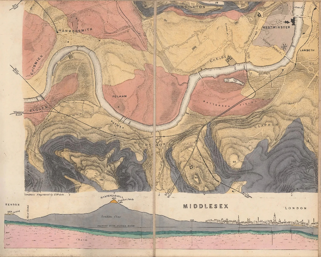
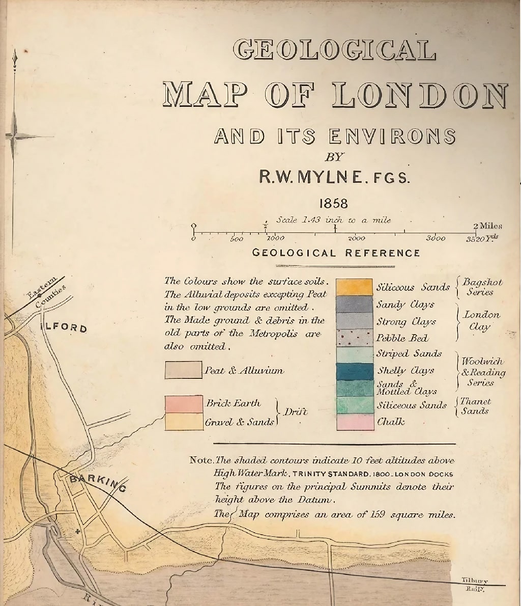
University of Wisconsin online version (VG)
https://collections.lib.uwm.edu/digital/collection/agdm/id/32070/
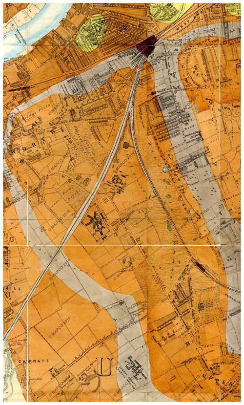
Here's a screengrab of part of the map:
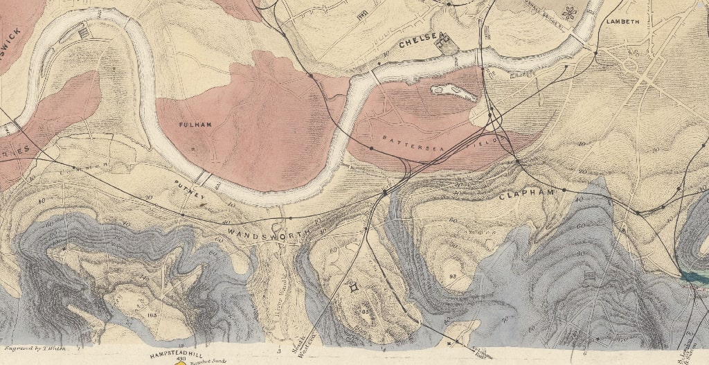
[The original screengrab is very good / much larger: mylne-1858-geological-wisconsin-5000px.jpg.I tried to download the whole map using "" but didn't work 24 Jan 2025. Perhaps too large? Try other browsers? Try aghttps://dezoomify.ophir.dev/#https://collections.lib.uwm.edu/iiif/2/agdm:32070/info.jsonain?]
The London Topographical Society produced (and still sell, for c.£18?) a version of the Mylne map — but it may be a different edition — possibly with clearer contours?
Map of the Geology and Contours of London and its Environs, by R. W. Mylne (1856) with an introduction by Eric Robinson and topographical notes by Simon Morris."
This map is similar in concept to Mylne’s earlier maps however this later, much larger map differs in a number of respects. First, the scale is some two and a half times greater, permitting features to be shown in clearer detail. Secondly, contours are shown in continuous lines rather than by shading and thirdly, the geological colouring is more detailed and more accurate than before.
There's no image of this edition on the LTS website (!), but there is one here: here. The colouring seems much brighter, and the contours clearer. (But less evocative?). More buildings are shown, and in more detail e.g. the prison. The northern branch of the Falconbrook is shown quite distinctly.
Layers of London also have a version, but earlier (1851)). In Jan 2025 I couldn't make the layer work (though I didn't try very hard). It also appeared to be savagely watermarked.
Layers of London: ‘Topographical [and Geological] Map of London and its Environs’ created by Robert William Mylne (1817-1890) and published by James Wyld, London in 1851..
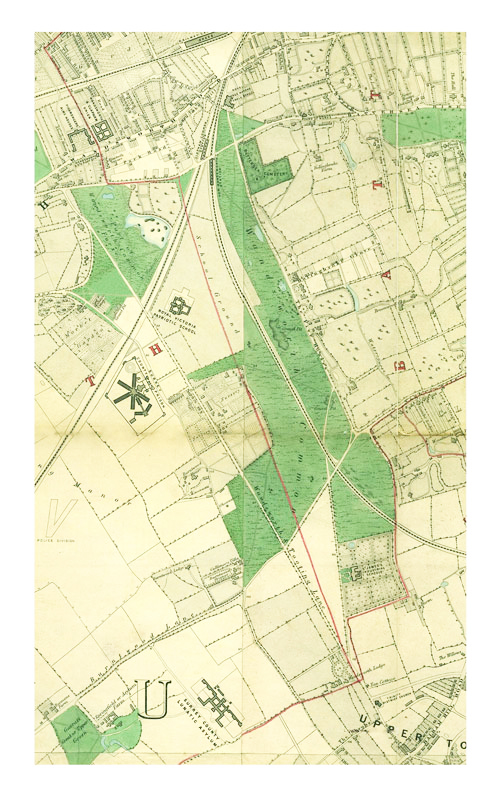
24 sheets, six inches to a mile. A number of versions available online, e.g. at London Ancestor.
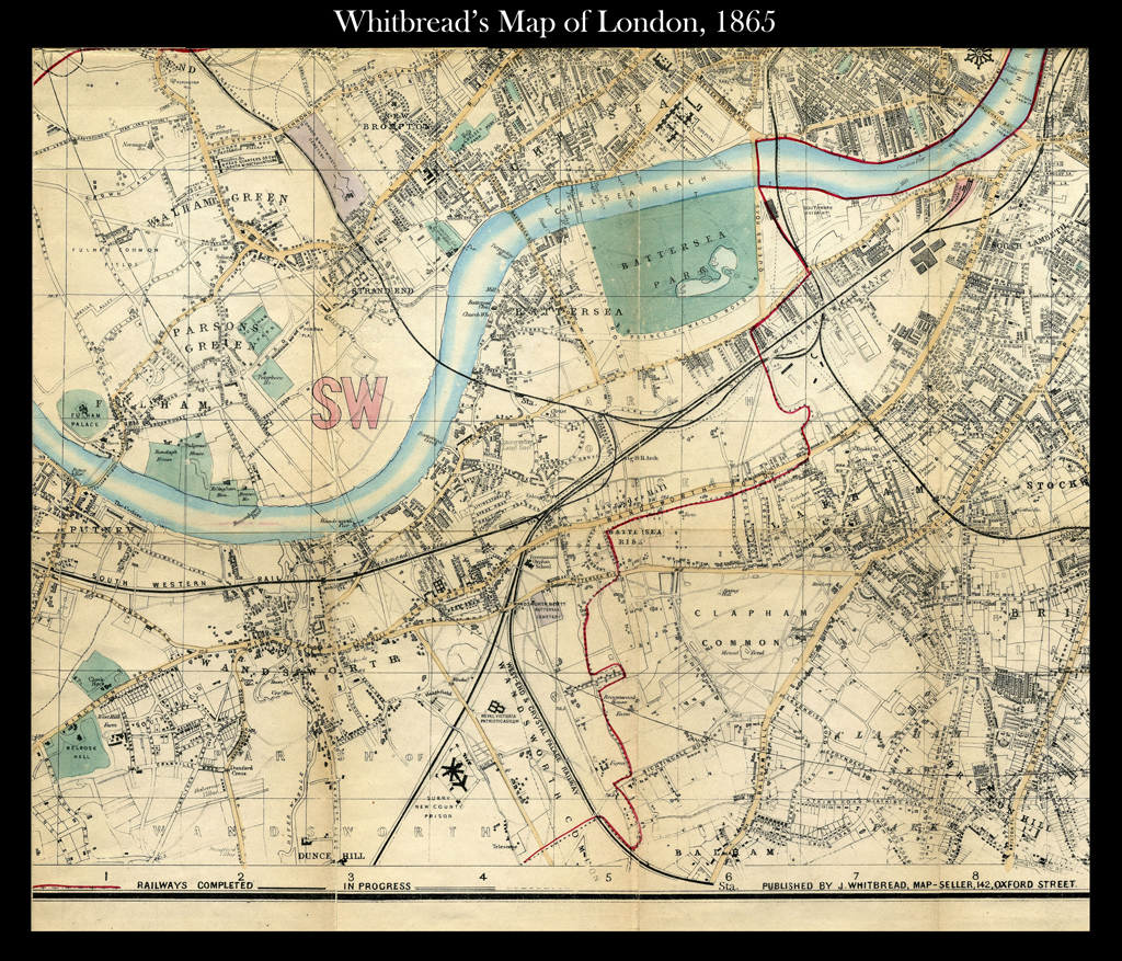
[Source - Mapco? David Hale?]
[What is the red line (on top of crosses)? It's a postal boundary!]
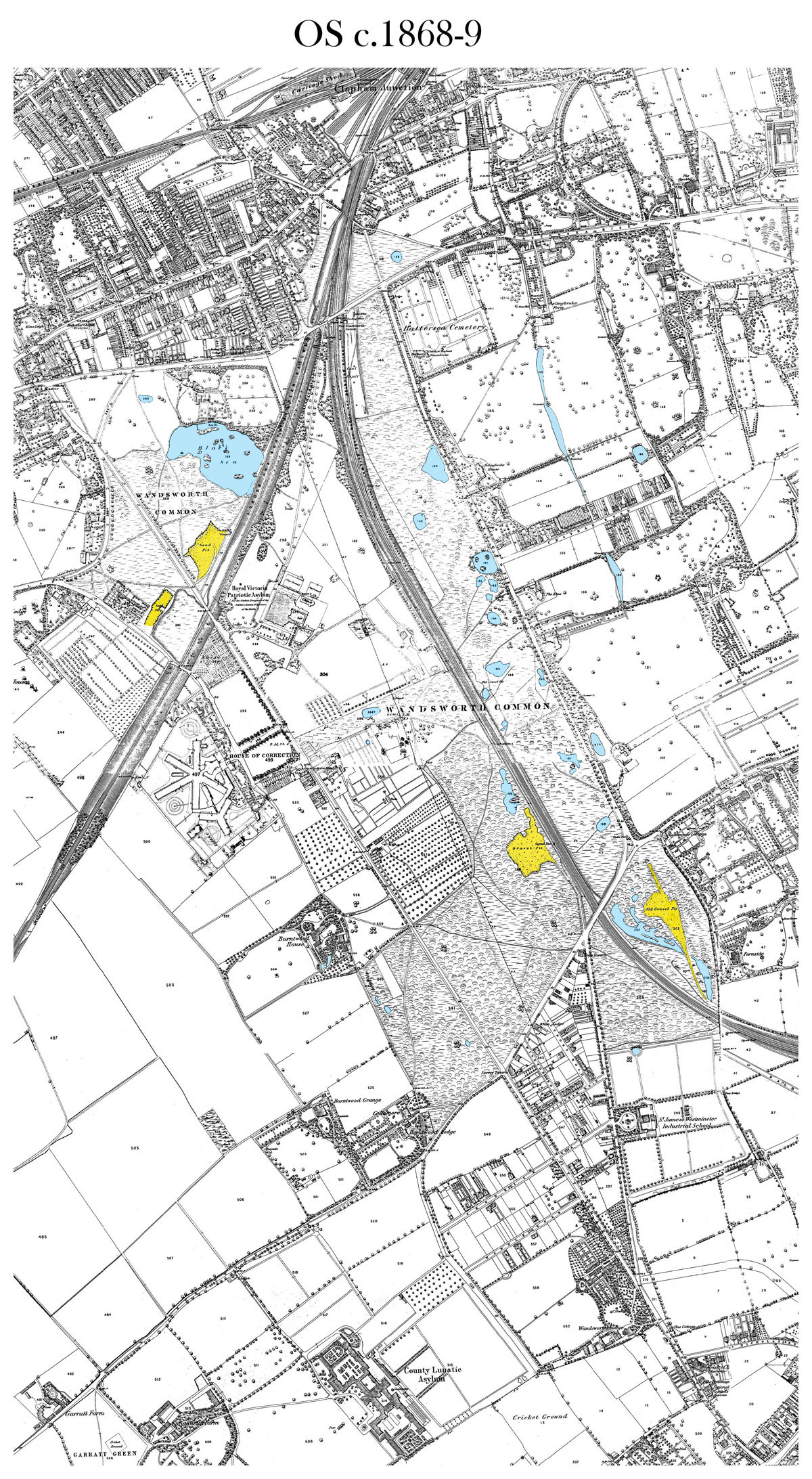
[March 2023: I'm fairly sure I've now got better versions of the north part. Find and work on...]
Digital versions online e.g. at Wandsworth Historical Maps [LINK?].
A printed version of Sheet ??? [south] is available from the Alan Godfrey Maps: Old Ordnance Survey Maps of Wandsworth [March 2019: South only].
Pamela Taylor notes on Godfrey edition [Sheet?, date]
[PB: Is the next para. Pamela Taylor or me?]
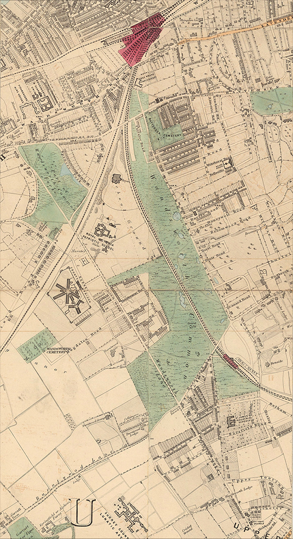
This map is particularly significant because it was produced just before the Common was "improved" i.e. taken into public ownership. Notice e.g. the relative absence of trees, but great areas of furze (gorse). Also the large number of gravel and sand pits, and associated ponds and lakes shown (and there were probably many ponds and pits to small and numerous to map). Wandsworth Common was famously wet and wild — hence a favourite destination for London's amateur and professional naturalists, and picnickers.
Subtitled "Levels taken by order of the Commissioner of Sewers."
Raremaps.com says "c.1872", but probably much earlier. Notice there is no RVPA or Crystal Palace railway line.
The red numbers are spot heights, since this is a map showing elevations for the purpose of constructing sewers.
[Is this derived fro the OS Skeleton map of 1850-something?]
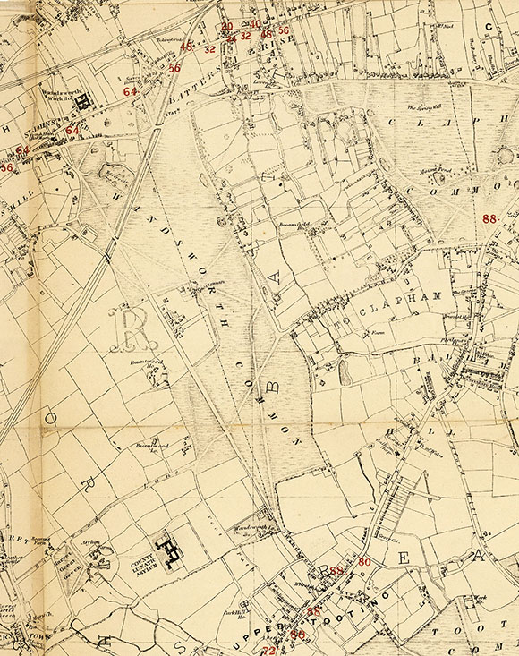
[Notice there was once a pub or a beer-house, The Sportsman, nar the corner of what is now Dorlcote Road and Baskerville Road (and therefore not far from the County Arms). This is the only reference I've ever seen — try to find out more.]
[The Black Sea is called "Reservoir".]
[RE-DO MAP]
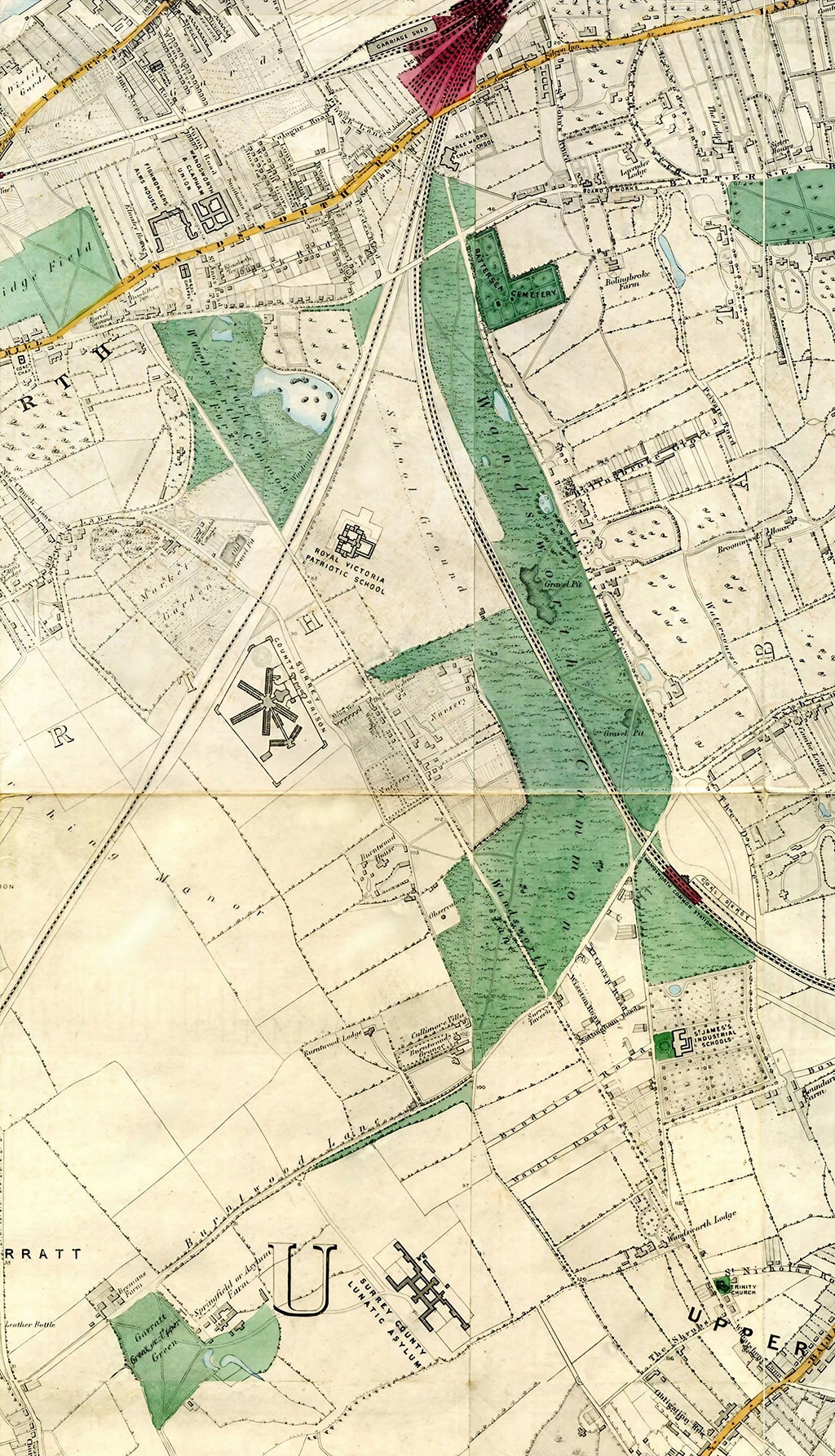
24 sheets, six inches to a mile. A number of versions are available online, e.g. at London Ancestor and London1872
http://www.bl.uk/onlinegallery/onlineex/maps/uk/zoomify135133.html
Red numbers refer to an index, on the back of the map.
[https://www.raremaps.com/gallery/detail/99880/stanfords-london-government-maps-stanford]

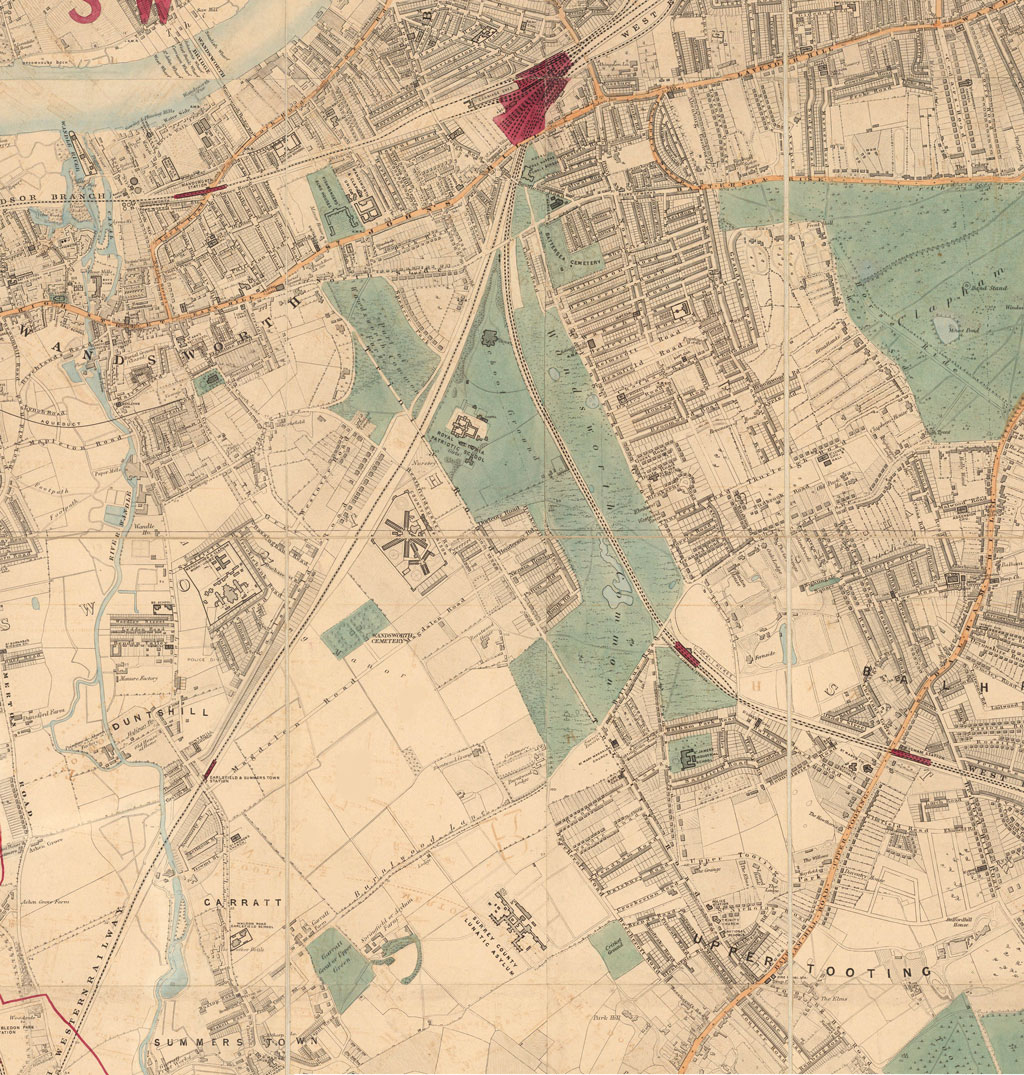
[Motco ("Man on the Clapham Omnbus"?) once sold this map (and others) on a CD-ROM, but they ceased trading in 2017. Sad.]
But I have now found an excellent version in the marvellous David Rumsey Collection:
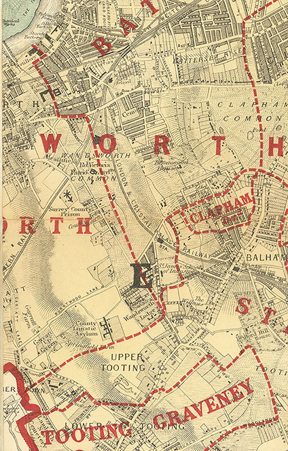
Stanford's Library Map of London and Its Suburbs, 1891 (1:10560).
Edward Stanford, Library Map of London and its Suburbs, London (1891). For sale (£2000) in 2019 by Daniel Crouch Rare Books (London):
Edward Stanford,, London, 1891. One of the most important maps of Victorian London Engraved map, hand coloured in outline on four sheets, each segmented into 25 segments, a few tears to linen folds each section with a key map pasted to the marbled wrapper. First published in 1862, the map was to go through 21 revisions until its final appearance in 1901. "The plates of Stanford's Library Map of London' were used in the production of a number of other maps including the School Board Map of London, Booth's Descriptive Map of London Poverty, several metropolitan improvement maps, a map showing the distribution of troops lining the streets for the 1897 royal jubilee, another showing the routes taken by the infantry from their quarters to their places on the streets on the occasion of Edward VII's coronation, and Stanford's plan of the Metropolitan Borough of Poplar, 1903." (Hyde) Scale: 6 inches to 1 statute mile. Hyde 91 (17).,/p>
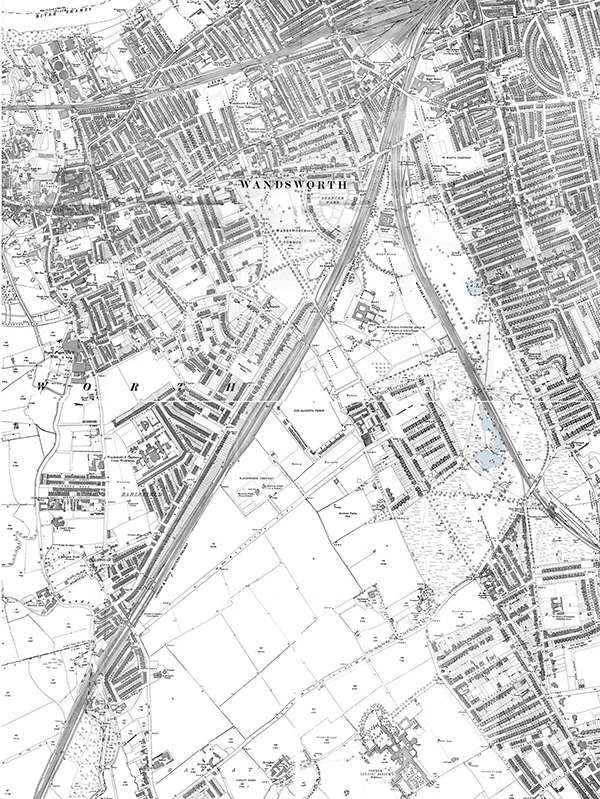
I have digitally stitched sections of two maps, and tinted the ponds.
There are digital versions online.
A printed version is available from the Alan Godfrey Maps: Old Ordnance Survey Maps of Wandsworth.These are taken from OS 25" series and reduced to a scale of approximately 14 inches to the mile. Each covers an area of a mile and a half by one mile, and includes an introduction: Alan Godfrey Maps: Old Ordnance Survey Maps of Wandsworth.

"No Common in the neighbourhood of London has suffered more cruelly in past times from encroachments of all kinds. It now consists of 194 acres, but a glance at the map will show that formerly it must have had a considerably larger area...[However] what remains of the Common, in its trisected and shorn condition, is still of considerable value to the residents in the neighbourhood" (pp.100-101).
Wikipedia: Charles Booth (social reformer)
Only the northern part of Wandsworth Common was mapped, but he and hs assistants walked a much wider area, including Lyford Road, Bellevue, Ravenslea Rd etc.
Charles Booth's London: Home page
Charles Booth's London: Poverty maps.
Charles Booth's London: Download maps
Charles Booth's London: Map sheet 10: South West District
Charles Booth's London: Search: "Wandsworth Common" (152 results — not all digitalised yet). FOLLOW UP/TRANSCRIBE
[Arthur Baxter's] Notebook: Police District 35 [Kennington (2nd) and Brixton], District 37 [Battersea West], District 38 [Clapham], District 39 [Wandsworth and Putney], District 40 [Streatham, Norwood and Dulwich] (1899)
Notebooks describing e.g. Western Lane, The Drive, Ravenslea Road, Mayford Road, Wexford Road, Bellevue Road, Althorp Road, Wiseton Road, Nottingham Road, St James Road etc.
Notebooks describing e.g. area bounded on the west and south by Wandsworth and Battersea parish boundary; on the north east by London South Western Railway:
Trinity Road, Alma Terrace, Heathfield Road, Warden's Quarters, Magdalen Road, Lyford Road, Dorlcote Road, Henderson Road, Nicosia Road, Patten Road, Routh Road, Baskerville Road, Brodrick Road, Wandle Road, Hendham Road, Dalebury Road, Crockerton Road, Beechcroft Road, Burntwood Lane, Franchecourt Road, Summerley Street, Skelbrook Street, Garratt Lane, Boyce's Cottages, Jubilee Cottages, Victoria Cottages, Trewint Street, Thoendean Street, Steerforth Street, Siward Road, [Turtte Road], Burtop Road, Headworth Road, Summer's Town, Riverside Road, Garrett Lane, Huntspil Street, Bellow Street, Squarry Street, Garrett Green, Aloyne Road, [Maskell Road], Edward's Terrace etc
Description of boundaries of walk: on the north Nightingale Lane, Clapham Common; on the east Balham Hill, Balham High Road; on the south west Trinity Road; on the north west Bellevue Road. [Parishes not indicated] Trinity Road, Wandsworth Place, Chetwoode Street, Holderness Road, St Nicholas Road.
etc etc
There might be something interesting in the notebooks — CHECK!
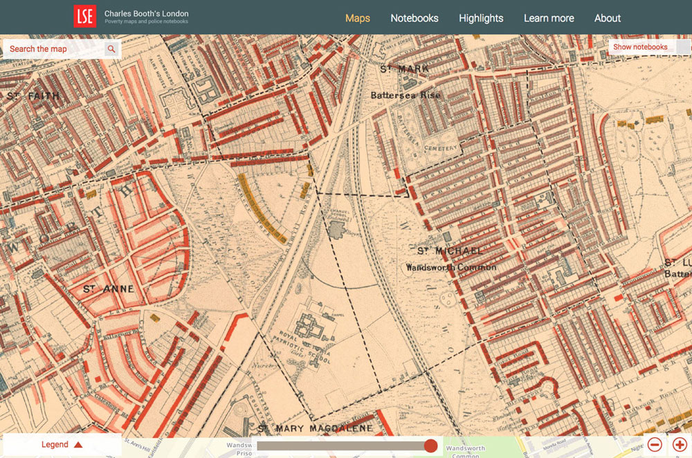
This is the 1898 map. According to Charles Booth's survey in 1889, over a third of London's inhabitants lived on or below the margin of poverty. His 17-volume survey included this coloured-coded map indicating London's poverty and prosperity street by street.
Key to the colours in 1889 (check they're the same as 1898):
Gold: Upper-middle and Upper classes.Wealthy.
Red: Well-to-do. Middle-class.
Pink: Fairly comfortable. Good ordinary earning.
Purple: Mixed. Some comfortable, others poor.
Pale Blue: Poor. 18s. to 21s. a week for moderate family.
Dark blue: Very poor, casual. Chronic want.
Black: Lowest class. Vicious, semi-criminal.
A visual evocation of poverty and wealth in close proximity around the Common at the time of the Boer War. Streets are coloured to indicate the income and social class of their inhabitants.
Compare, for example, Spencer Park (yellow — "Upper-middle and upper classes. Wealthy") with some of the densely-populated streets near Price's Candle Works (dark blue:"Very poor, casual. Chronic want" or black: "Lowest class. Vicious, semi-criminal").


"Geological map of London and environs, showing the superficial deposits. Compiled from the geological survey maps. South-west sheet" by George W. Bacon & Co (1903).
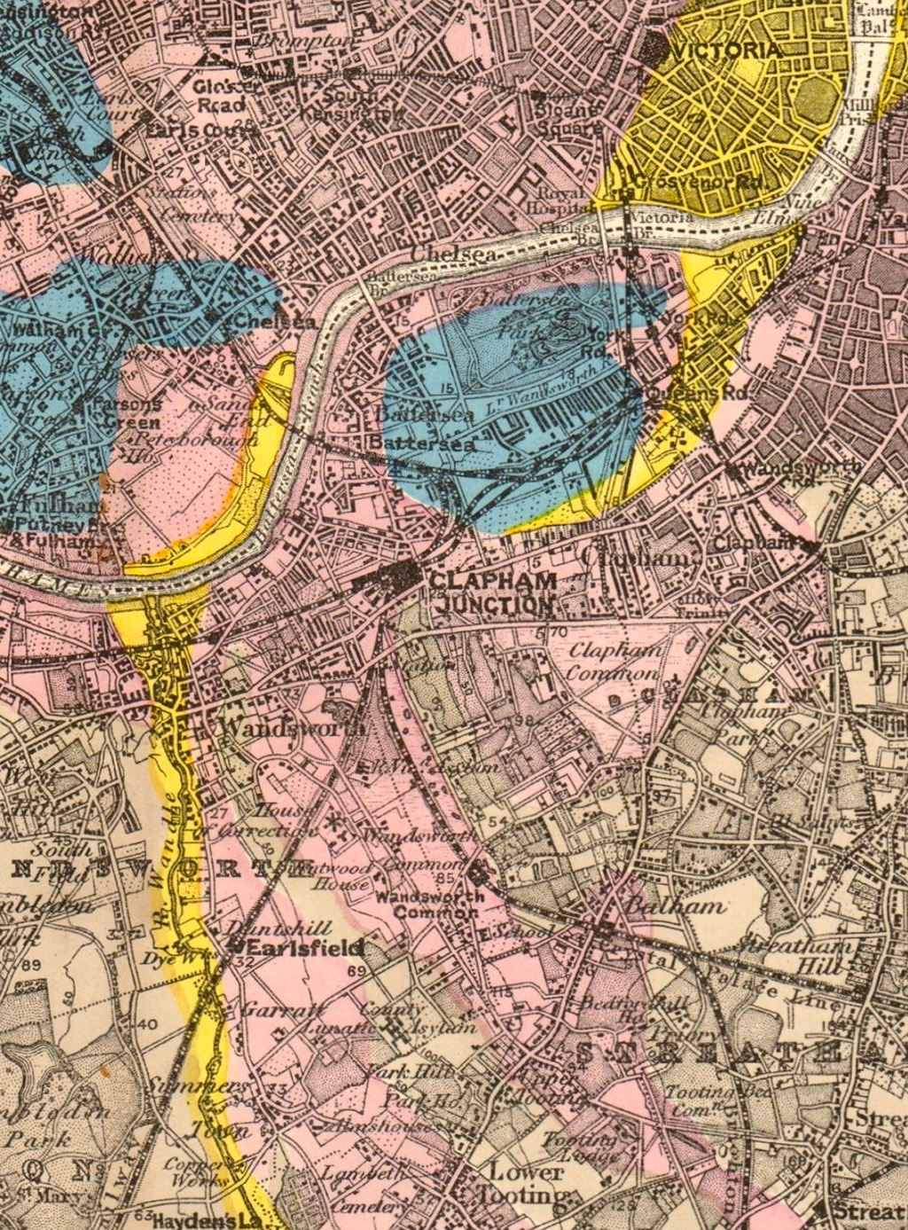
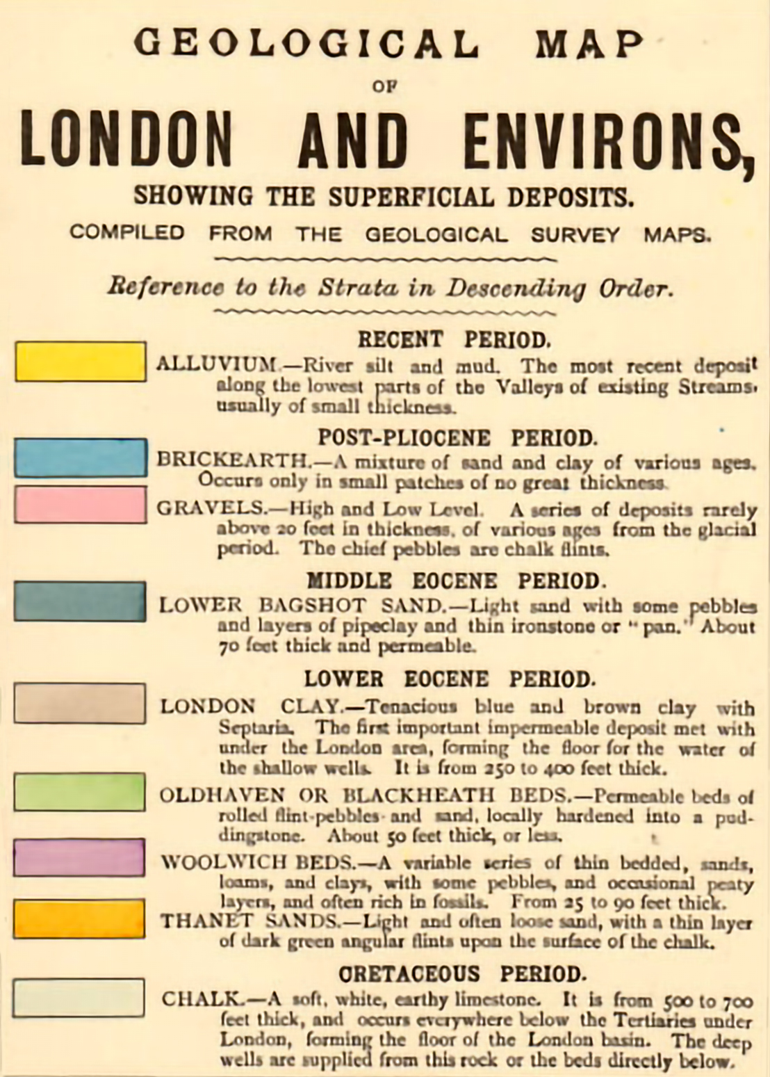
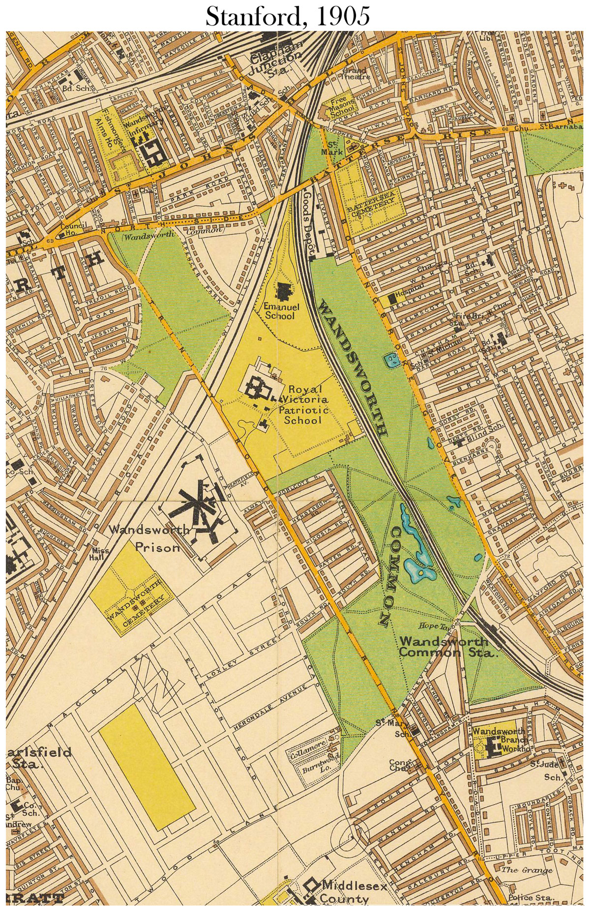
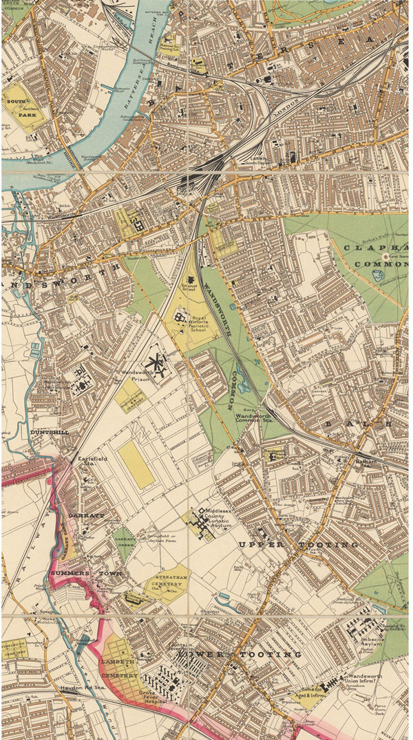
[To add.]
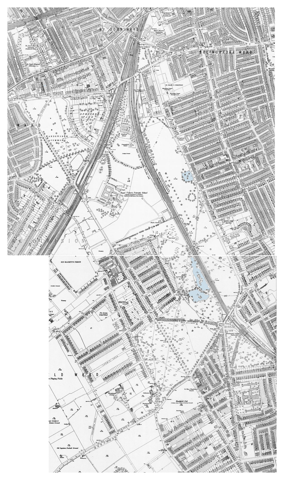
Digital versions online.
I have tinted the ponds.
A printed version is available from the Alan Godfrey Maps: Old Ordnance Survey Maps of Wandsworth [March 2019: North only].
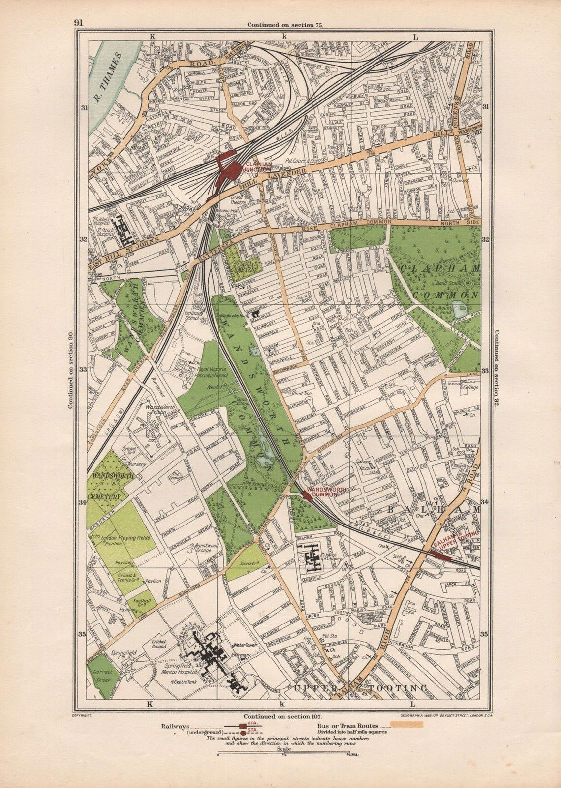
[CHECK DETAILS]
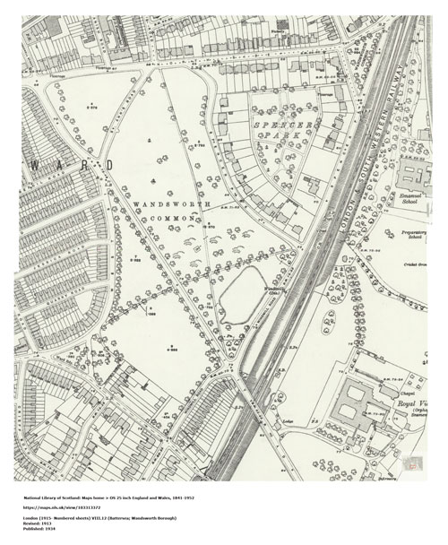
[No revisions between 1913 and 1934? Really?]
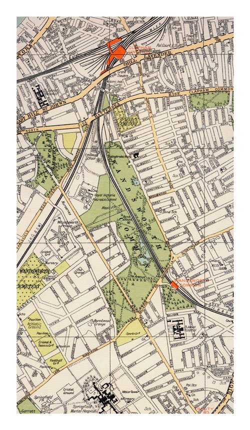
A curious map. Some of it seems speculative or futuristic (and therefore wrong). For example, the "Magdalen estate" is shown laid out like a garden suburb, including (unnamed) diagonal roads, but in practice e.g. Loxley/Frewin/Herondale Roads were abbreviated, and Ellerton became in effect a border or boundary between these roads and Tilehurst/Godley/Fieldview to the south-west.
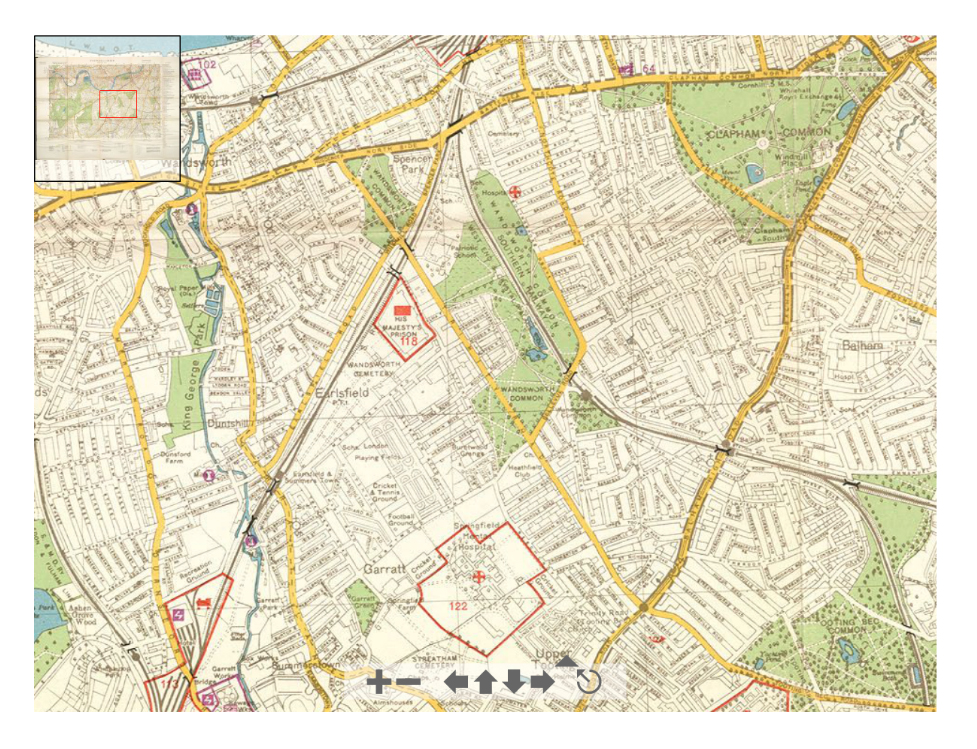
NB: Very little information shown about this map. It appears to be part of an invasion plan. Notice the prison and hospitals outlined in red. Why? Were they intended targets? Or were they highlighted as particularly useful if invasion was succesful?
http://www.bl.uk/onlinegallery/onlineex/maps/uk/004995881usw.html?
Nature, 13 October 1945
https://www.nature.com/articles/156445a0
A COLLECTION of German military maps is on public exhibition during this month at the Royal Geographical Society's House at the corner of Kensington Gore and Exhibition Road. A few of these maps are shown on wall panels: the remainder can be seen in the Map Room on request.,/p>
These maps are of interest in connexion with German plans for the invasion of England. Those shown on the wall panels include a plan of London on the scale of 1/20,000, emphasizing, in colour and by symbols, buildings and areas of special importance; for example: government offices; main railway stations, marshalling yards, tracks, and bridges; hospitals, industrial sites, and post offices; scientific institutions and historic buildings. A numbered key in the margin gives identifications and brief particulars.,/p>
There are similar plans on a large scale (1/10,000) of Birmingham, Cardiff and South Shields. A night-flying target map of London, 1/100,000, is also displayed; target areas, outlined in red, include docks, airfields, reservoirs, etc. Other exhibits are a sheet of the Stellungskarte of Great Britain, about 2½ inches to the mile, with military information; a sheet, London (West), of the air edition of the German Army map, 1/200,000, with airfields conspicuously marked, and a sheet, Tipperary, of a 1/100,000 map of Ireland. Most of these maps are reproductions on slightly different scales, with additional information overprinted, of maps published by the Ordnance Survey. Official surveys of most countries in Europe were also reproduced by the German Staff, for example, Spain, Portugal, Turkey, Greece and Russia, and representative sheets of these are exhibited.
The LCC maps are generally very reliable. Some, more recent, maps (e.g. Bomb Site, below) much less so.
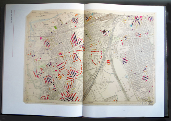
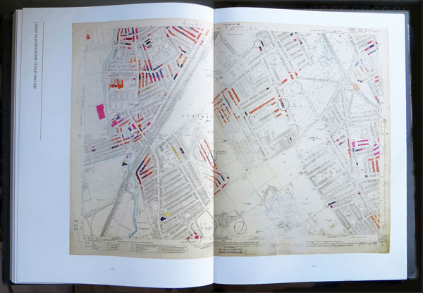

Colour coding:
Black — Total destruction
Purple — Damage beyond repair
Dark Red — Seriously damaged, doubtful if repairable
Light Red — Seriously damaged, repairable at cost
Orange — General blast damage, minor in nature
Yellow — Blast damage, minor in nature
Green — Clearance areas
Small circle — V2 Bomb
Large circle — V1 bomb
[ADD better scans of the extra-ordinarily detailed LCC maps: Laurence Ward (ed), The London County Council Bomb Damage Maps 1939-1945 (2015) / https://www.amazon.co.uk/London-County-Council-Damage-1939-1945/dp/0500518254.,/p>
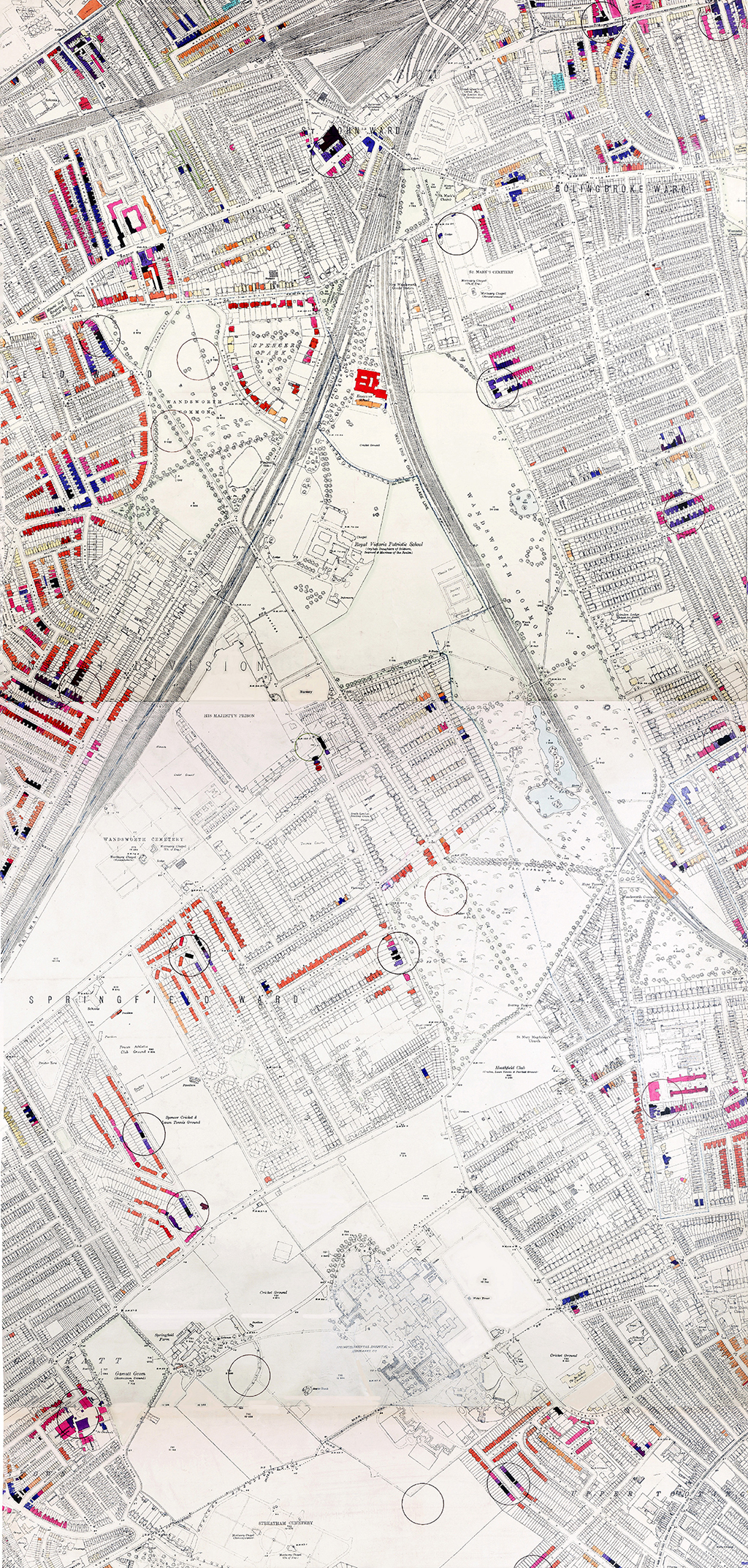
[These maps are now online as part of the Layers of London project.]
[Have a closer look at this map, which was made for WBC by the Director of Technical Services in 1994 (1984?). I have a pdf of the entire map, of which this is detail. It seems to show some bombs not on the LCC map, perhaps because they caused no deaths or injuries, or no significant damage to property? For example, on the Common itself it shows high-explosive bombs, whereas the LCC map only shows V-1s and V-2s. Is this right?]
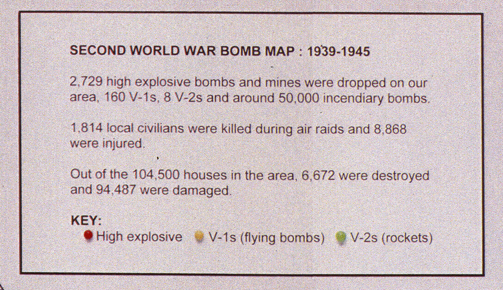
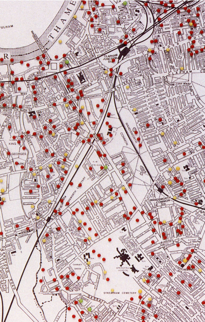
[ADD reference to WHS and other sources.]
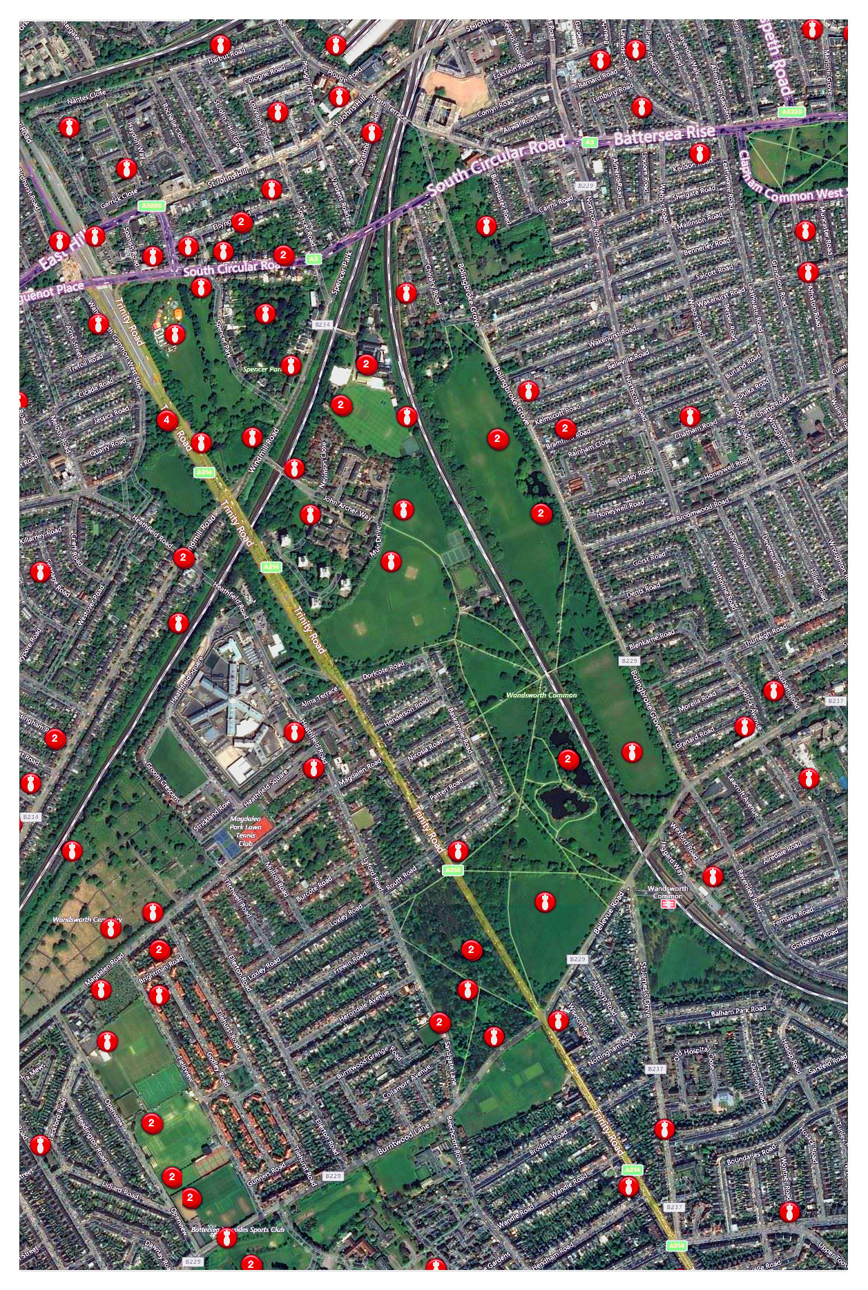
[PB: Attractive as this map is, it is not at all reliable. I have not looked very closely, but I notice it e.g. does not show the Loxley Rd, misplaces the Lyford Rd bomb, and includes others for which I have found no evidence.]
[For useful background information, see Jim Slade's article, "WWII Air Raid Casualties in Battersea and Wandsworth", Wandsworth Historian, 82, Spring 2006 (pdf)]
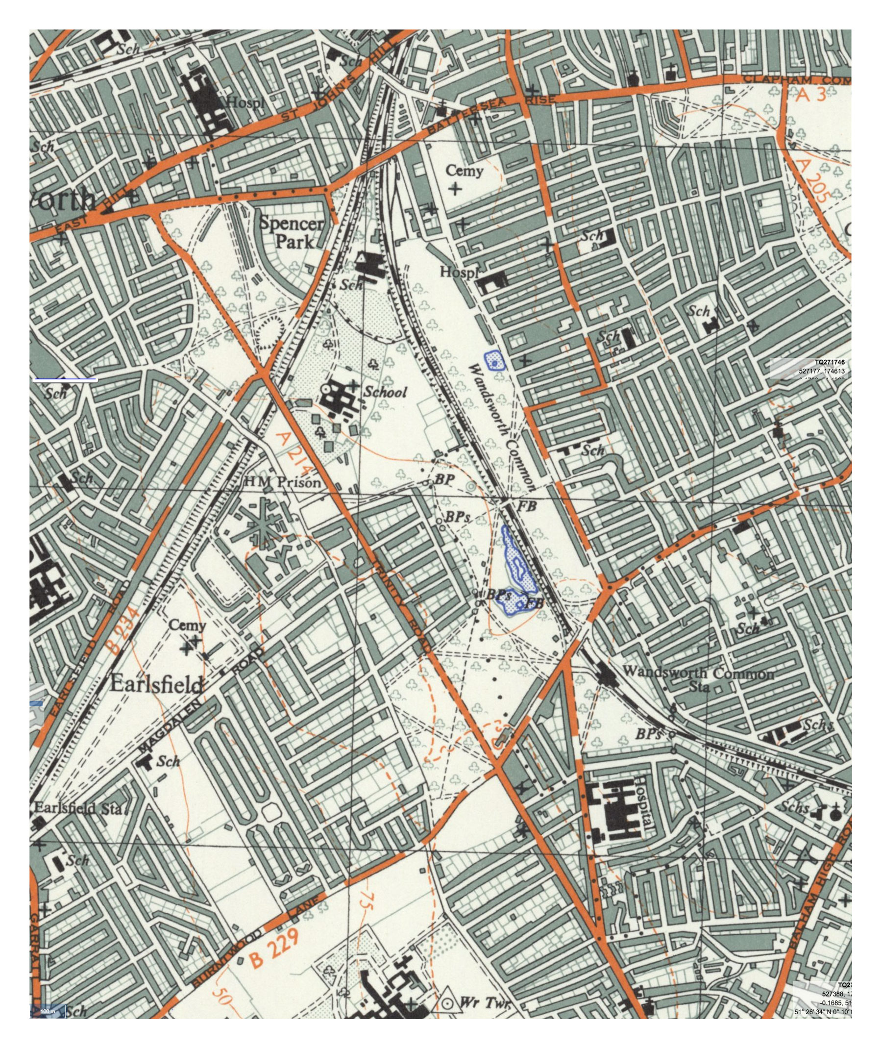
Notice the wartime "pre-fabs" shown on several parts of the Common — along Bellevue and Bolingbroke Grove, near Spencer Park, and covering the triangles of Common near Clapham Junction Station. (What do the fairly numerous crosses or plus signs represent?) I wonder where the squatted Nissen Huts were? Do they appear on this map, or had they already been destroyed?
Search: "Prefabs Wandsworth Common". When I first created this page, I couldn't find a single photograph of prefabs on the Common, which was a shame. But I've got quite a few now!
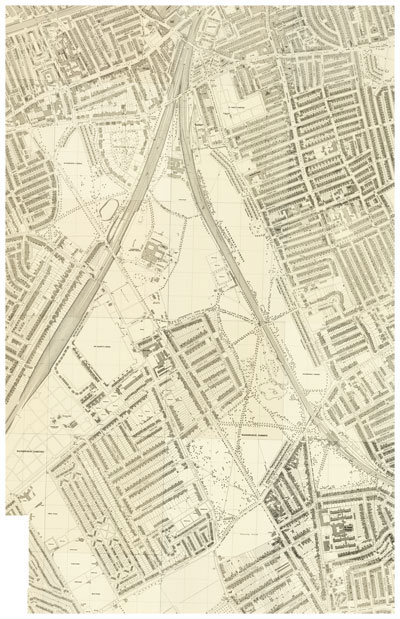
As above, notice e.g. the pre-fab bungalows, sometimes in double rows, along Bellevue and Bolingbroke Grove, near Spencer Park, and covering the triangles of Common near Clapham Junction Station. [PB: Higher resolution maps in hand.]
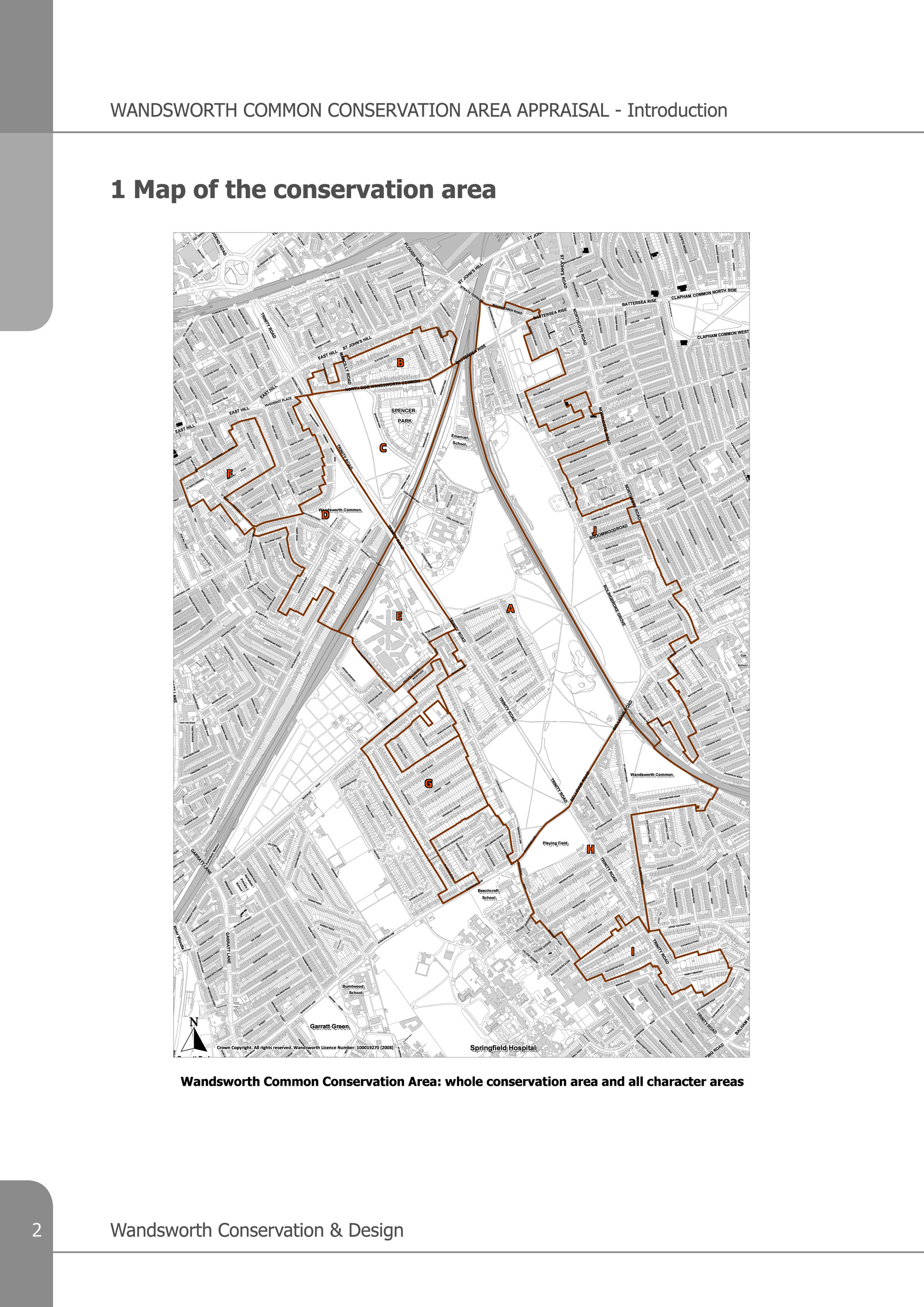
[Highest resolution map here.]
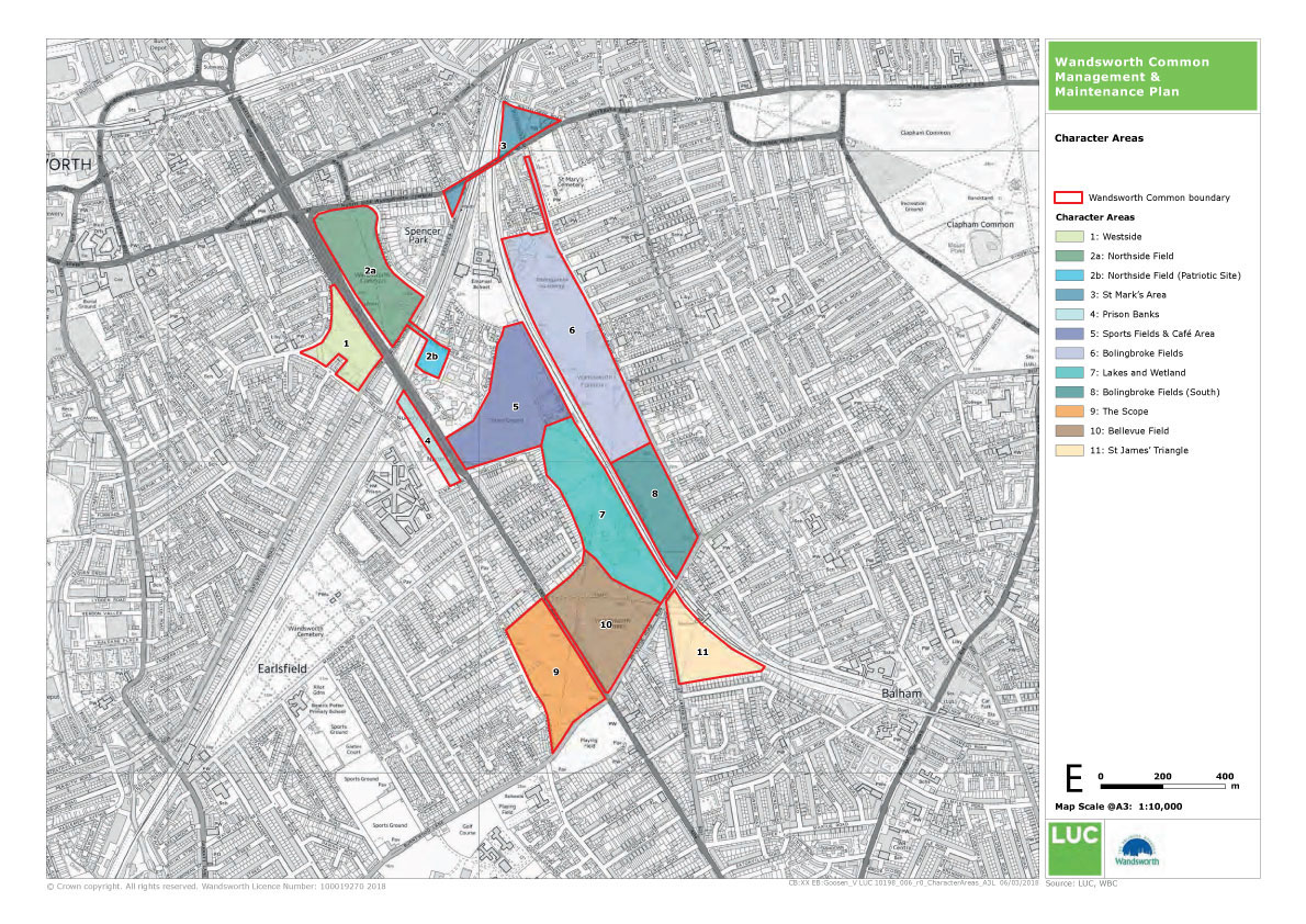
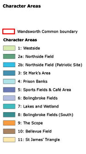
"Character areas"
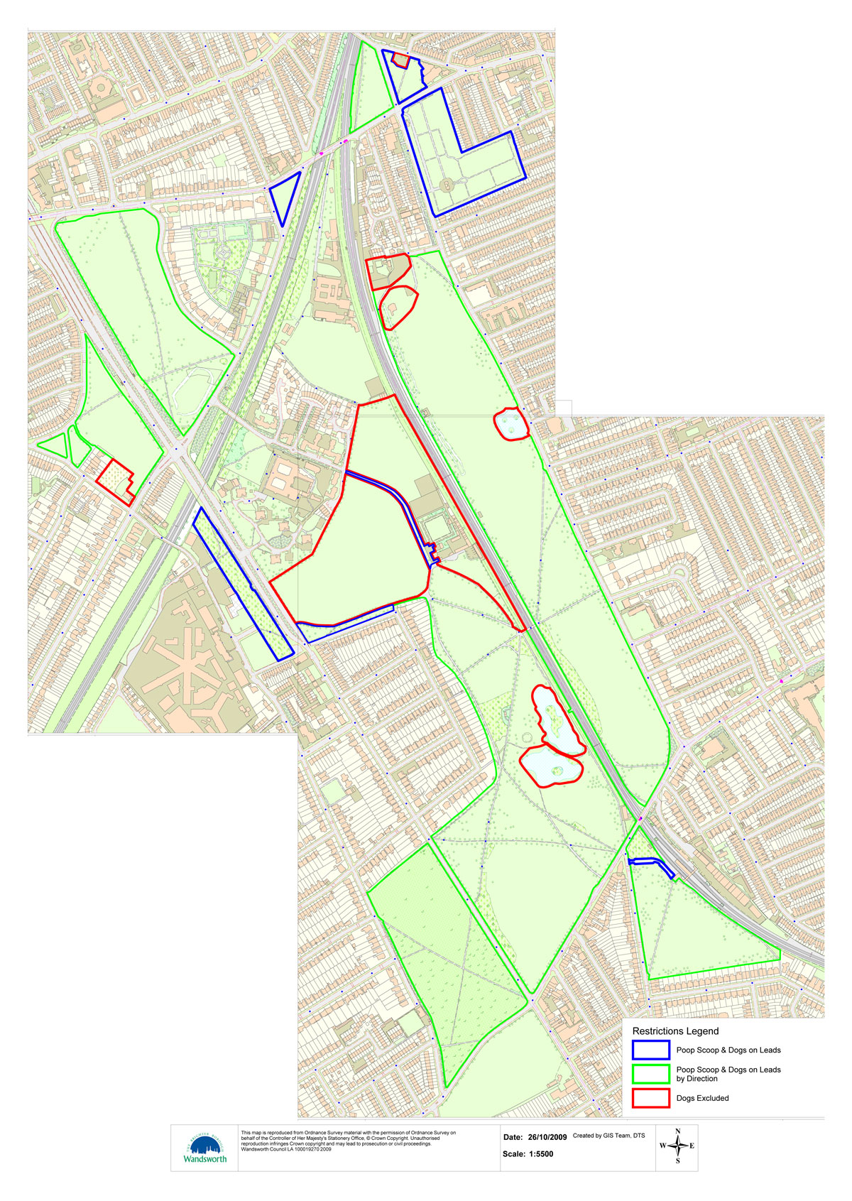
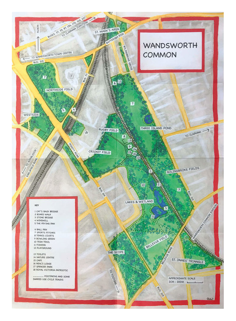
Poop and scoop zones, etc
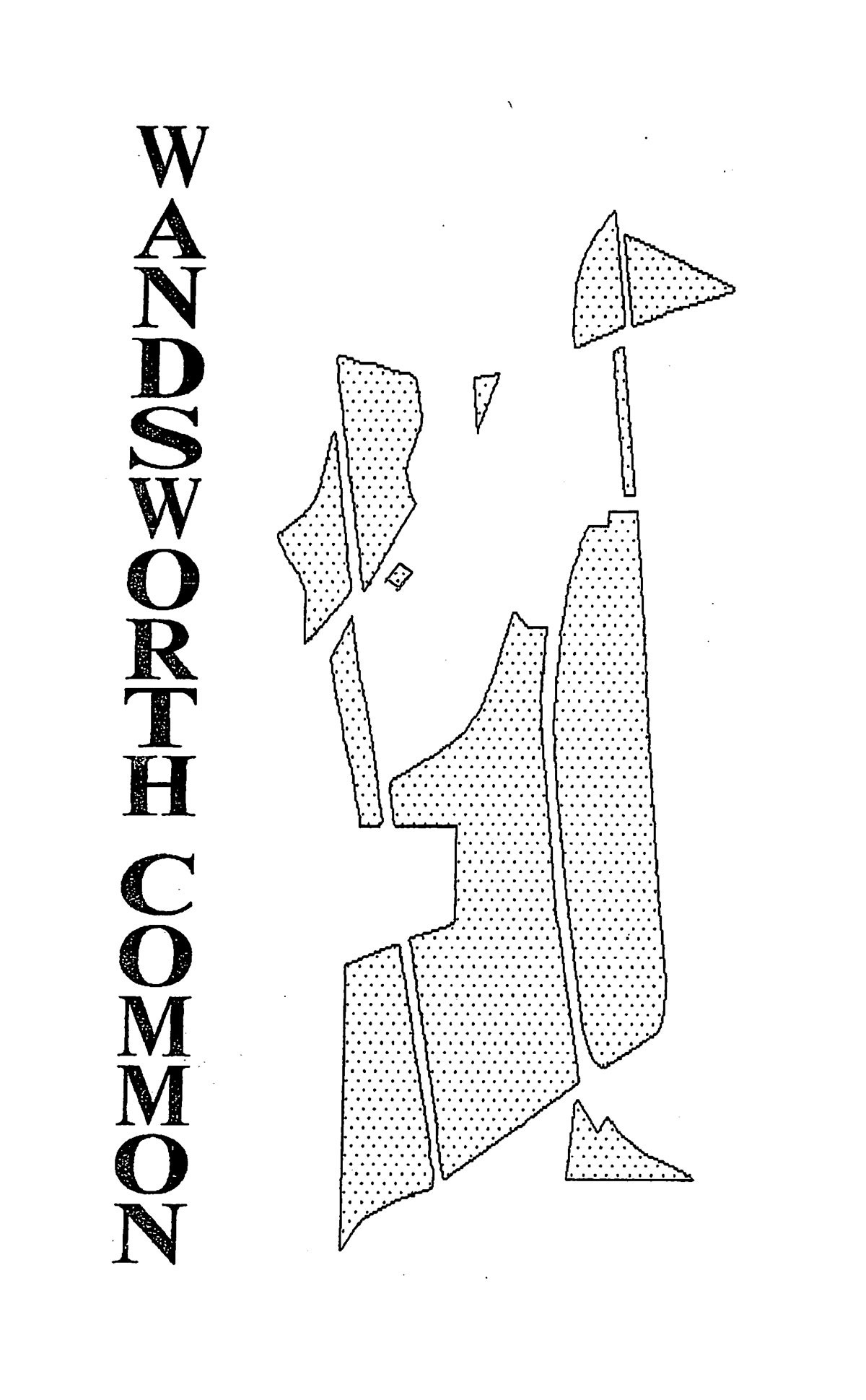
Shirley Passmore, Wandsworth Common divided, [TITLE?], cover
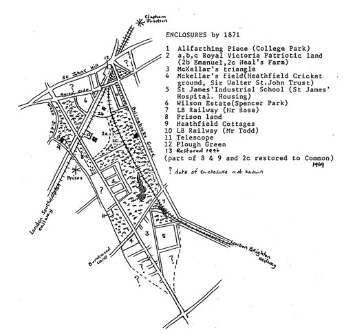
Shirley Passmore, areas enclosed by 1871
On sale for just £2 in the Skylark and Toast Rack Cafés.
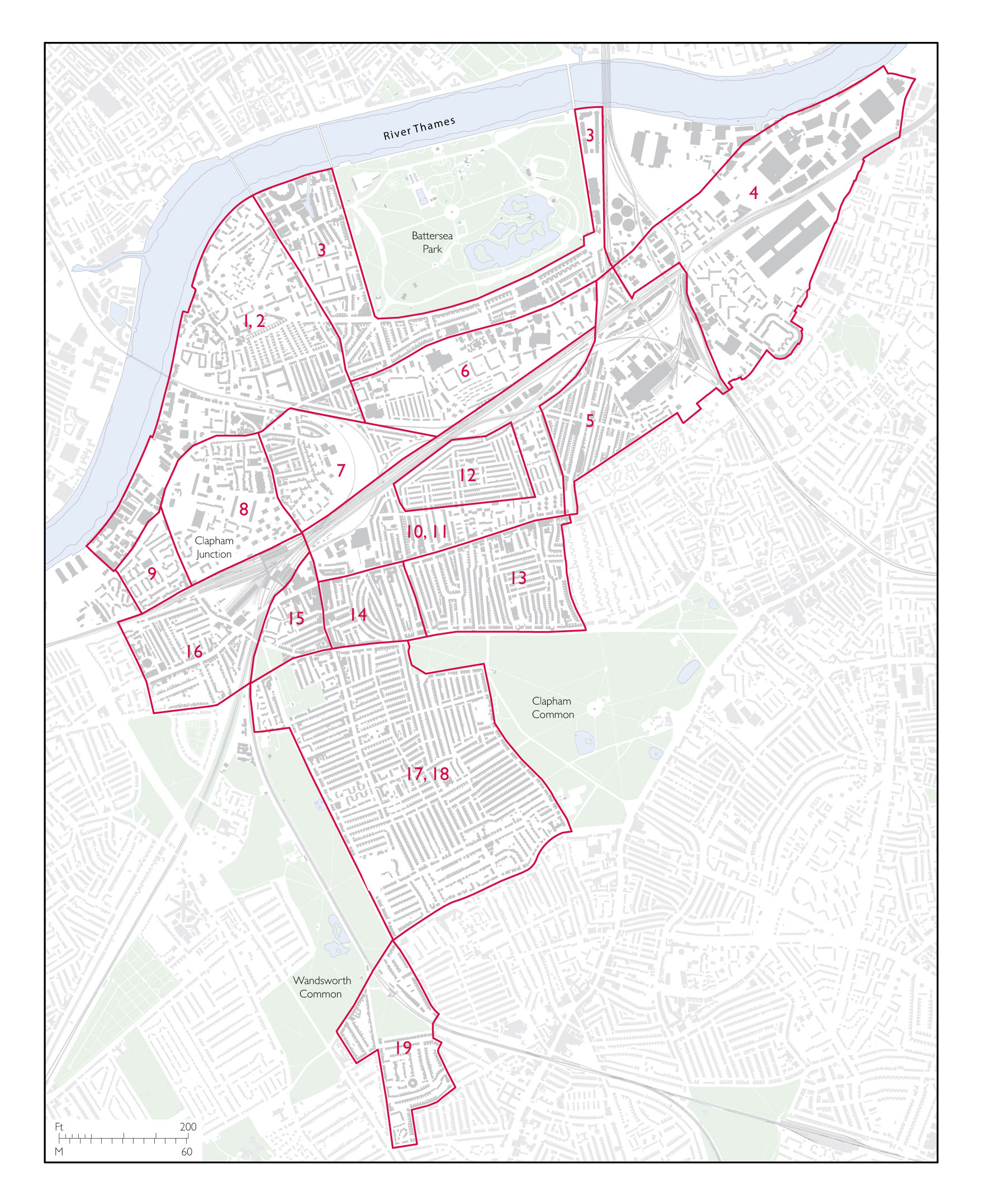
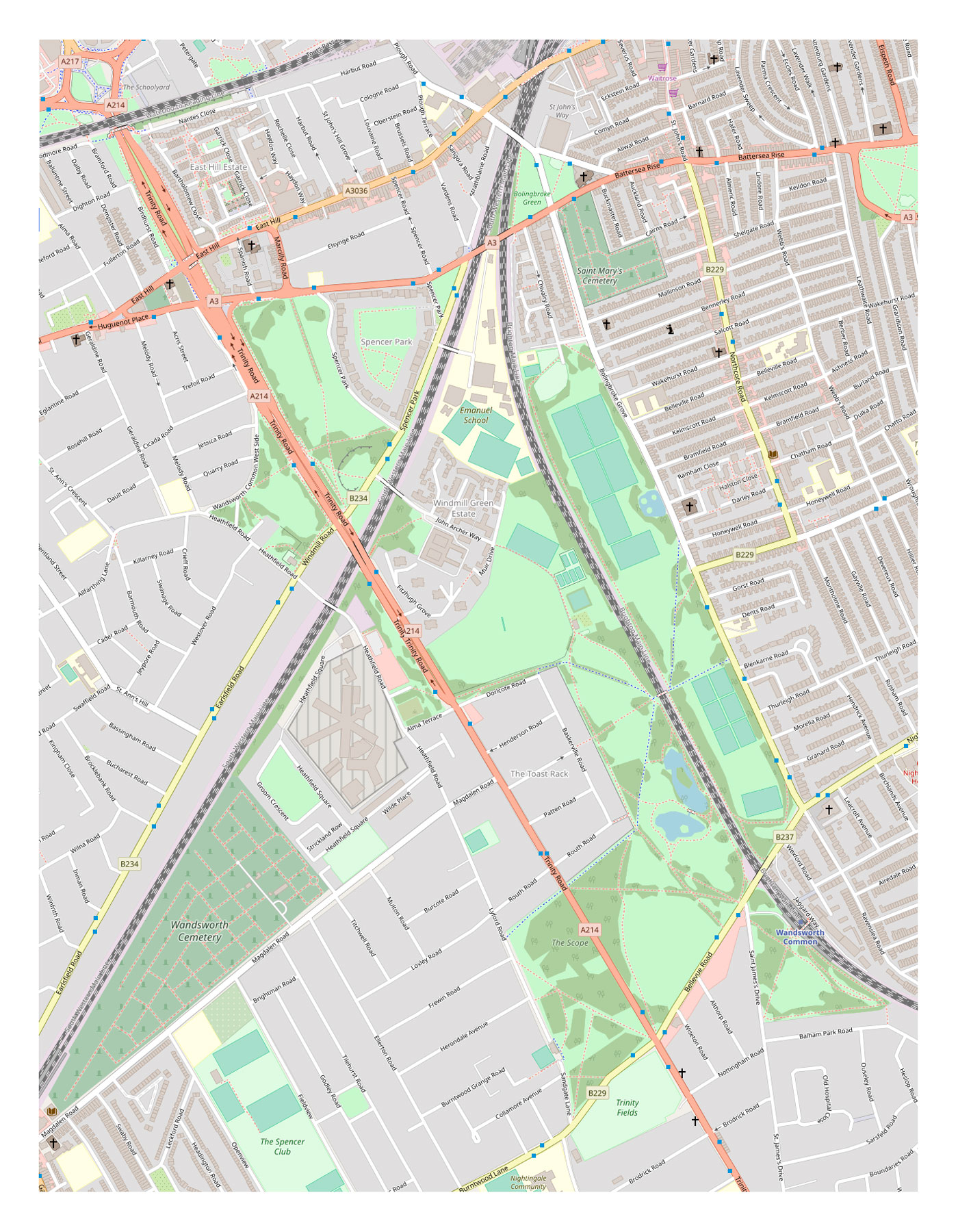
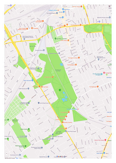
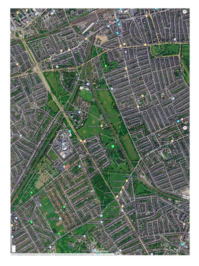
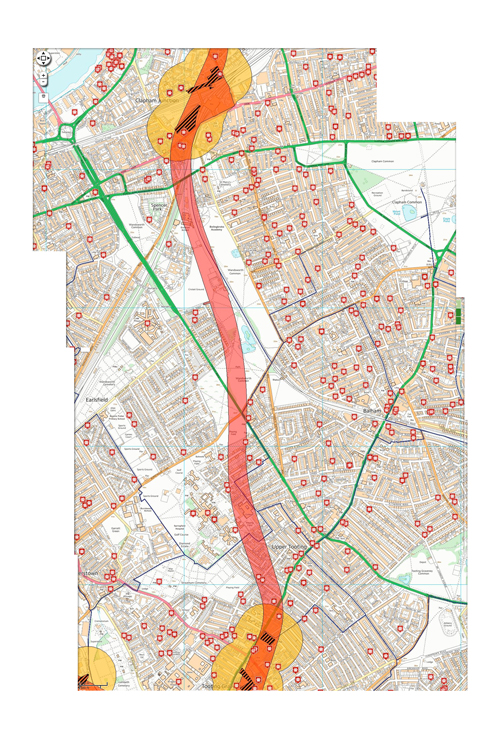
[screen grab of map on WBC Planning website, March 2020, but from c.2018? There was a protest at the time, with photographs in the press — I think I've downloaded some info.]
Sources of maps and aerial photographs