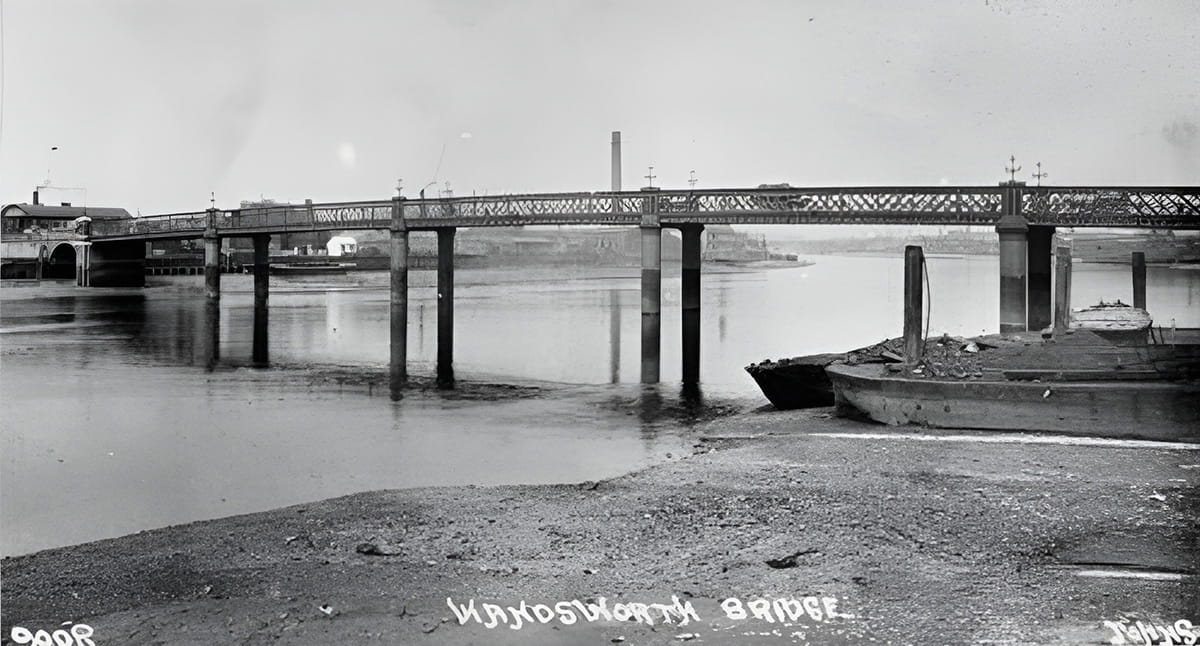
It seems very odd to me now, but when I grew up in the 1950s and 1960s I rarely crossed Wandsworth Bridge, though I frequently used Putney Bridge and Battersea Bridge. Yes, they had far more interesting places to visit on the other side (Battersea Bridge took you to the Museums at South Ken, for instance); but mainly because no buses crossed from my side of the Common (I lived near the Prison), and there was no easy access on foot except through a tangle of small streets.
 click to compare
Even today no buses cross the river to and from the Common area — Fulham might as well not have existed. And this probably reflects the fact that the first Wandsworth Bridge, an iron box-girder affair of 1873, was too narrow and too puny to carry omnibuses. And even when the new reinforced concrete bridge was made in the late 1930s, public transport routes didn’t change.
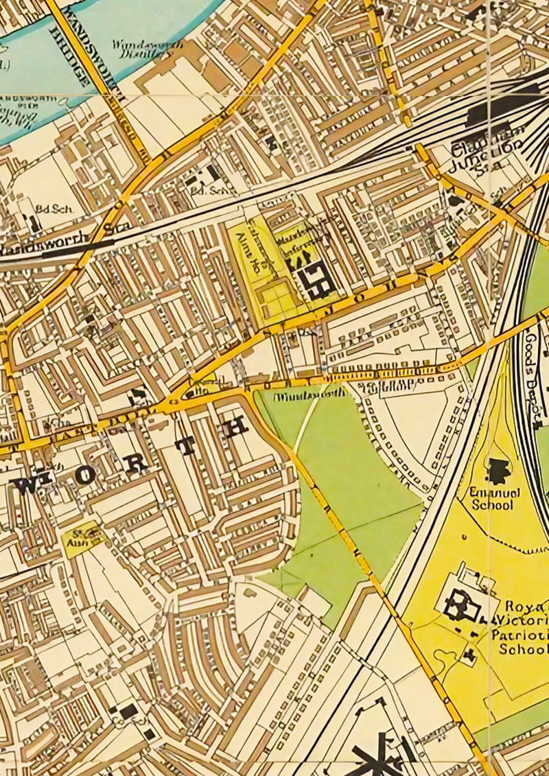
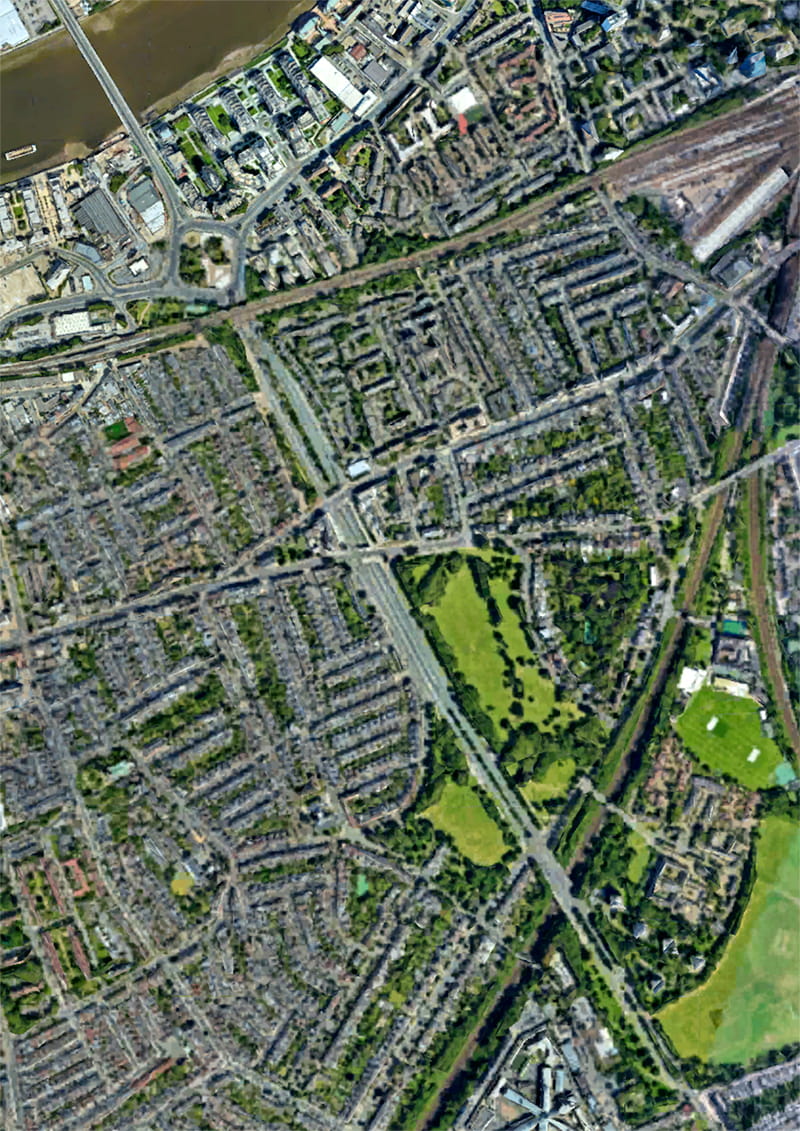
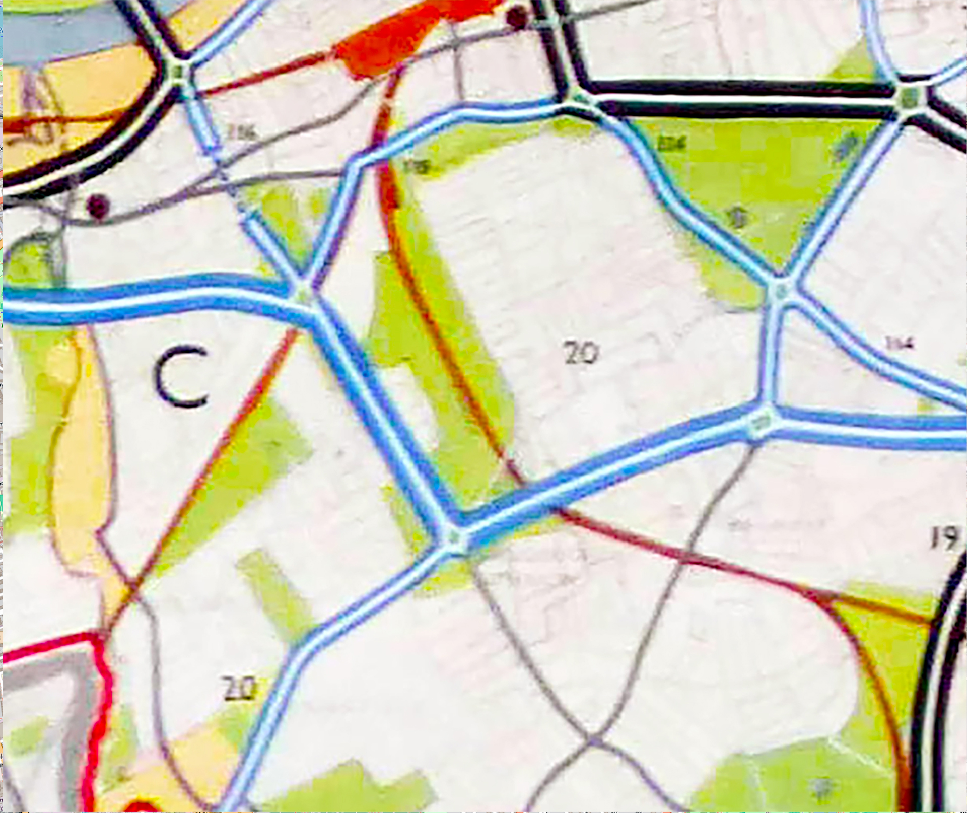
Yet seen from the sky, or on an early twentieth-century map, Trinity Road seems to be aiming straight for the bridge. So why then did it stop short at North Side? Was the original Trinity Road (though it was not called that until the 1870s) intended to continue to the river, but its onward progress was somehow stymied? And why was the first Wandsworth Bridge made so narrow and so weak? Good questions for another time. (But you can find out some of the answers in the excellent Wikipedia article Wandsworth Bridge.)
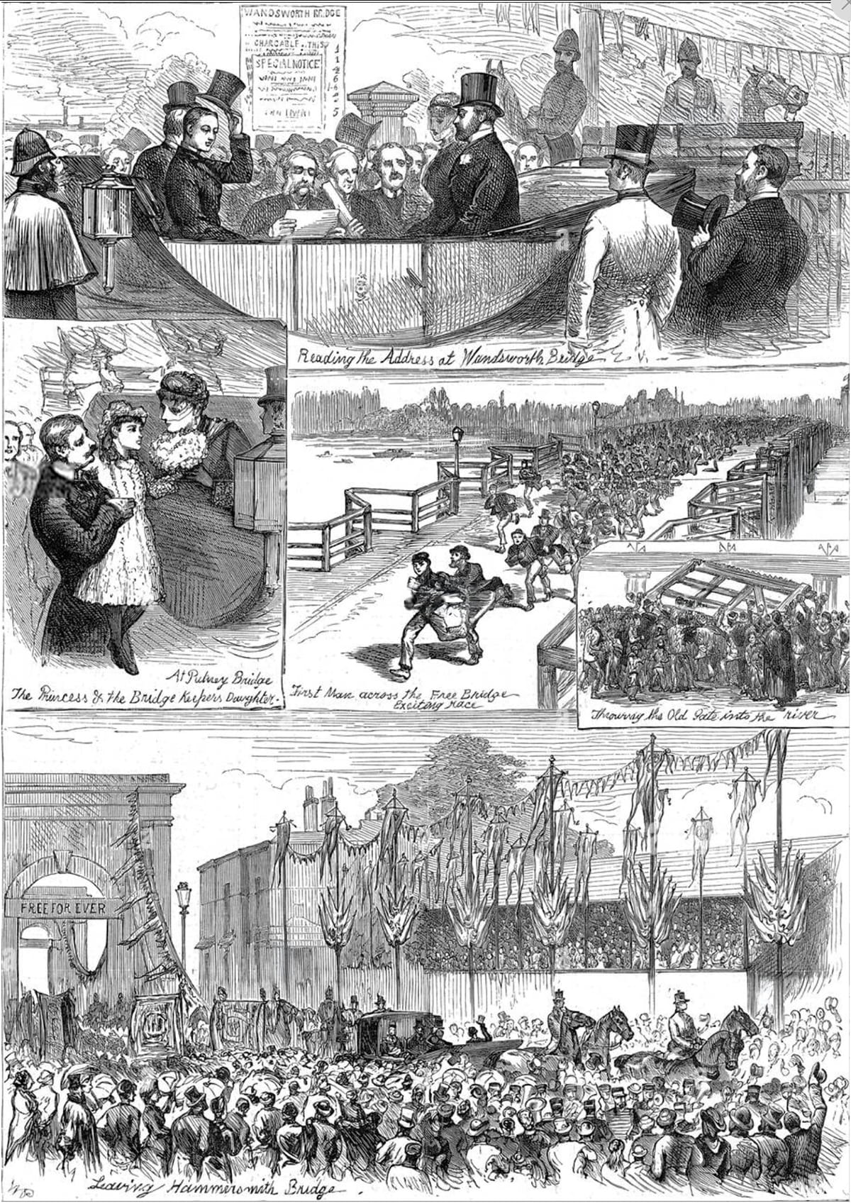
The abolition of bridge tolls, 1880. With great ceremony and popular celebration, Wandsworth, Putney and Hammersmith bridges were taken into public ownership in June 1880.
The images show (clockwise): the address being read at the opening of Wandsworth Bridge; a race to be the first across Putney Bridge; the toll gates from Putney Bridge being thrown into the river; the Prince and Princess of Wales leaving Hammersmith Bridge; the bridge-keeper’s daughter with the Princess of Wales at Putney Bridge.
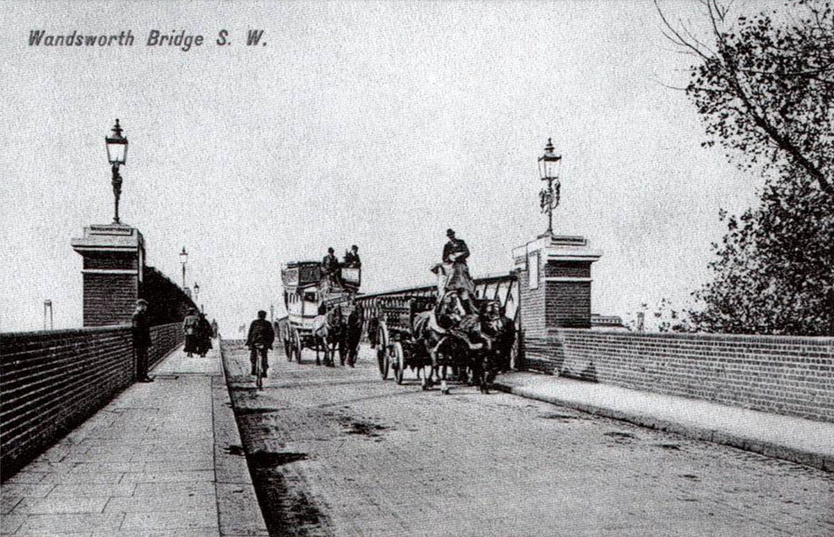
Postcard of old Wandsworth Bridge. Postcard of unknown date, but the bicycle suggests around 1910. Is that a horse-drawn omnibus behind the cart?
The contract for the bridge went to the Holloway Brothers (a local company that had previously built most of the houses in the area enclosed by Lyford/Ellerton/Burntwood and Magdalen Roads on the southwest of the Common).
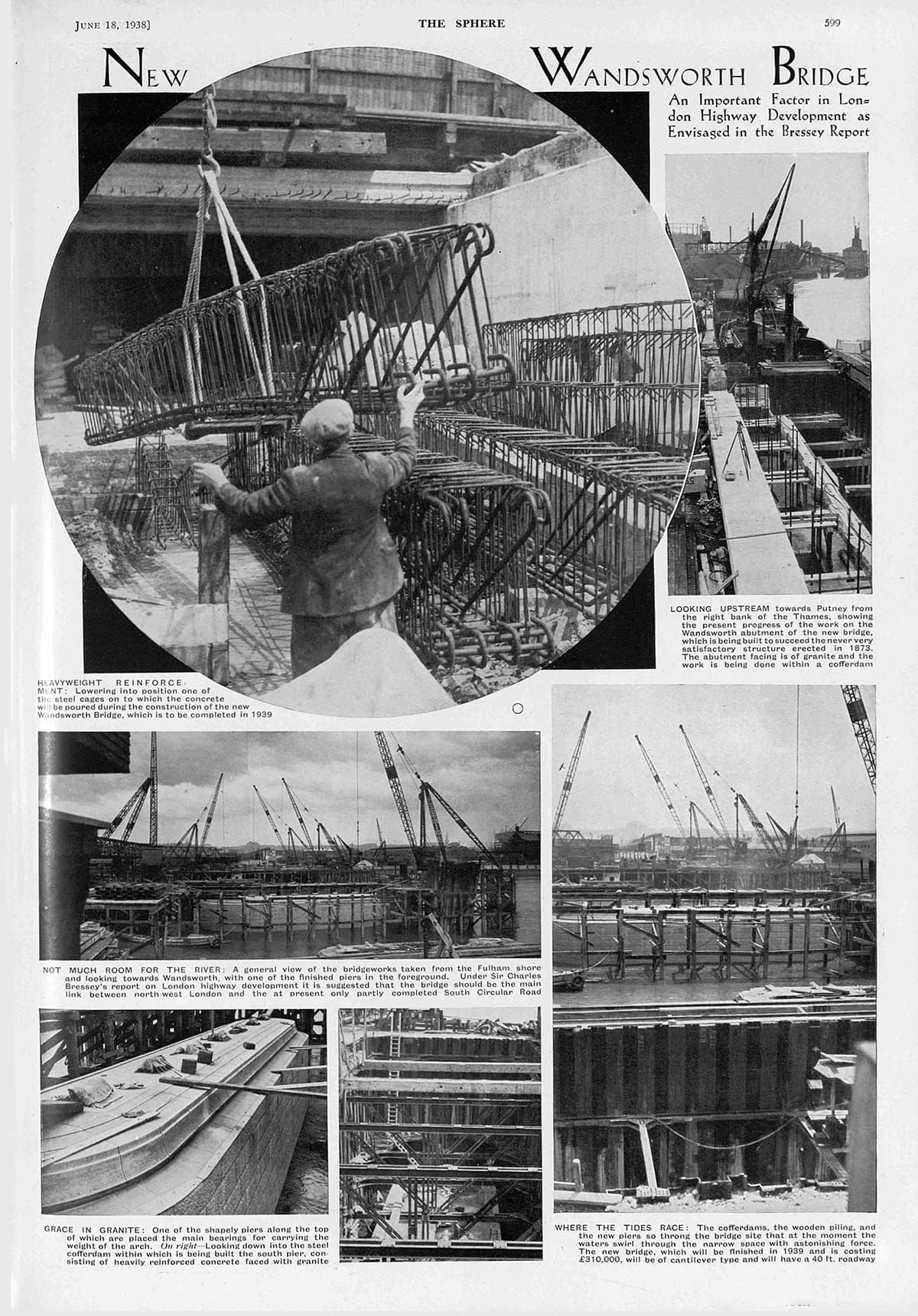

1941 — The German Luftwaffe were so interested in this bridge that they photographed it, and noted details of its structure.
“In preparing to invade Britain, the German military preparations included the production of a series of military/geographical assessments, showing what might be found by those arriving. This material was also used in a military evaluation of the regions of the British Isles, and considered each from the viewpoint of invasion.”
David Rumsey Map Collection: Wandsworth Brücke in London-SW, England.
Wandsworth’s Bridge has been described as “probably the least noteworthy in London.
I disagree.
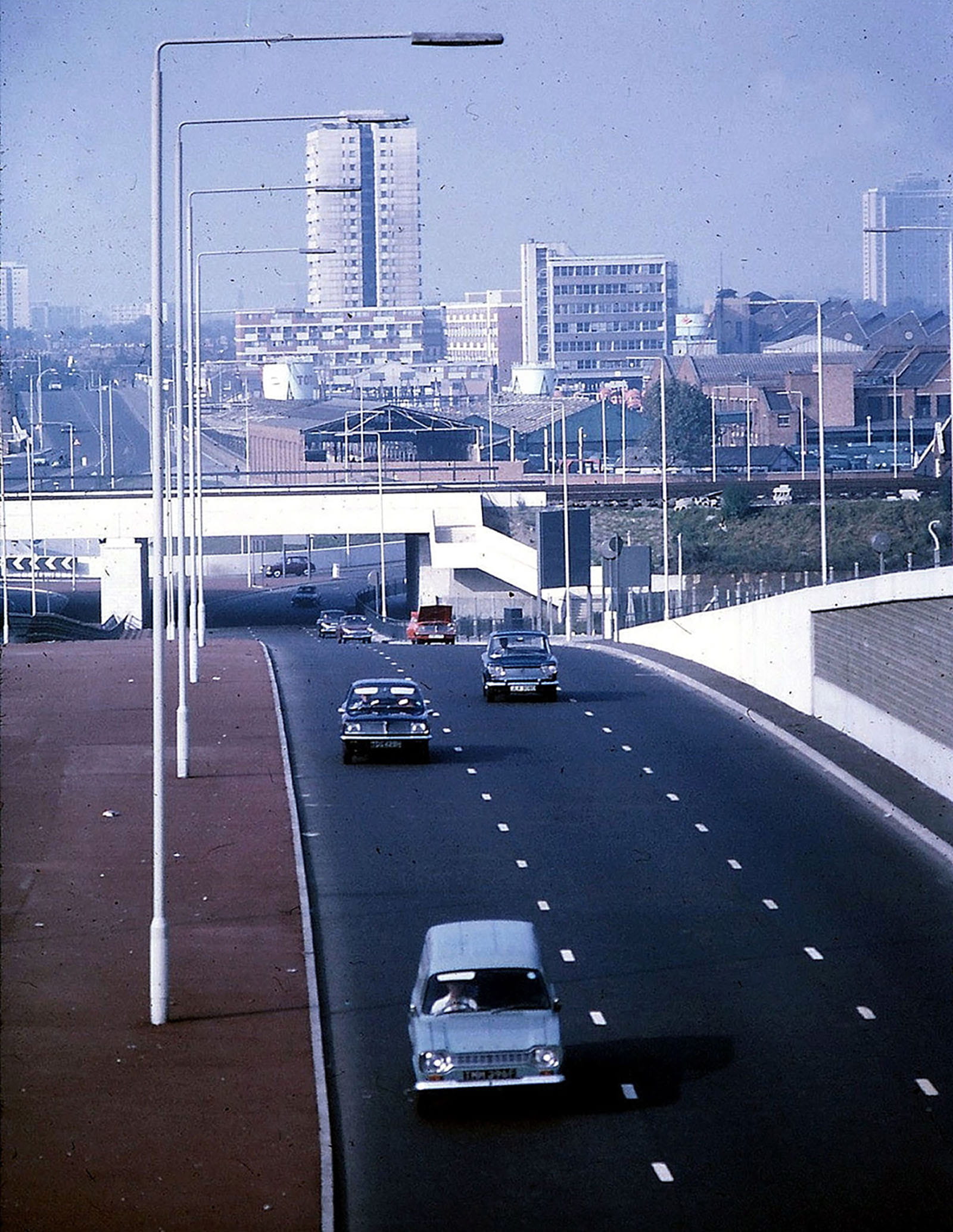
The creation of a new, more substantial bridge demanded better approaches north and south. From the direction of Streatham and Tooting, Trinity Road’s alignment seemed propitious, but there were numerous problems. Even if the intervening land could be bought and its houses and roads disposed of, any extension would have been too steep — it’s a nearly 100-foot drop from the Common at North Side to the river. (The Common being a gravel terrace left over from the last Ice Age.)
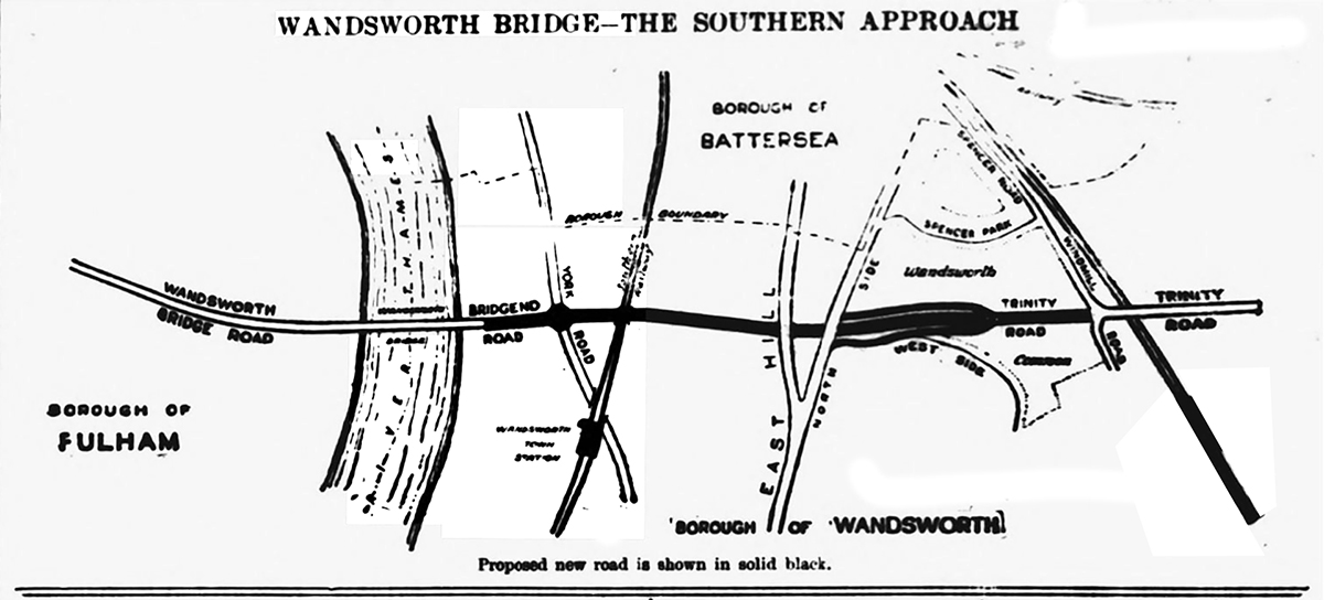
So what was to be done? A cutting had to be made, with roundabouts — still new-fangled, poorly understood things in the 1930s — to ease the flow of traffic at each end.
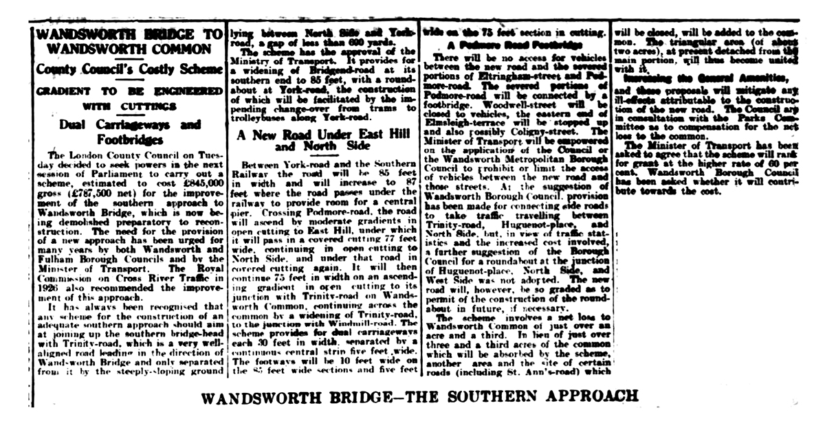
WANDSWORTH BRIDGE TO WANDSWORTH COMMON
County Council’s Costly Scheme
GRADIENT TO BE ENGINEERED WITH CUTTINGS
Dual Carriageways and Footbridges
The London County Council on Tuesday decided to seek powers in the next session of Parliament to carry out a scheme estimated to cost £845,000 (£787,000 net) for the improvement of the southern approach to Wandsworth Bridge, which is now being demolished preparatory to reconstruction.
The need for the provision of a new approach has been urged for many years by both Wandsworth and Fulham Borough Councils and by the Ministry of Transport. The Royal Commission on Cross River Traffic in 1926 also recommended the improvement of the approach.
It has always been recognised that any scheme for the construction of an adequate southern approach should aim at joining up the southern bridge head with Trinity Road, which is a very well aligned road leading in the direction of Wandsworth Bridge and only separated from it by the steeply sloping ground lying between North Side and York Road, a gap of less than 600 yards.
The scheme has the approval of the Ministry of Transport. It provides for a widening of Bridgend-road at its southern end to [?] feet, with a roundabout at York-road, the construction of which will be facilitated by the impending change-over from trams to trolleybuses along York-road.
New Road Under East Hill and North Side
Between York-road and the Southern Railway the road will be 85 feet in width and will increase to 87 feet where the road passes under the railway to provide room for a central pier. Crossing Podmore-road the road will ascend by moderate gradients in open cutting to East Hill, under which it will pass in a covered cutting 77 feet wide, continuing in open cutting to North Side, and under the road in covered cutting again.
It will then continue 75 feet in width on an ascending gradient in open cutting to its junction with Trinity-road on Wandsworth Common, continuing across the common by a widening of Trinity-road to the junction with Windmill-road.
The scheme provides for dual carriageways each 30 feet in width, separated by a continuous central strip five feet wide. The footways will be 10 feet wide on the 85 feet wide sections and five feet wide on the 75 feet section in cutting.
A Podmore Road Footbridge
There will be no access between the new road and the severed portions of Eltringham-street and Podmore-road. The severed portions of Podmore-road will be connected by a footbridge. Woodwell-street will be closed to vehicles, the eastern end of Elmsleigh-terrace will be stopped up and also possibly Coligny-street.
The Minister of Transport will be empowered on the application of the Council or the Wandsworth Metropolitan Borough Council to prohibit or limit the access of vehicles between the new road and those streets.
At the suggestion of Wandsworth Borough Council, provision has been made for connecting roads to take traffic travelling between Trinity-road, Huguenot-place, and North Side, but, in view of traffic statistics and increased cost involved, a further suggestion of the Borough Council for a roundabout at the junction of Huguenot-place, North Side, and West Side was not adopted. The new road will, however, be so graded as to permit of the construction of the roundabout in future, if necessary.
The scheme’s advocates admitted that there would be losses to the Common, though St Ann’s Road (aka Marcilly Road) would be grassed over — which is exactly what happened in the 1970s:
The scheme involves a net loss to Wandsworth Common of just over 1 acre and a third. In lieu of just over three and a third acres of the common which will be absorbed by the scheme, another area and the site of certain roads (including St. Ann’s-road) which will be closed, will be added to the common. The triangular area (of about two acres) at present detached from the main portion, will then become united with it
Increasing the General Amenities
and these proposals will mitigate any ill-effects attributable to the construction of the new road. The Council are in consultation with the Parks Committee as to compensation for the net loss of the common . . .
[BNA: Link.]
The Second World War halted the scheme to join the bridge with Trinity Road, delaying it for nearly thirty years. But even as war was raging, you might say that a far greater threat to the Common was being planned — not by German High Command but by two Brits: an academic, Patrick Abercrombie, and the LCC’s deputy chief architect, J.H. Forshaw.
The pair had been appointed by the London County Council to create an over-arching vision of a post-war London. They were asked to address longstanding concerns — of overcrowding, poor housing, traffic congestion, and industrial jumble — and to propose modern, spacious urban planning, including the creation of new parks and a functional, decentralised city structure.
I’ll be looking at their proposals, as set out in their County of London Plan (1943), and Abercrombie's Greater London Plan (1944), in more detail next month, but in the meanwhile here’s a hint of what was in store for us:
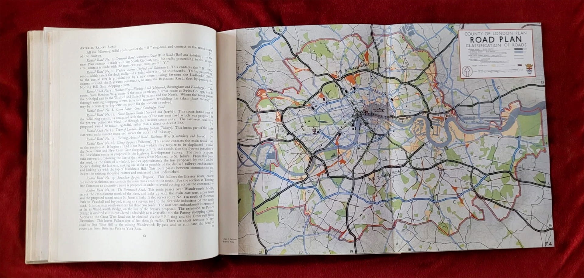
Here is just a tiny fragment of their proposed map of roads. Drag the slider to fade between the Abercrombie and Forshaw scheme and the modern map:
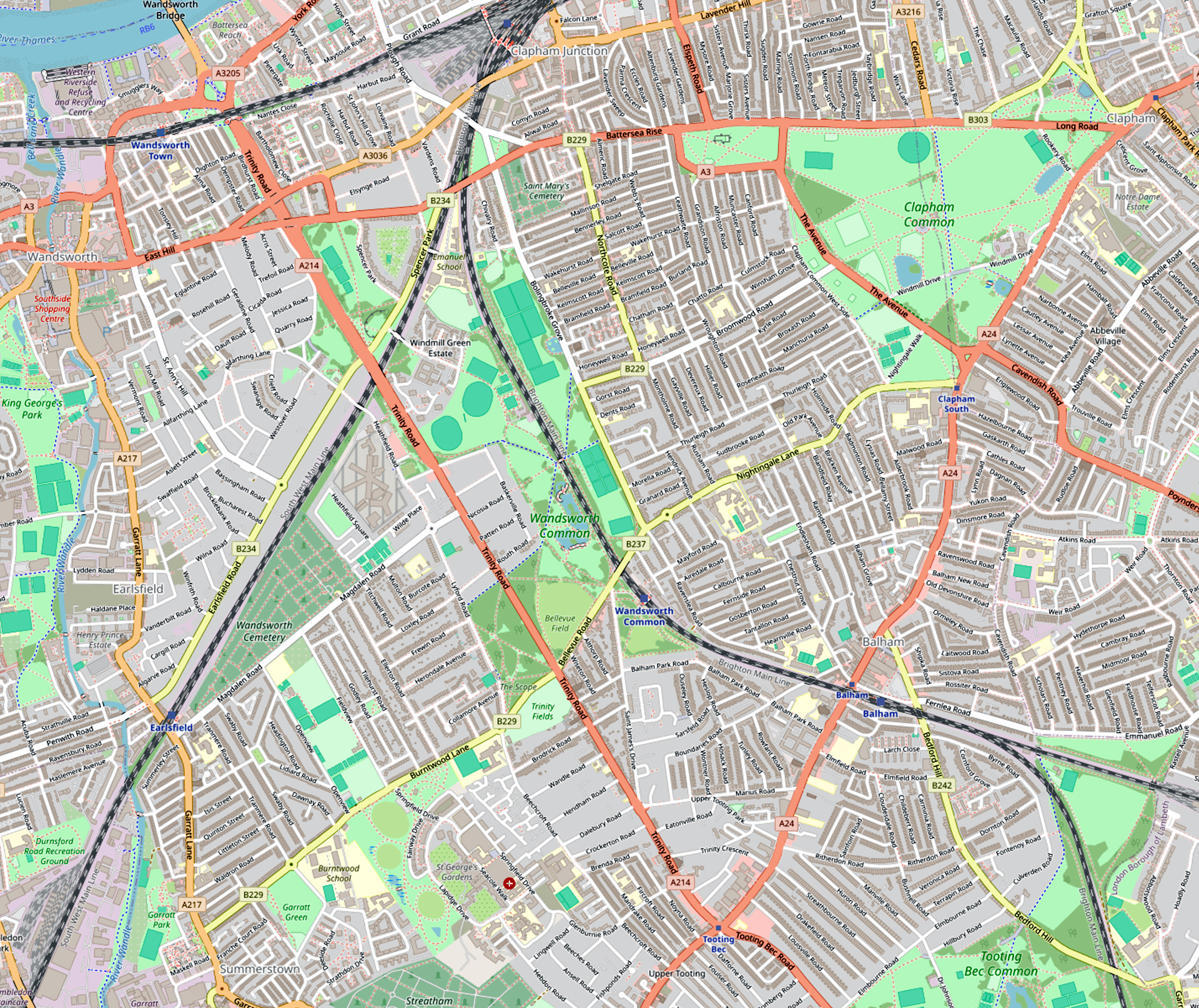
Drag the slider to fade between the Abercrombie and Forshaw proposed road scheme and the modern map.
One of the best things about doing these Chronicles every month, on all sorts of almost random topics, is that I get such interesting responses from readers.
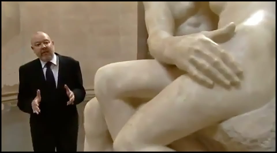
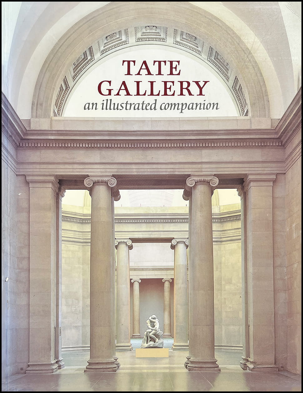
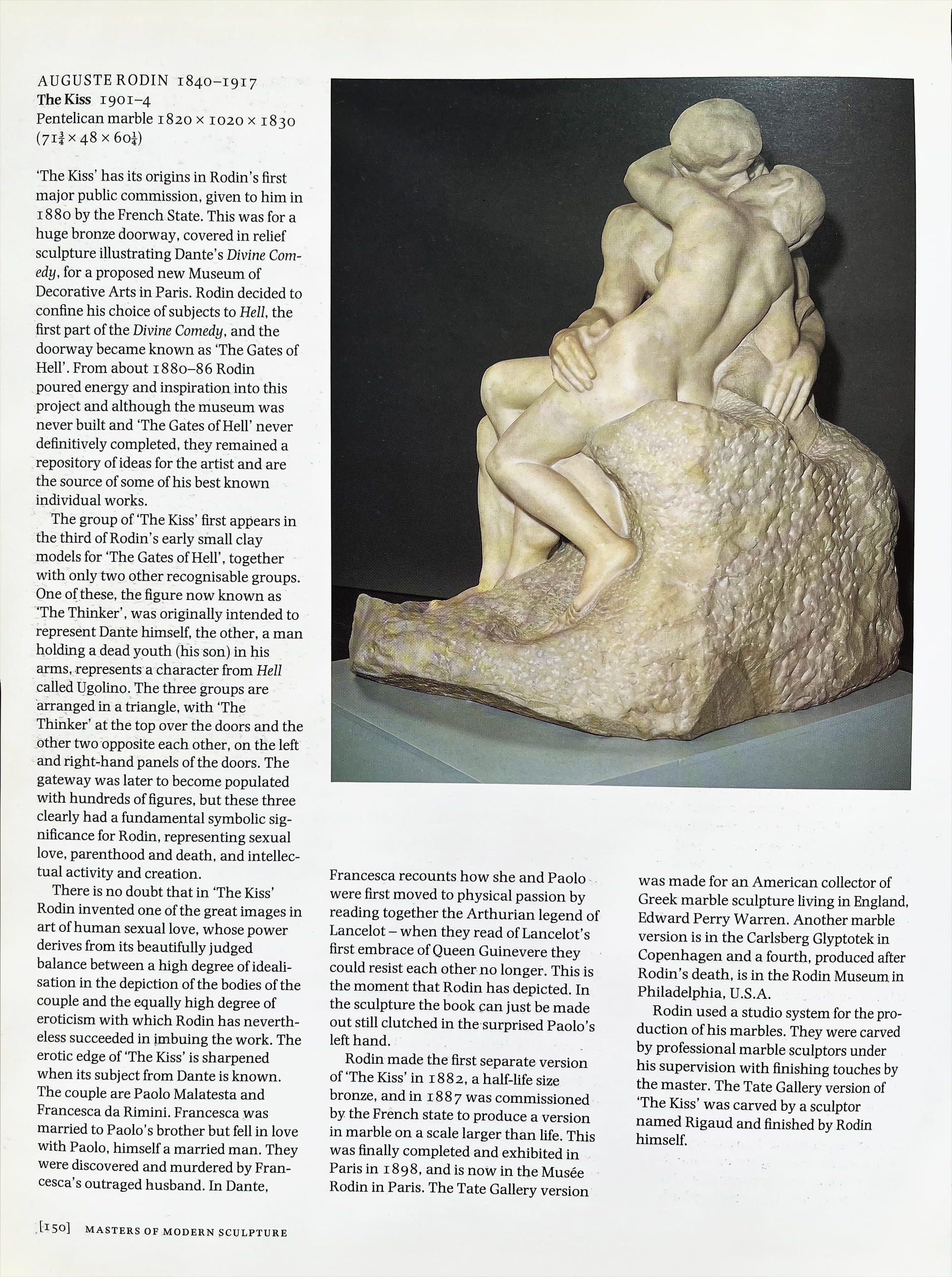
Last month, I wrote about “Forbidden Love on Wandsworth Common”, which included a discussion of Rodin’s sculpture The Kiss, now in the Tate Gallery.
So you can imagine my pleasure when my Loxley Road neighbour Simon Wilson (a former curator and head of education at the Tate) got in touch about various pieces he’d written about The Kiss over the years, and his appearance in that wonderful TV series, The Secret Life of a Masterpiece.
Sarah Vey and I will be talking about our exploration of the amazing Geoffrey Bevington Album of albumen prints, now in the Victoria and Albert Museum. Geoffrey, who died in 1874 at the age of 34, was a gifted young photographer working in the early days of the medium — most of his images were taken in the early 1860s.
Thanks to local photographer Tim Wren, we now have good copies of all the eight hundred or so images — thanks, Tim! Tweaking the photographs in Photoshop has helped to bring out a huge amount of fascinating detail.
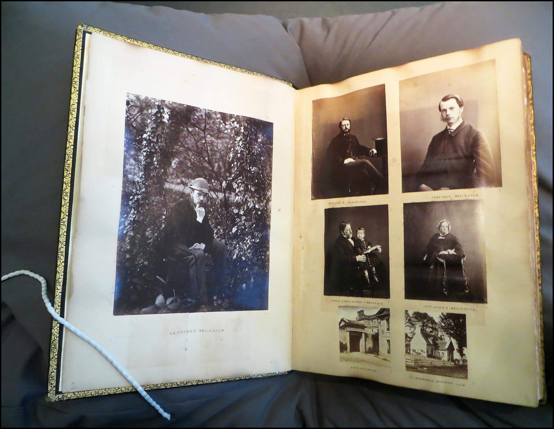
There are nearly 800 images in the collection, with a great variety of themes and locations. There are numerous photographs of his family and friends in London and Northern Ireland, including exquisite portraits of his gorgeously dressed relatives.
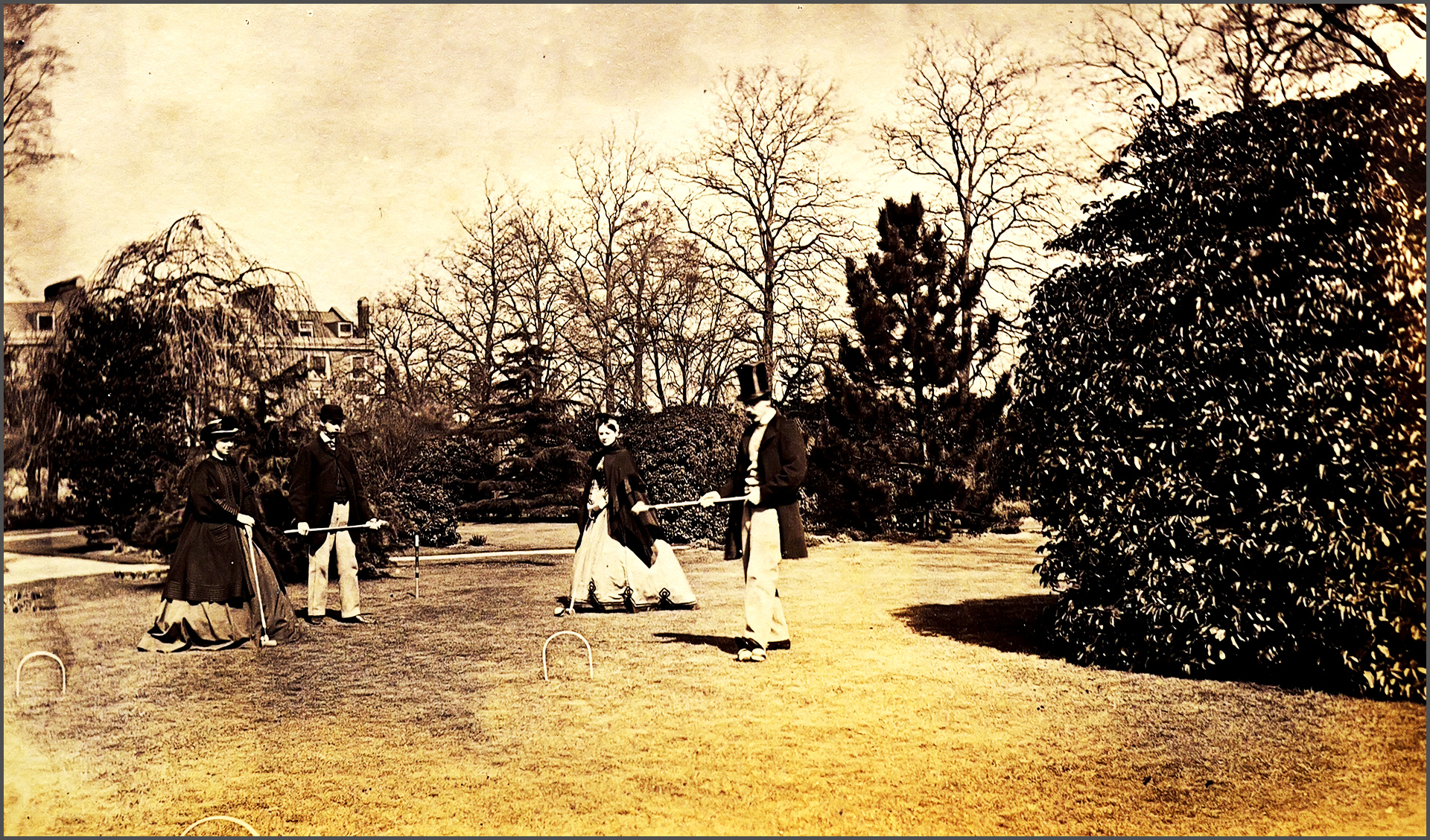
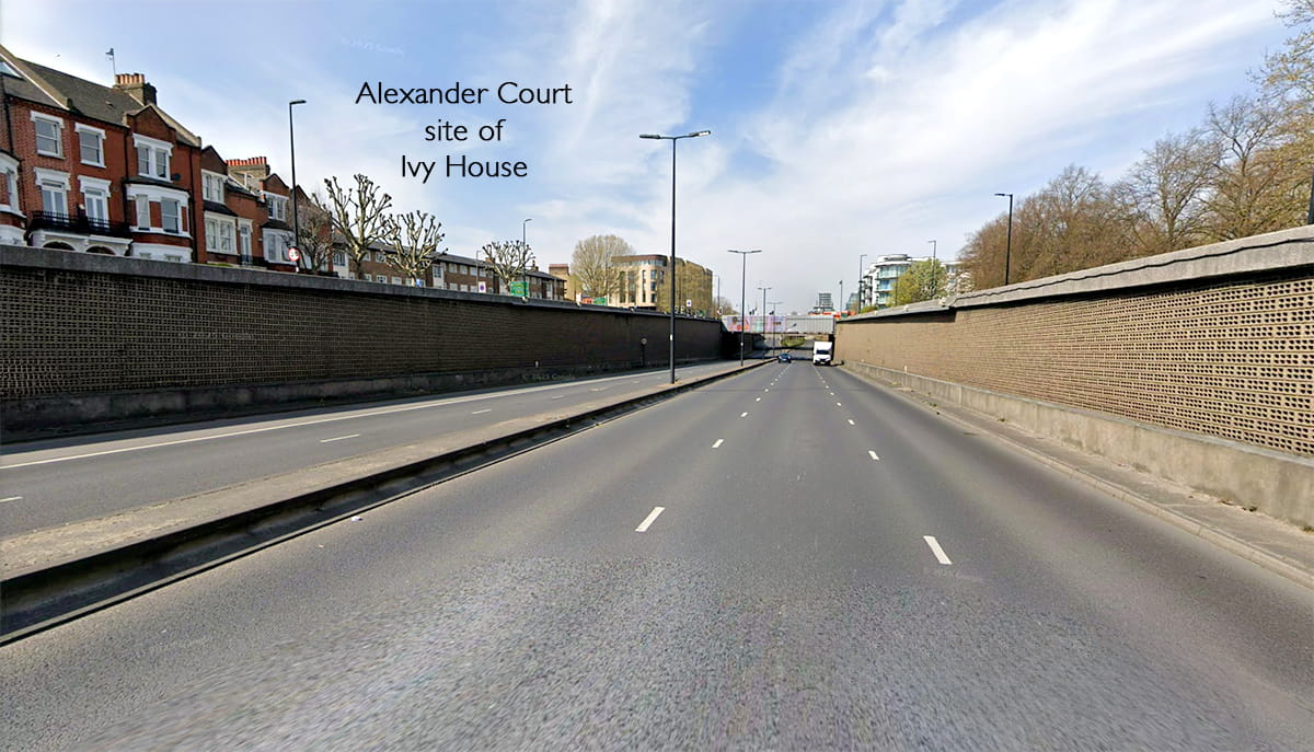
Some portraits are formal in feel, but many are more casual and humorous, including scenes of games (such as croquet) and dressing up. There are numerous holiday and work scenes, too, but the most interesting for us are likely to be the local scenes — for example of the Common — but above all of their home, Ivy House, on West Side.
It really is a remarkably complete view of an affluent family living on the edge of Wandsworth Common in the 1860s.
[Bookings are available through the Friends of Wandsworth Common’s members’ newsletter. If you are not currently a member, but are interested in coming to the talk, please contact the Heritage Group Chair, Stephen Midlane using this email link.]
Send me an email if you enjoyed this post / want to comment on something you’ve seen on the site / would like to know more — or just want to be kept in touch.
If you would like to receive notifications of new Chronicles, let me know . . .
— Friends of Wandsworth Common
— Wandsworth Historical Society