← Abercrombie and Forshaw
Today →
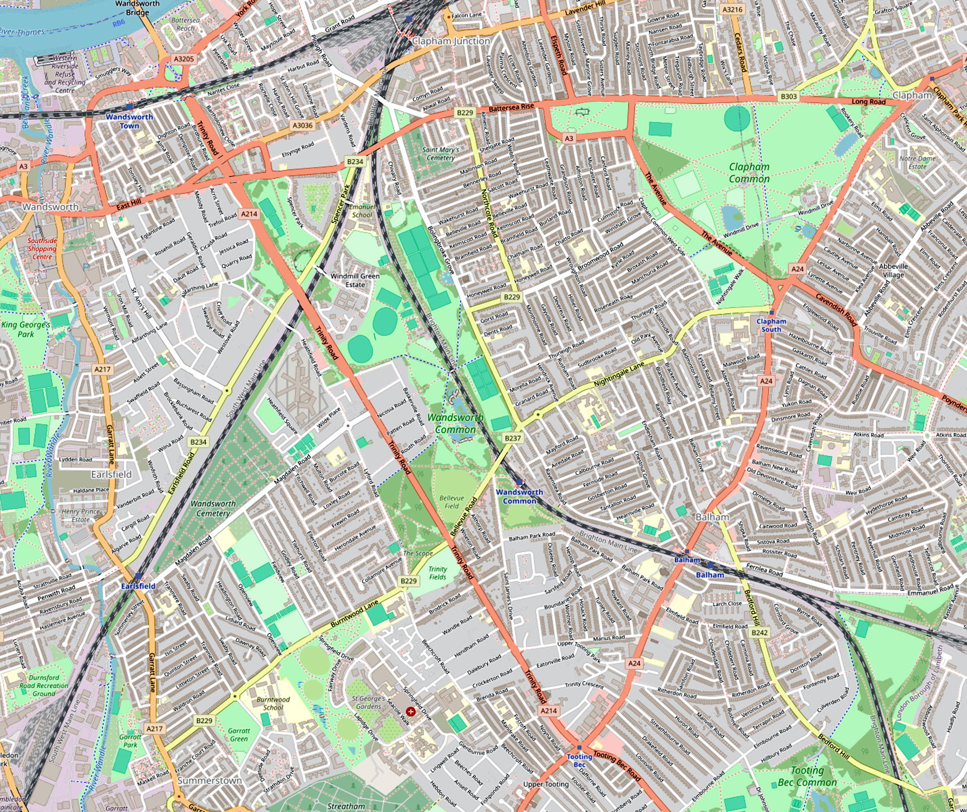
Drag the slider to fade between the Abercrombie and Forshaw proposed road scheme and a modern map.
“Big Problems need Big Solutions”
As I wrote last month, the Second World War halted the scheme to join Trinity Road with the new Wandsworth Bridge (opened September 1940), delaying it for nearly thirty years. But even as war was raging, you might say that a far greater threat to the Common was being planned — not by German High Command but by two Brits: an academic, Patrick Abercrombie, and the LCC’s deputy chief architect, J.H. Forshaw.
The pair had been appointed by the London County Council to create an over-arching vision of a post-war London that would address longstanding concerns — of overcrowding, poor housing, traffic congestion, and industrial jumble — and to propose modern, spacious urban planning, including the creation of new parks and a functional, decentralised city structure.
It may seem in retrospect a little previous of the LCC to be thinking so ambitiously, but we should recall that this was some time after the Blitz had ceased (May 1941). Most people now assumed that aerial bombardment was over — this of course was before the V1 and V2 assault began (June 1944).
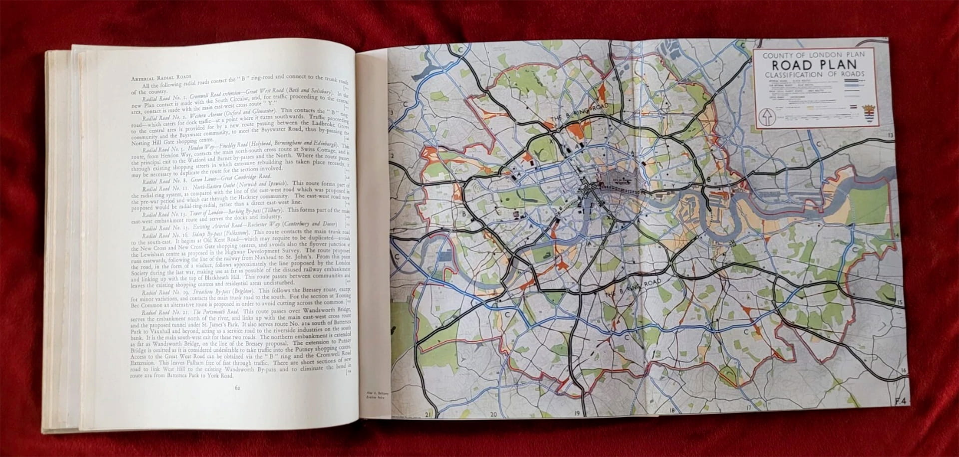
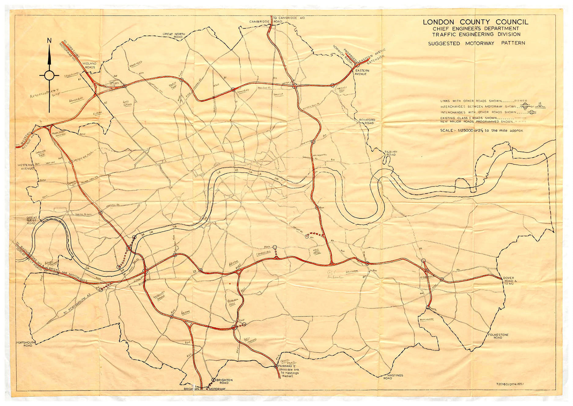
Abercrombie and Forshaw set out their sweeping proposals in their County of London Plan (1943), and Abercrombie’s Greater London Plan (1944).
They certainly knew how to wow the reader with the scope and scale of their ambition. This is just the map of what was planned for the roads into and around London:
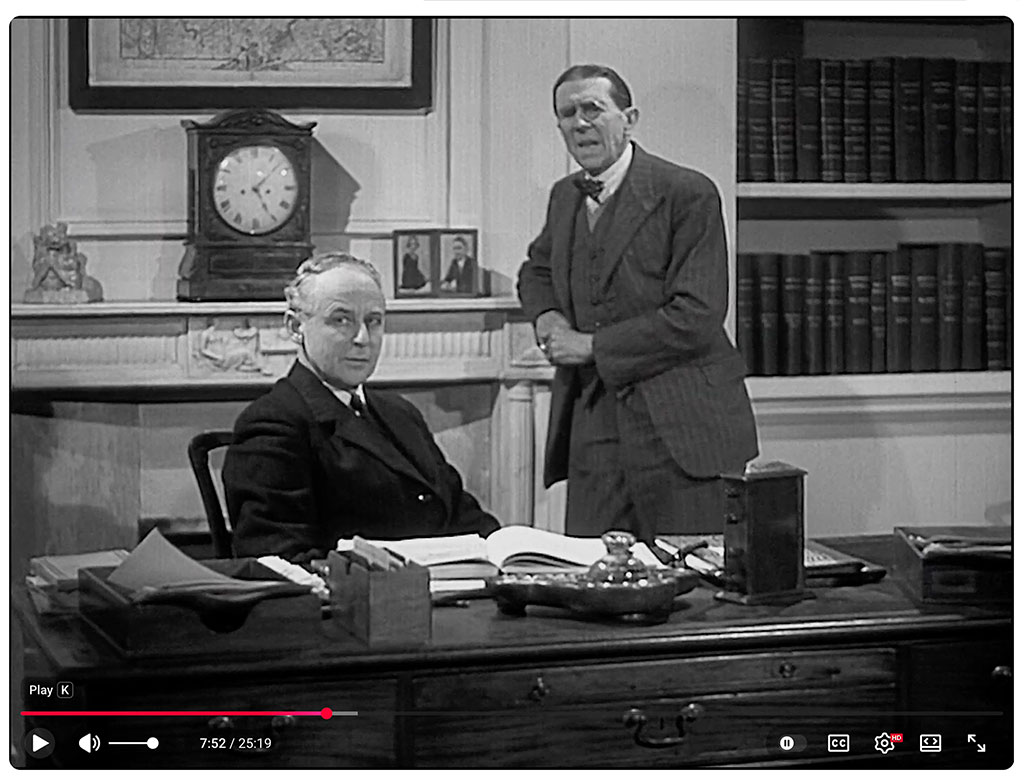
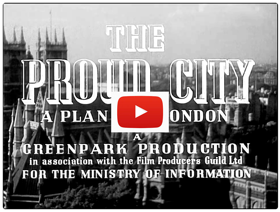
Before we continue, you might like to watch The Proud City — a wonderfully evocative film about the plan — and the big-name planners Abercrombie and Forshaw. It’s hard not to see it as parody, but it isn’t — and it contains remarkable images of the best and worst of London:
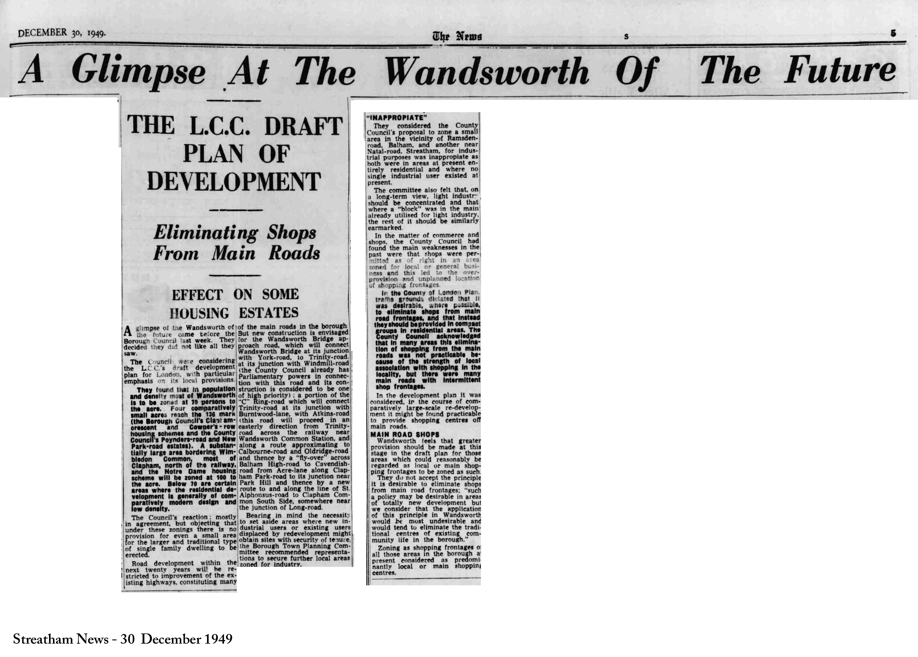
After years of earnest endeavour, the planners’ and road-builders’ ambitions were largely thwarted: “Road development within the next twenty years”, they were told, “will be restricted to improvement of the existing highways.” But a couple of sweeteners remained: some at least of Abercrombie and Forshaw’s vision would still be realised:
[N]ew construction is envisaged for the Wandsworth Bridge approach road, which will connect Wandsworth Bridge at its junction with York-road, to Trinity-road at its junction with Windmill-road . . . and a portion of the “C” Ring-road, which will connect Trinity-road (at its junction with Burntwood-lane) with Atkins-road, proceeding:
- — eastward from Trinity-road across the railway near Wandsworth Common Station,
- — along a route approximating to Cabourne-road and Oldridge-road,
- — thence by a “fly-over” across Balham High-road to Cavendish-road,
- — from Acre-lane along Clapham Park-road to its junction near Park Hill,
- — thence by a new route along the line of St. Alphonsus-road,
- — to Clapham Common South Side, somewhere near the junction of Long-road.
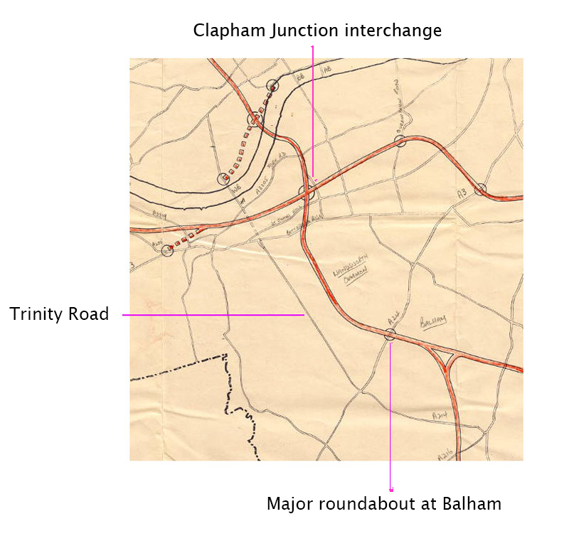
This is the route you can see in the slidable map at the top of the page, though the roundabout on Balham High Road is now conceived as an overpass leading into Oldridge Road (in front of Alderbrook School).
I lived for many years on the planned route: on Calbourne Road and, before that, on Trinity Road. It’s clear that this road would have utterly transformed the Common and indeed our whole area.
Then, in the early 1960s, for reasons I can only guess at, the extension of Trinity Road to the river remained an ambition but Abercrombie and Forshaw’s zig-zag between Clapham and Putney via Wandsworth Common and Earlsfield was abandoned. For a while a rather different idea took its place. The motorway would still cross the Common, but no part would run along Trinity Road — instead it would run along the course of the Balham-Clapham Junction railway line.
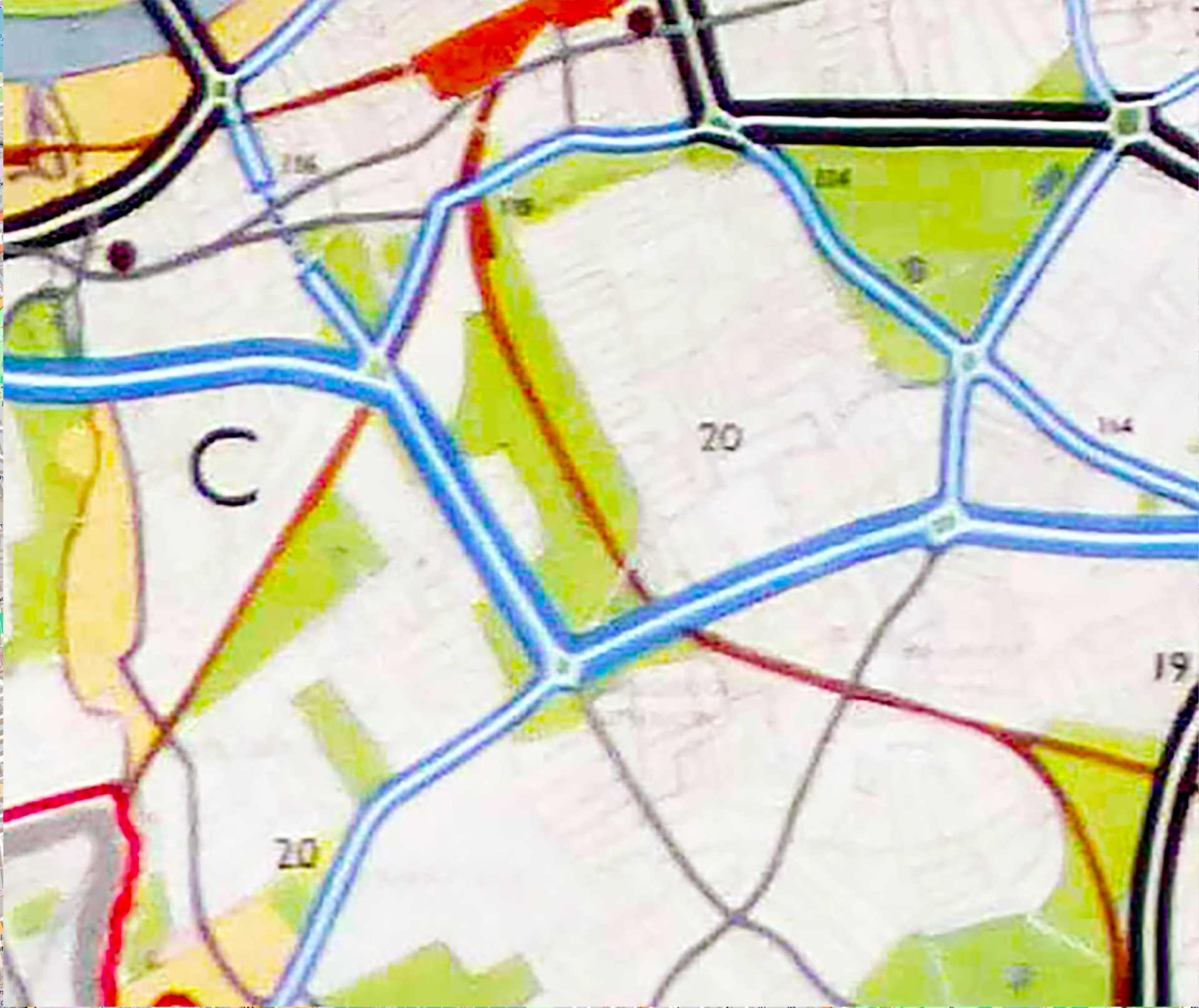
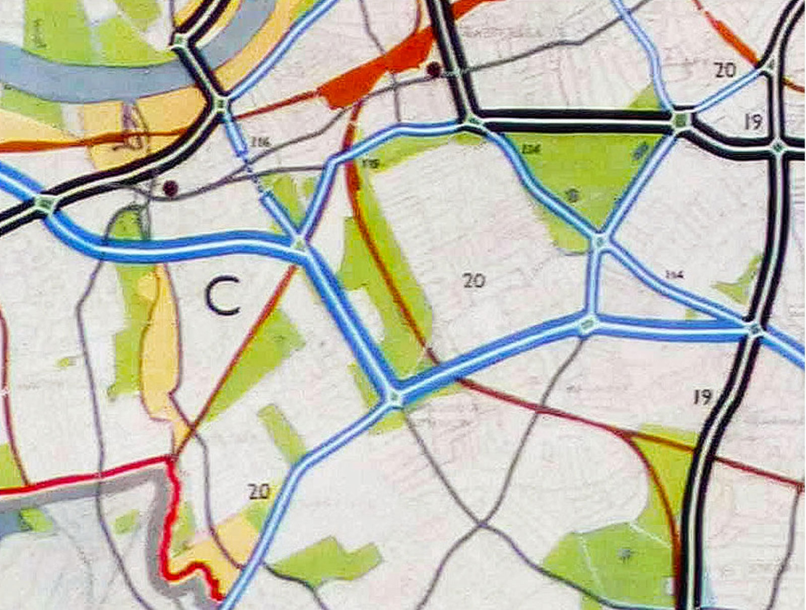
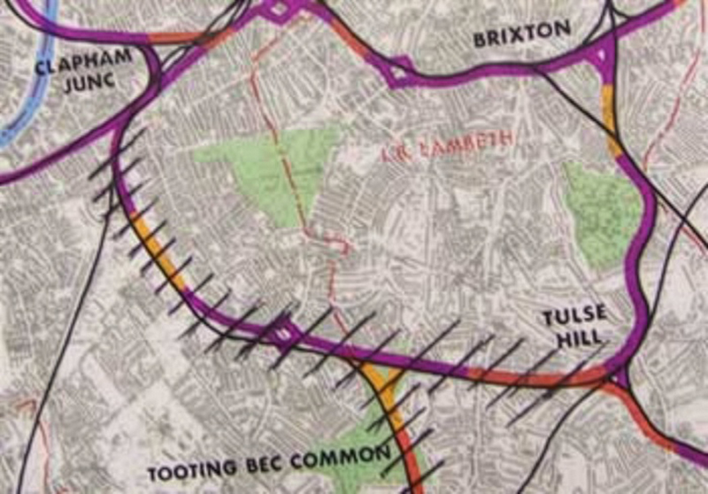
Here’s the big picture for Battersea, Tooting and Wandsworth: an east–west motorway across South London would cross a south–north motorway at a massive interchange at Clapham Junction.
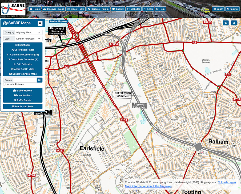
In the early 1960s, the “Balham Loop” motorway was a serious prospect. Various alternatives had been mooted from as early as the 1930s, but this was a brilliant new solution for south-west London’s traffic problems: a new motorway from the south coast, now called the M23, would meet the east-west “Ringway 1” on Tooting Bec Common.
Here’s what the new road layout would have looked like. (I have adapted maps found on the Sabre Roads (on which, below); the proposed “Balham Loop” is highlighted in purple, imposed on a modern map:
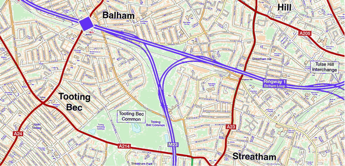
Elevated above the existing London–Brighton railway line, Ringway 1 would carry traffic across Wandsworth Common to a Ringway 2 connecting Battersea, Wandsworth and Putney.
(I assume this new highway was expected to be carried on stilts above the existing track. Or would the railway have been elevated on top of the new road?)

And here’s an artist’s impression of what it would have meant for Clapham Junction:
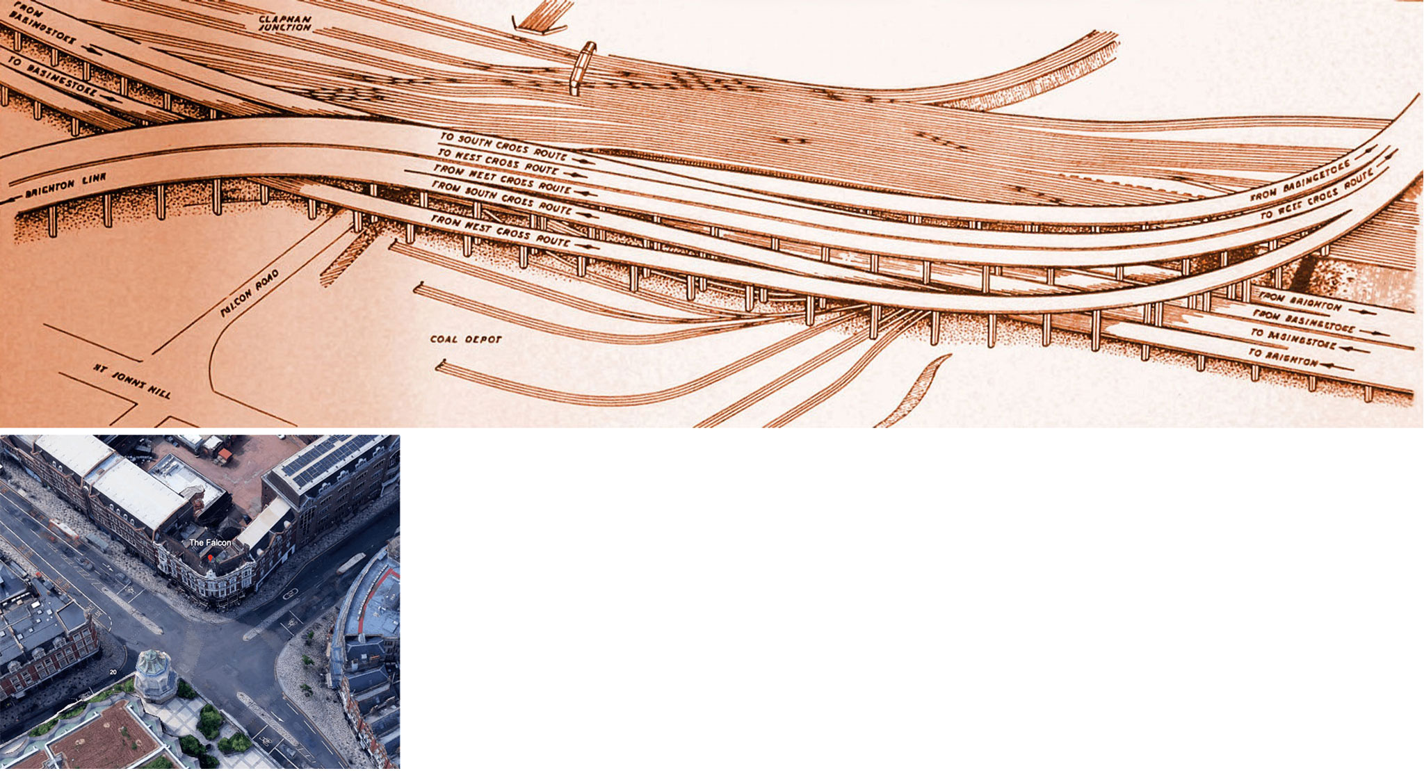
I wonder how pedestrian-friendly this bridge/underpass — twice the length of the current one — would have been?
As you can see, the sensibilities of 1960s’ planners gave little weight to the wider significance of Commons for nature, or for people’s leisure, health and well-being. Commons seem to have been a conveniently empty space on which to plonk their motorways — one that wouldn’t involve knocking down more houses and thereby engaging the wrath of the “Homes Before Roads” groups that were growing in strength.
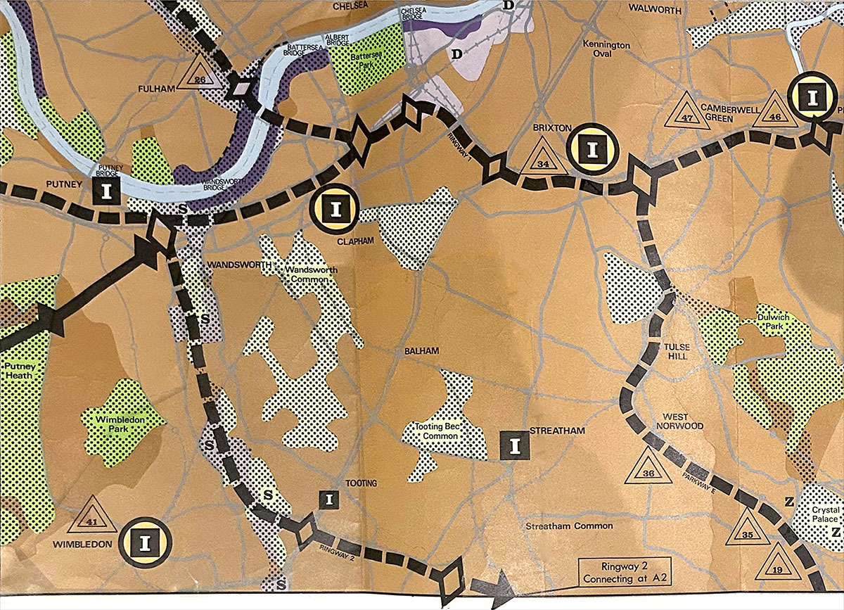
With the change from the LCC to the Greater London Council (GLC) in the mid-1960s, the M23 was cut short at the outskirts of London rather than allowed to penetrate Tooting. At a stroke, any justification for the Balham Loop disappeared. So, as this report makes clear, “the GLC ended anxiety for many families living in Wandsworth by dropping the ‘Balham Loop’ section from its scheme.”
But as we shall see in this article from the Wandsworth Borough News, post-war motorways grew like Hydra’s heads. Just as one threat was removed another arose in the form of the C Ring: “an elevated motorway through the greater part of the Wandle Valley”.
Motorway Plan Abandoned
This part of the proposed motorway box for inner London, which had previously been “safeguarded”, is no longer required because the Transport Ministry has decided that the M.23 from Brighton can stop its main journey into the centre at an earlier interchange at Streatham Vale.
The section now abandoned would have run between Clapham Junction and Tulse Hill and from the northern section of the M23 from Gleneagle-road across Tooting Bec Common.
So the people living on these lines can now forget their motorway fears — just when others find their district drawn into the possible road network.
As the SABRE site puts it, the Balham Loop’s
deletion from the GLC’s roads programme came so soon after the motorway plans were formally announced that it continued to appear on standard maps of Ringway 1 — known as the “Provisional Urban Motorway Plan” — for several years afterwards, presumably until a new print run was ordered.
Dozens of copies of the map are found scattered through archive documents about motorway planning in London, and in some of them the Balham Loop has been crudely scribbled out, a quick and undignified end for the GLC’s shortest-lived, and perhaps its strangest, road proposal.
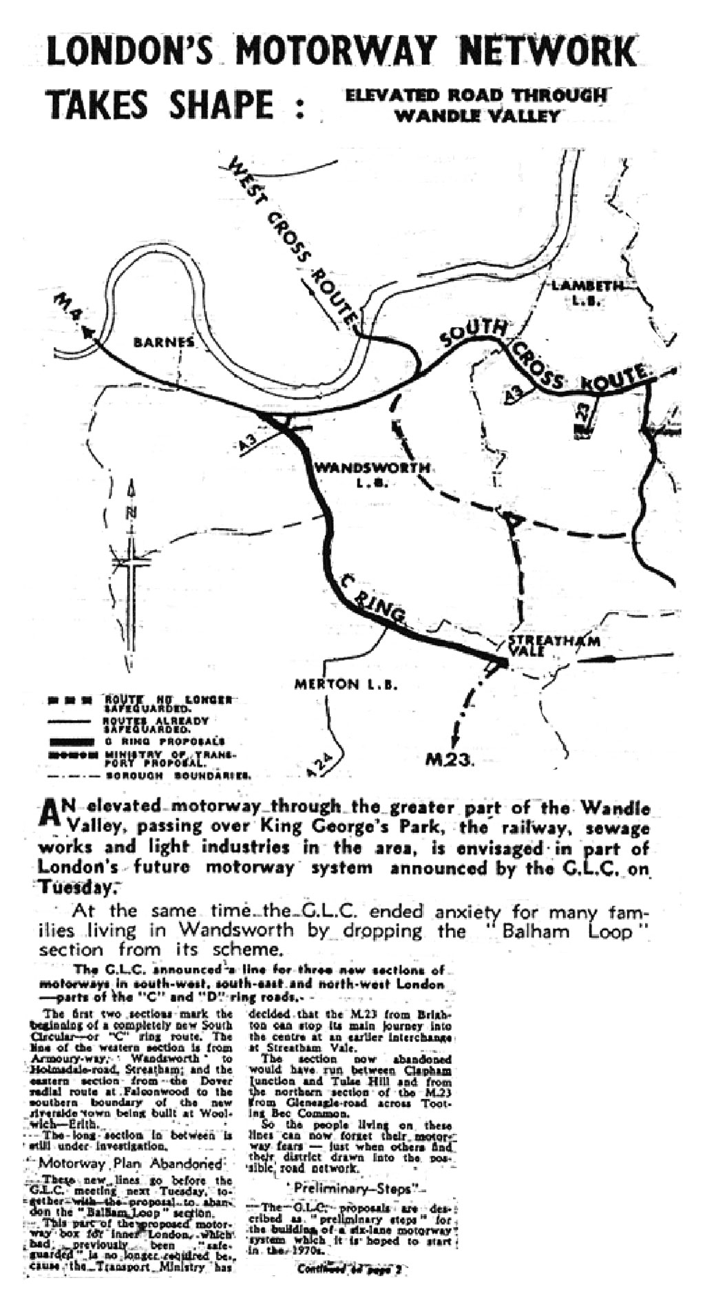
So what was this previously undisclosed “possible road network”? This is what the GLC map from July 1969 tells us:
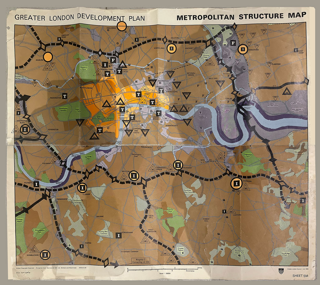
The map confirms that the “Balham Loop” had been well and truly abandoned, but now another motorway was on the drawing board — "an elevated motorway through the greater part of the Wandle Valley, passing over King George’s Park, the railway, sewage works and light industries in the area." The planners could take advantage of a (then) largely unloved natural corridor in which there were few houses:
London’s Motorway Network Takes Shape: Elevated Road Through Wandle Valley
An elevated motorway through the greater part of the Wandle Valley, passing over King George’s Park, the railway, sewage works and light industries in the area, is envisaged in part of London’s future motorway system announced by the GLC on Tuesday.
At the same time the GLC ended anxiety for many families living in Wandsworth by dropping the “Balham Loop” section from its scheme.
The GLC announced a line for three new sections of motorways in south-west, south-east and north-west London — parts of the “C” and “D” ring roads.
The first two sections mark the beginning of a completely new South Circular — or “C” ring route. The line of the western section is from Armoury-way, Wandsworth, to Holmsdale-road, Streatham; and the eastern section from the Dover radial route at Falconwood to the southern boundary of the new riverside town being built at Woolwich — Erith.
The long section in between is still under investigation.
“Preliminary Steps”
The GLC proposals are described as “preliminary steps” for the building of a six-lane motorway system which it is hoped to start in the 1970s.
In short, the changes were only reassuring to some: “[P]eople living on these lines can now forget their motorway fears — just when others find their district drawn into the possible road network.”
Do you remember this time? Tell me more.
There is an enormous literature on post-war road plans for London as a whole, and for Wandsworth and Battersea in particular. It’s easy to get lost.
The source most relevant to us is Nigel Black’s “The curious tale of Wandsworth’s motorways”, Wandsworth Historian, n.106, 2018. Deeply informed, analytical, incisive.
For a more general account, see the incredible Sabre-Roads website, which includes a section on the Balham Loop, from which I have learnt a lot. Plenty of links for you to follow.
I love Jay and Mark’s videos. Here’s their brilliant one on London’s Unfinished Motorways (c.2010). Very funny — especially about the South Circular. Absolutely to the point.
SABRE-ROADS’ beautiful (and painstakingly constructed) online maps are incredibly absorbing: click on the image below or here.
In 2025, a map of the Ringways was added, including Ringway 2 — whose Southern section was intended to run through the Wandle Valley.
After a six-month-long illness that had threatened his life, Thomas Hardy’s first walk is on Wandsworth Common. He is alone. In his ecstasy, he recites poetry out loud.

Here’s how Thomas recalls the event in his Autobiography (but writing in the third person):
Though he had been out in vehicles it was not till a day early in May, more than 6 months after he had taken to his bed, that he went forth on foot alone; and it being a warm and sunny morning he walked on Wandsworth Common, where, as he used to tell, standing still he repeated out loud to himself:
“See the wretch that long has tost
On the thorny bed of pain,
At length repair his vigour lost,
And breathe and walk again:
The meanest floweret of the vale,
The simplest note that swells the gale,
The common sun, the air, the skies,
To him are opening Paradise.”[Thomas Hardy, The Life and Work of Thomas Hardy, ed. Michael Millgate, 1984, p.153.]
I wonder exactly where on Wandsworth Common Thomas stood for his recitation?

Returning to the theme of Trinity Road, here is a house on the opposite corner to the Hardys, photographed by the LCC in the 1960s. I cannot say for certain that the dilapidation was caused by “planning blight”, as it used to be called — but I remember that many along Trinity Road were similarly affected after World War Two, particularly in the stretch through the “Toast Rack” from the Scope to the County Arms. (So much so that as a child in the 1950s I dreaded walking past them.)
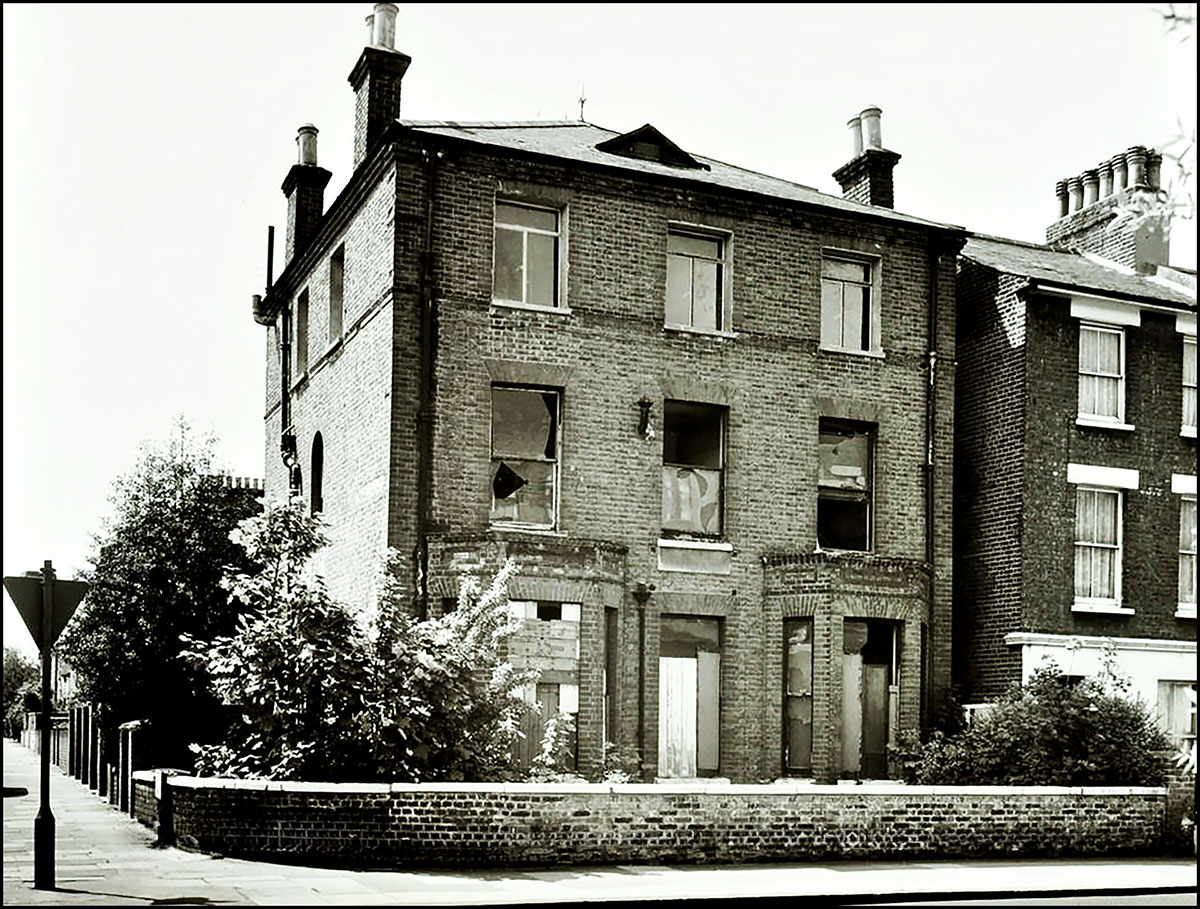
Things only looked up for these houses when the decision was finally taken to start the new roadworks at the County Arms, and leave the south of the Common alone.
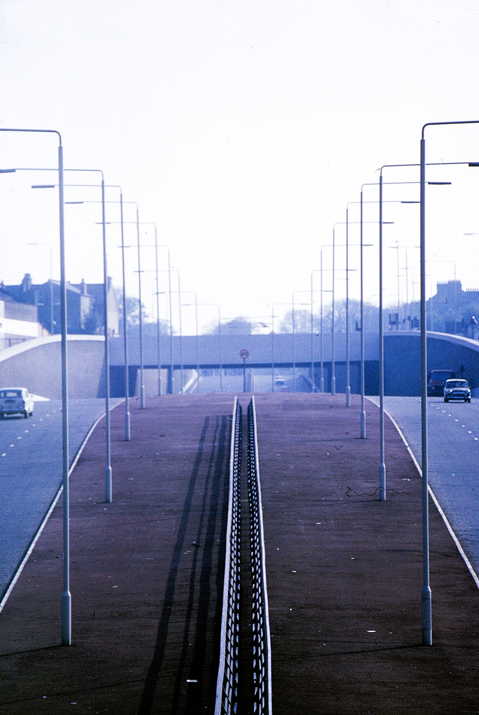
Next month, I hope to conclude the story with a look at the northern end of Trinity Road that actually was built in the late 1960s — widened and extended through a deep underpass down to Wandsworth Bridge. As we have seen, this had been envisaged at least since the 1930s, but its actual construction postponed several times. At the end of the 1960s, many houses between East Hill and the Thames were evacuated to make way, and hundreds of people displaced.
Do any readers recollect the impact of these endlessly altered plans, and the one that was actually implemented? Please let me know.

A video of the talk (made by Cameron Hills and John Crossland) is now online on YouTube and on the Friends of Wandsworth Common website — thanks, Cameron and John!
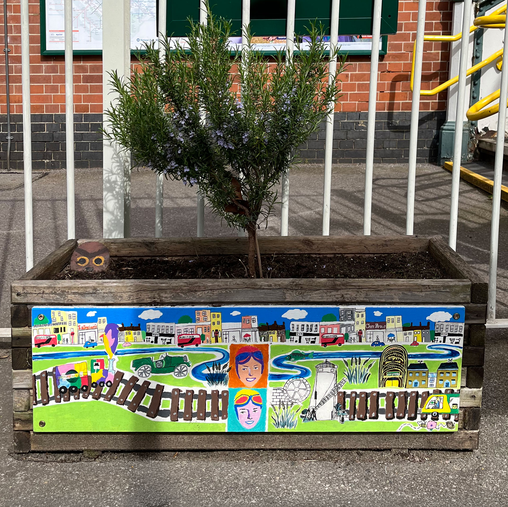
Clearly the artist has made a close study of The Wandsworth Common Story. LOTS of local references, including to Bellevue shops, 1930s' racing driver Doreen Evans, the railway, and the Scope. Can anybody tell me more about this and the other planters up and down the platform?
A terrific variety of walks, talks, and exhibitions brought together by Heritage Wandsworth: the local history and historic environment partnership for the Borough of Wandsworth.
— Vist the website: Wandsworth Heritage Festival
— Download the Heritage Festival programme — chock-a-block with delights.
The Friends of Wandsworth Common are making a number of contributions to the Festival, including:
Emma Anthony, Archivist at the Wandsworth Libraries & Heritage Service, has mounted a display of some of D&M's fine postcard photographs. Each captures a fleeting moment in the Common's history.
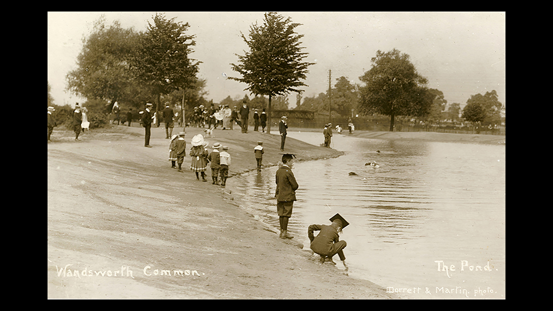
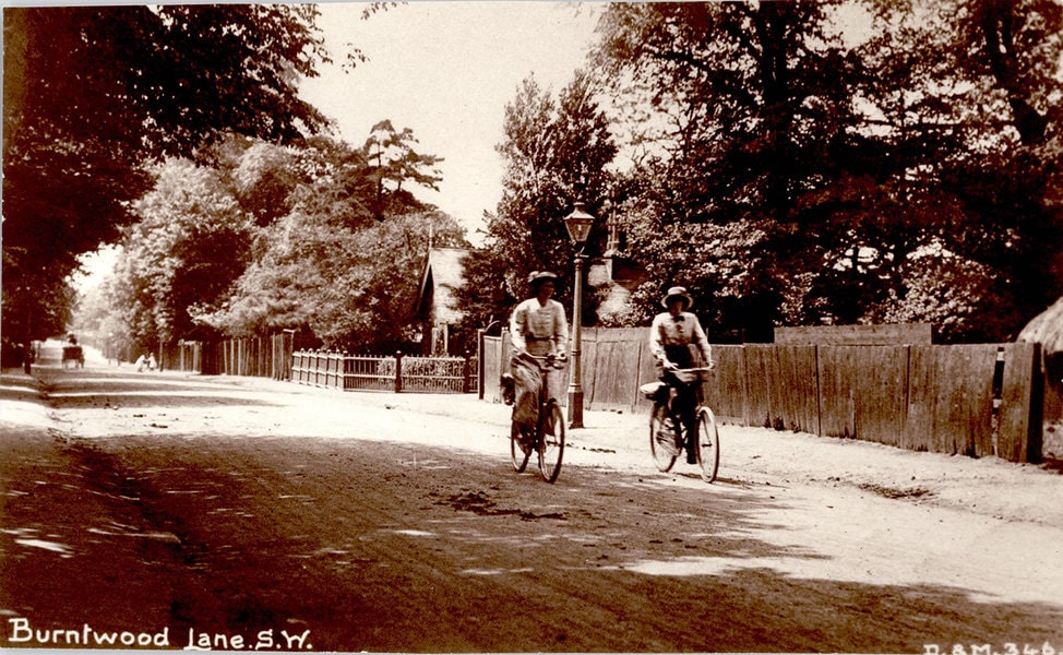
The exhibition has been produced by the Friends of Wandsworth Common, who jointly with the Wandsworth Society purchased almost a thousand postcards from Ron Elam's "Collection of Local Yesterdays" — many of you will remember his stall on Bellevue Road. The postcards, which show Wandsworth Common and the surrounding area, are now available to view in Wandsworth Heritage Service — contact heritage@gll.org for further information.
A Talk by Stephen Midlane and Philip Boys, organised by the Friends of Wandsworth Common
From drapers to dog groomers, from umbrella making to spa treatments, come and hear about the changing face of Wandsworth Common's 'high street'.

A Walk by Stephen Midlane and Philip Boys, organised by the Friends of Wandsworth Common
From drapers to dog groomers, from umbrella making to spa treatments, come and explore the changing face of Wandsworth Common's 'high street'.
Send me an email if you enjoyed this post / want to comment on something you’ve seen on the site / would like to know more — or just want to be kept in touch.
If you would like to receive notifications of new Chronicles, let me know . . .
— Friends of Wandsworth Common
— Wandsworth Historical Society