
This is the second part of June's Chronicles. My draft had grown so long and complicated that it seemed kinder to hack the thing into two and serve the halves up separately. To view Part I, click on the "Previous" link above.
From The Beatles Diary Volume 2: After The Break-Up 1970-2001:
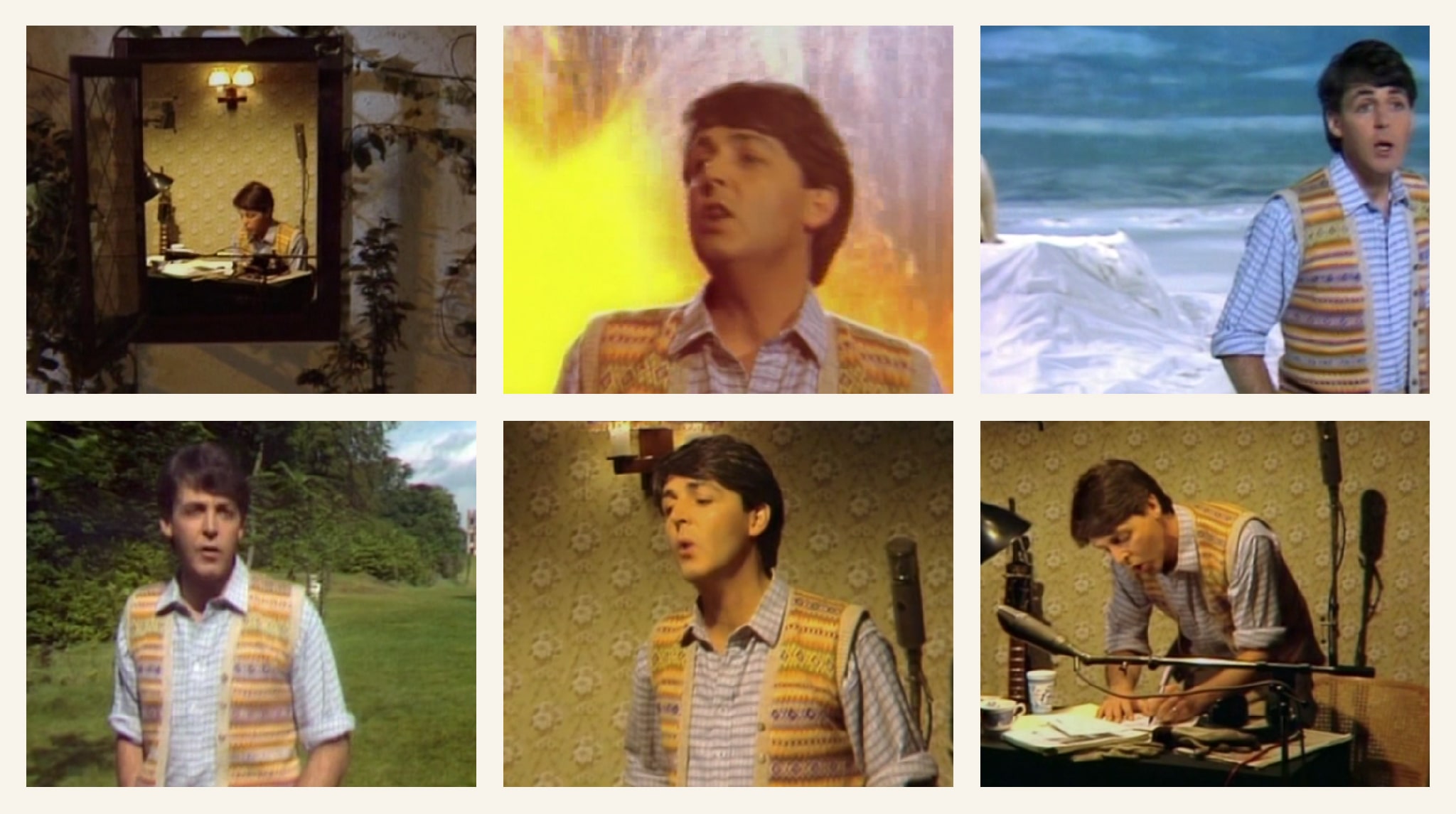
[June 1980] . . . Paul shoots a promotional film for the song ‘Waterfalls’ on a specially built set in the middle of Wandsworth Common, with additional scenes being shot in a disused aircraft hangar.
To assist with the taping, Paul obtains one and a half tons of polystyrene, and an eight-foot Polar bear called Olaf, hired from Chipperfield’s Circus. After numerous re-edits of the sequences, a total of six different promotional films are prepared, but only version three will be screened on shows such as Meet Paul McCartney . . .
From the outset, this production was to be an epic! Not just in terms of length or indeed technical wizardry (like ‘Coming Up’), but as a series of set pieces each requiring meticulous setting up and shooting . . . There are only four shots in the whole clip — Count them!
Water was used as the link between each shot. This not only gave a literal interpretation of the lyrics but also provided a clever way of introducing each new set. In order to achieve this water effect at the various locations, special portable fountains were designed and constructed for ‘Waterfalls’.
The video starts with Paul playing the piano in what appears to be a pretty country cottage but is, in fact, a studio set in the middle of Wandsworth! What seemed to be a simple shot as the camera goes through the open window, was the result of a complicated and much rehearsed set of manoeuvres.
As the camera moves in towards the open window, the entire cottage wall comes apart enabling the camera to move into the room. As Paul moves from the piano, the fountains burst into view to provide the first ‘waterfall’ background.
As the waters disappear an arctic wasteland is revealed. This again is a set, complete with an enormous painted backdrop measuring 150′ x 65‘ No mean feat with a paintbrush! When the set building was completed, to add that final touch of authenticity, a real live polar bear was cast in the supporting role at Paul’s request!

Although “Olaf” had been trained to perform in a circus [Chipperfield's], every safety precaution had to be taken and rigidly enforced as Paul was singing on the set very close to the bear. It took ten days to build and light this set and this scene ends with more fountains which dissolve into the next location.
Each set required something extra and this one was no exception. A fire engine was needed to pump water from a lake in the gardens, over a hill, to the shooting site 500 yards away, for the next watery background.
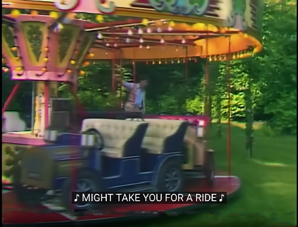
[Presumably these are the scenes filmed on Wandsworth Common. But which "lake" supplied the water, and where exactly was the carousel erected?]
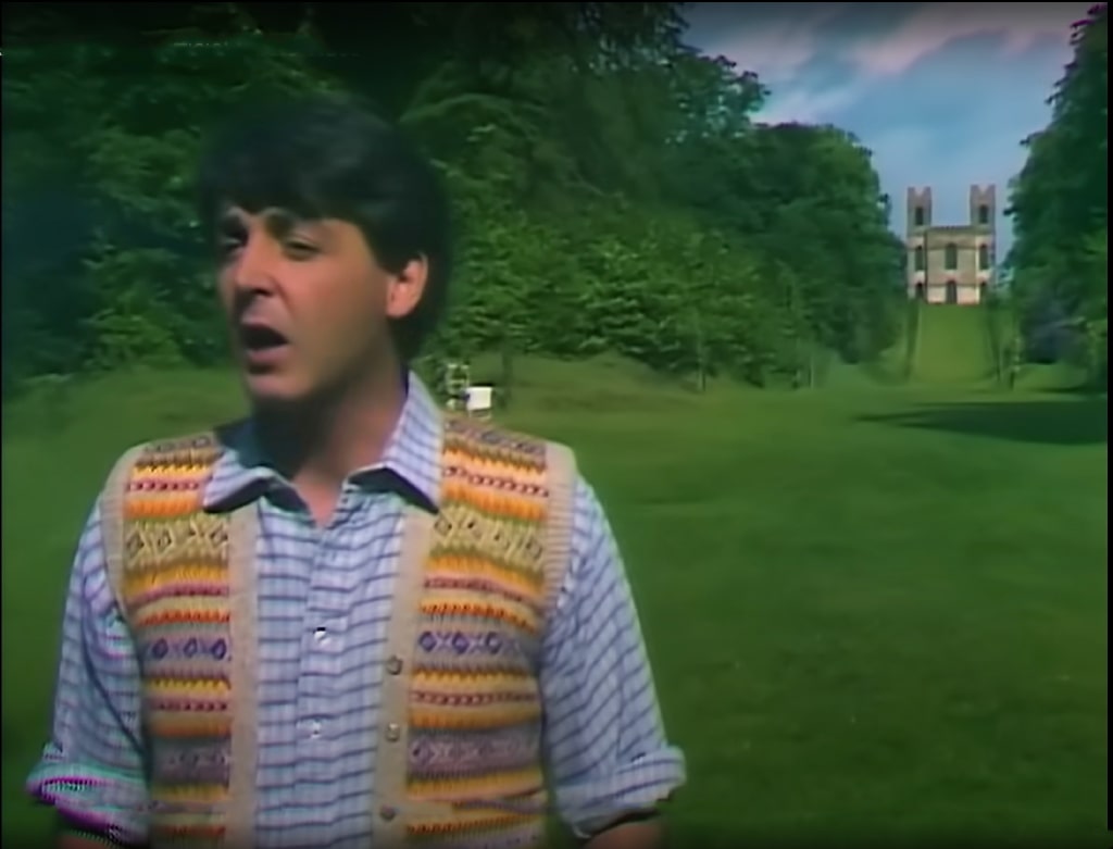
This shot starts with Paul walking down an avenue with a castle in the background. The camera ‘tracks’ (that is, it is pushed along on rails like a train) for 120 feet with Paul. He then steps onto a Carousel which was brought in specifically for this shot and is not a permanent feature of the gardens.
As Paul steps off the carousel, the fountains appear once more and we are transported back with him into the country cottage. He walks back to the piano and finishes the song. Obviously the cottage walls had to return to their original position as the camera passed back out through the window, and once again, a lot of rehearsing was required. The song is now over, Paul gets up and closes the window, leaving the cottage in darkness.
[The Paul McCartney Project: Waterfalls.]
Do you have any recollections? Do share.
I'm rather keen on maps, as you may have noticed. The ones I generally show were produced either by the Ordnance Survey (the gold standard) or Stanford. But other mapmakers produced work of great interest, including William Faden (1749-1836).
Here's part of his hand-coloured "The country twenty-five miles round London: planned from a scale of one mile to an inch" (1790 printing):
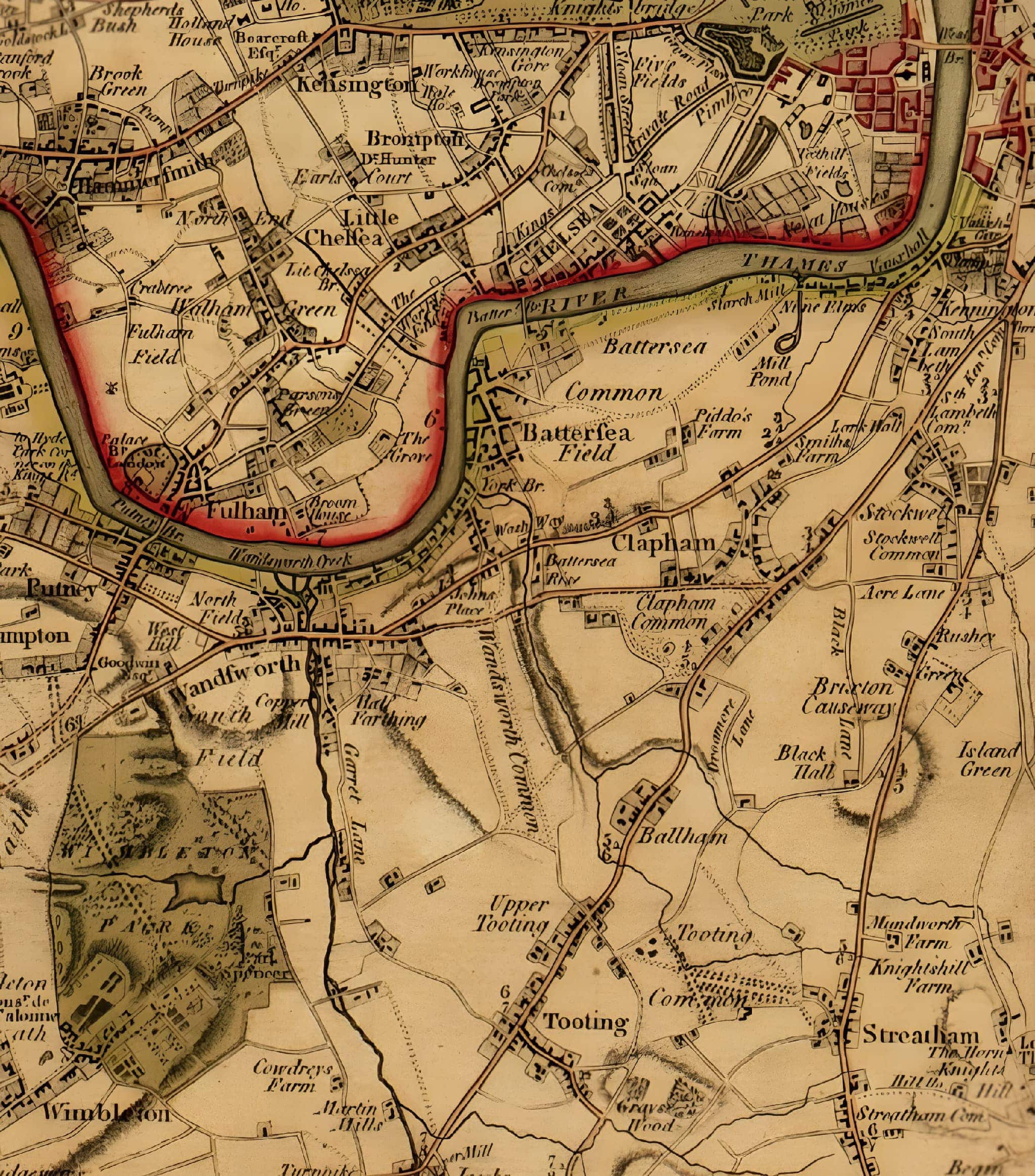
It's not very detailed, of course, and quite out-of-date even at the point of publication (an inevitable problem for all maps, of course). As it happens, it's not from a new survey by Faden himself but a composite of existing county maps published in the previous decades.
[This probably explains why the "Five Houses" are missing, even though they'd been built a decade earlier.]
It may be sketchy but there's still a lot to see. Faden's map shows the country just before the great transformations of the next century.
As Andrew Macnair has written, it gives us a good idea of the landscape
close to the metropolis in the last third of the 18th century. It shows the extensive commons, downs and heaths which were soon to disappear with Parliamentary Enclosure as well as the estates of the landed gentry who wanted to enjoy the countryside but who also wished to live close to the capital.
[Incidentally, Macnair tells is that in 1801 the French War Department copied and engraved this map in preparation for an invasion of England.]
Most obviously, the population is very much smaller in our area, and more thinly distributed across the terrain. There are no railways, of course.
Notice the map's emphasis on the location and extent of large houses (the inhabitants of which were doubtless Faden's intended customers). Their grounds are clearly outlined and strongly tinted (Earl Spencer's estate at Wimbledon, in particular). Wandsworth Common itself is only lightly shaded. Field boundaries are not shown
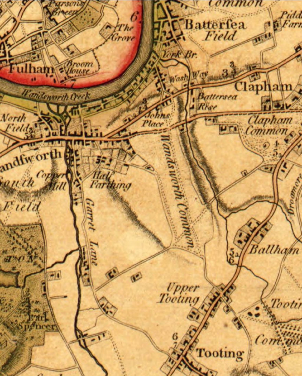
For the moment, I'll only point to a couple of features. There are still very few houses on or around the Common — mainly a cluster in the north-west, near the main road between Wandsworth and London.
Notice also the absence of the future Trinity Road. Yes, there is a long straight road across the Common, but it's heading from "Upper Tooting" towards "Johns Place" and "York Bridge", near the Thames (down what we now call Plough Road).
[This is exceedingly odd. We've seen the same on John Rocque's map of the 1740s. Was there really no straight "Trinity Road" until the C19? Was the main route really a more easterly one, across to Plough Road? If so, what's happened to it?]
Faden had some problems showing elevation and slope — this is before visual conventions such as hatching or contour lines had settled down. See the dark shading showing the valley in which the (unnnamed) Falcon Brook flows, just to the east of the Common.
[A curious feature: see also the prominence of the two tributaries of the Falcon Brook that meet close to the Common and proceed to the Thames in Battersea. The southern arm is shown as originating in Tooting, and the northern as far as Knight's Hill! At this time, the stream was worth recording its course over many miles on a map. Today, hardly anybody is aware of its existence. The Falcon Brook is of great interest to me — I hope to talk about its course, now entirely underground, in the autumn.]
For now, I'll leave it up to you to look in more detail at this map — but please send me your comments, which I'll add to this article.
A few decades later, Faden carried out a proper survey. Here's his 4th edition, of 1819.
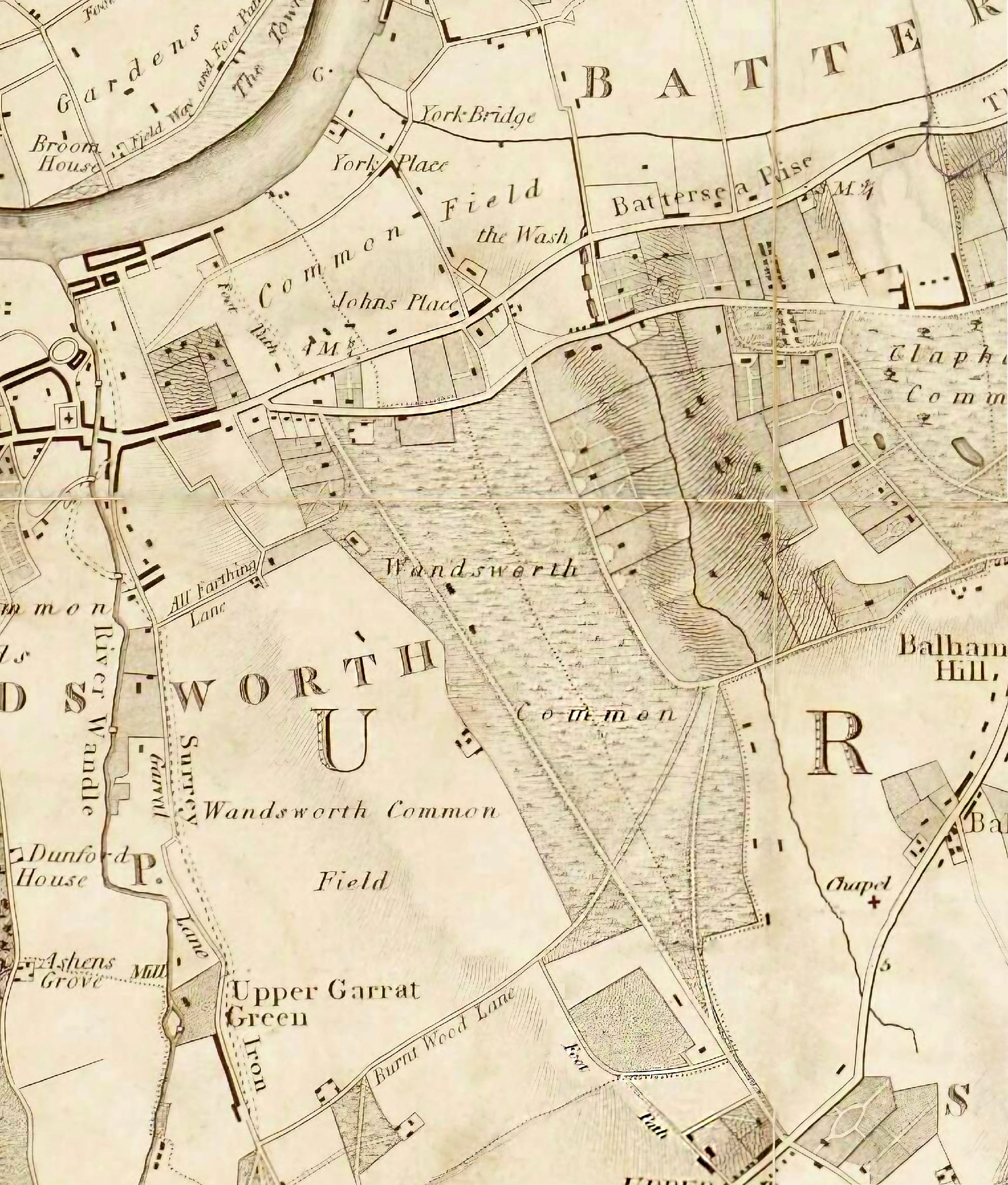
I'm sure this new version would have been much more use to Napoloeon, had he escaped exile on St Helena and decided to fight his new Waterloo on Wandsworth Common.
[You may recall reading in past Chronicles about the "sham fights" — mock battles or military manoeuvres — that took place between various yeomanry regiments over Wandsworth Common during the Napoleonic period e.g. in September 1804 and October 1807.]
Here's another story I have no recollection of, though it was fairly recent. Perhaps you do?
The Belfast Telegraph reported the theft on 21 June 2000:
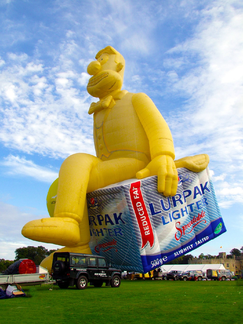
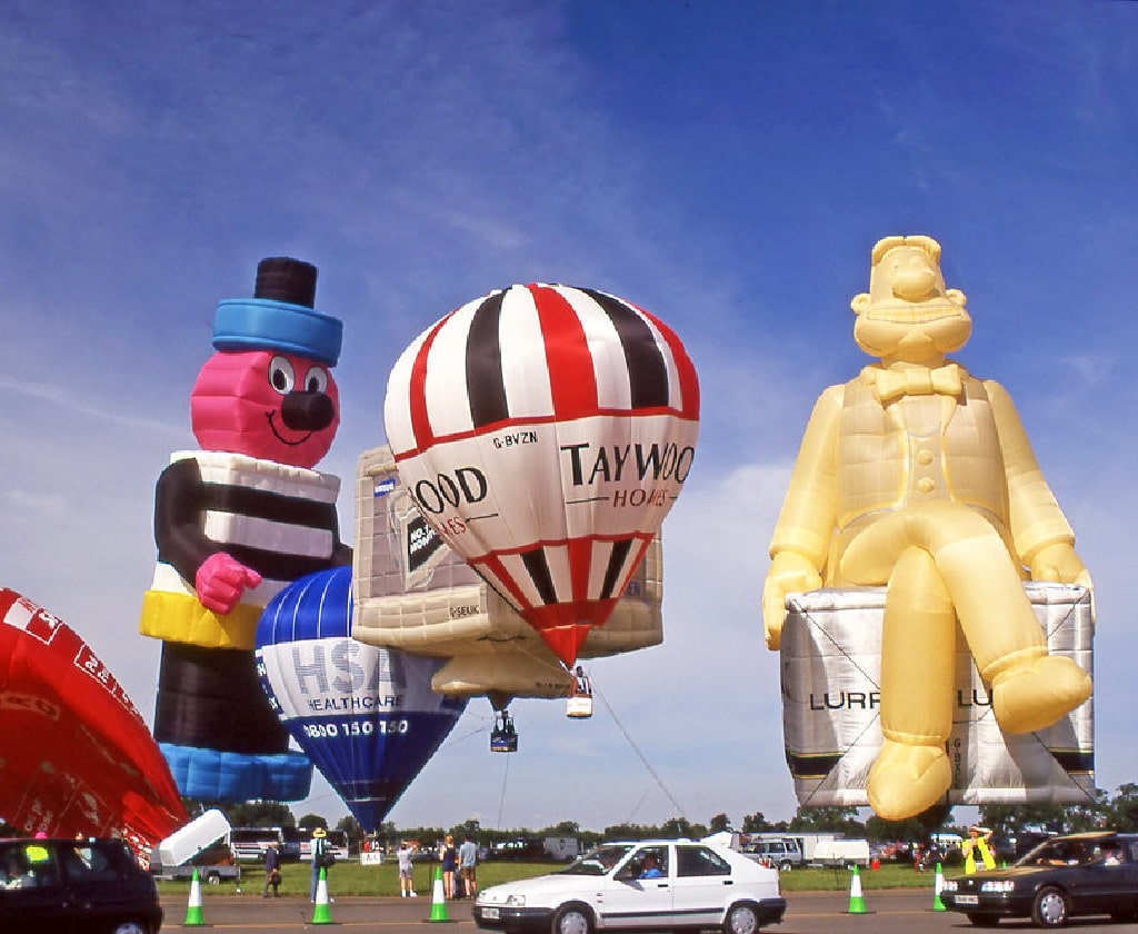
A 130ft high hot air balloon of Douglas, the Lurpak Butter character, was stolen yesterday.
The balloon had been flown yesterday morning and a second flight was planned later in the day.
It was stolen from Wandsworth Common, London, at 3pm along with the Lurpak trailer carrying it.
A local estate agent saw the silver and blue trailer, weighing 1.5 tonnes, being towed away by a red Peugeot 205.
On the same day, the Wolverhampton Express added some helpful background: Douglas, it said, was a small man made from butter . . . "
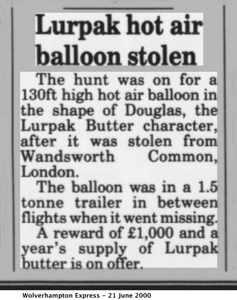
The hunt was on for a 130ft high hot air balloon in the shape of Douglas, the Lurpak Butter character, after it was stolen from Wandsworth Common, London. The balloon was in a 1.5 tonne trailer in between flights when it went missing. A reward of £1,000 and a year’s supply of Lurpak butter is on offer.
[BNA: Link.]
Douglas served as the mascot in UK adverts for Danish butter brand Lurpak from 1985 to 2003 and again from 2014-2015.
He was a small man made from butter.
In earlier adverts, Douglas would emerge from a block of Lurpak and would sing about it before either going back into the block or into food.
In 1992, to mark that year's Olympic Games, an advert featured Douglas diving into a bowl of soup.
In later adverts, Douglas is depicted as a trombonist who in the adverts, played "Flight of the Bumblebee" on his trombone and would sometimes be stopped by the advert's narrator (played by Penelope Keith). Douglas is shown to be nice and jolly to Penelope anyway.
In 1994, a Christmas advert was made in which Douglas was allowed by Keith to play his trombone, to which he plays "Deck The Halls".
Some rather nice collections of Duncan ads:
— YouTube: The Best Lurpak ‘Douglas’ TV Adverts Compilation
— YouTube: Lurpak Butter Douglas Aardman Advert Compilation (1985-2003)
— Lostmediawiki: Lurpak (partially lost Aardman Animations commercials for Danish butter brand; 1990s)

[FYI: "Ballooning brilliance: the greatest special shapes of all time": Part 1, Part 2, Part 3.]
Just I was about to send these Chronicles out, I came across a sequel:
Balloon finder may get reward
A scaffolder was celebrating the prospect of £1,000 reward today after finding a 130 ft high hot air balloon which had been taken from Wandsworth Common in its storage trailer yesterday.
Simon Fovargue, from Wandsworth, is in line for the reward which was offered to anyone giving information to help return the balloon, depicting Lurpak butter character Douglas, to Flying Pictures. Mr Fovargue found the trailer on Tuesday night.
[BNA: Link.]
A happy ending, then. (I wonder if it was.)
I was very disappointed last month not to be able to attend an unveiling of a plaque at Le Gothique in the Royal Victoria Patriotic Building, involving local residents Louisa Russell and Paul McCue.
Fortunately John Crossland was on hand to make a video of the event:
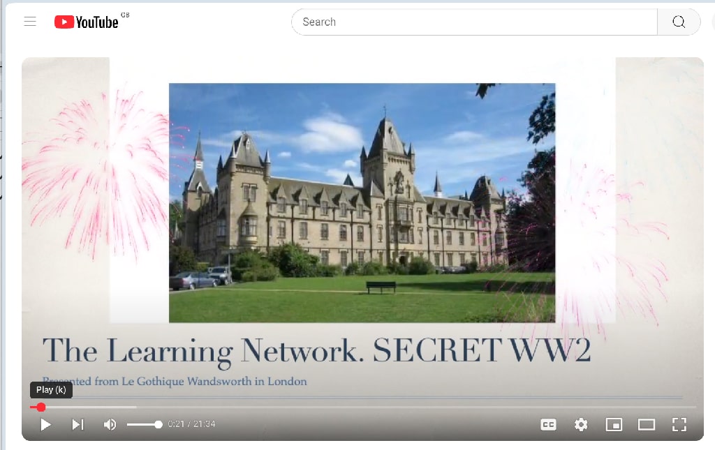
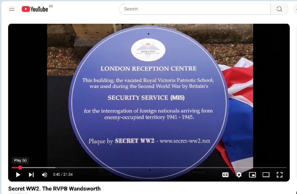
In a fascinating talk, Paul McCue explains what the plaque commemorates:
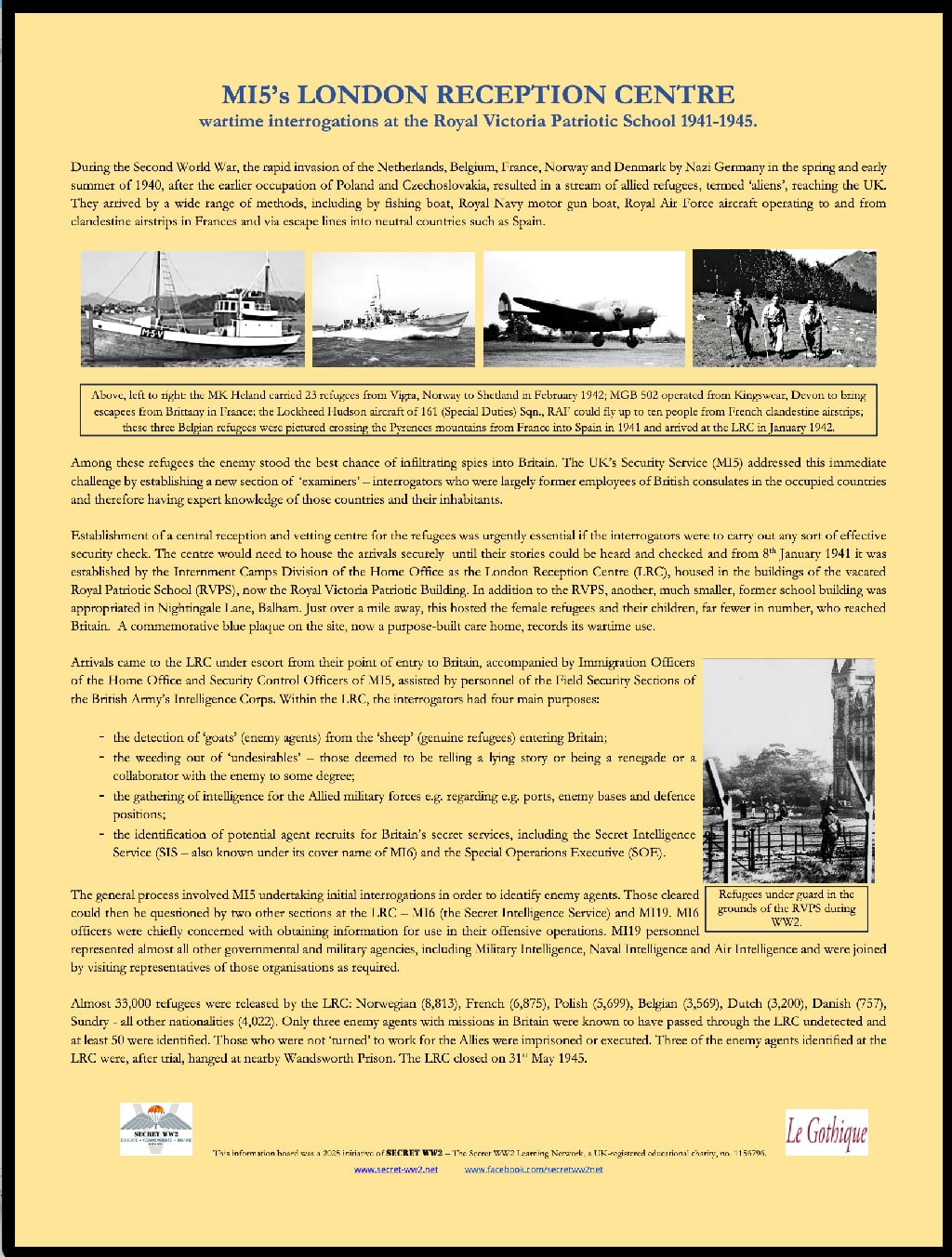
During the Second World War the rapid invasion of the Netherlands, Belgium, France, Norway and Denmark by Nazi Germany in the spring and early summer of 1940, after the earlier occupation of Poland and Czechoslovakia, resulted in a stream of allied refugees which we called "aliens" — so the aliens came here, having reached the UK.
They arrived by a wide range of methods, including by fishing boat, Royal Navy motor gunboat, Royal Air Force aircraft operating to and from clandestine air strips in France, and via escape lines into neutral countries such as Spain and Portugal.
Among these refugees the enemy stood the best chance of infiltrating spies into Britain, so the UK's security service MI5 addressed this immediate challenge by establishing a new section of "examiners" — these were interrogators largely former employees of British consulates in the occupied countries, so they had knowledge expert knowledge of the country and of the inhabitants.
So the establishment of a central reception and vetting centre for the refugees was urgently required if any sort of effective security check was to be carried out.
The centre would need to house the arrivals securely until their stories could be heard and checked, and from the 8th of January 1941 this establishment was established by the Internment Camps Division of the Home Office and was called the London Reception Centre . . .
Paul's talk continues, and is followed by scenes of the unveiling of the plaques.
The Secret WW2 Learning Network – is an educational charity established in 2014 with the aim of creating greater public awareness of the contributions and experiences of the men and women who took part during the Second World War in Allied special operations, intelligence gathering and resistance.
For further info, and to support this educational charity, visit the Secret WW2 Learning Network website.
I am very grateful to Louisa Russell, Chair of the Secret WWII Learning Network, for providing a pdf of an information board that describes the significance MI5's London Reception Centre — thanks, Louisa!:
I look forward to returning to this important subject in future Chronicles.
SO many more stories still to tell. But that's all for now, folks.
Send me an email if you enjoyed this post / want to comment on something you've seen on the site / would like to know more — or just want to be kept in touch.
If you would like to receive notifications of new Chronicles, let me know . . .
Philip Boys ("History Boys")
June 2025
— Friends of Wandsworth Common
— Wandsworth Historical Society
